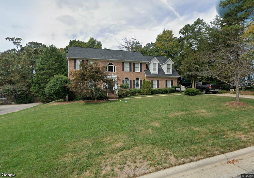
506 Oneil Dr Jamestown, NC 27282
Estimated Value: $372,000 - $460,000
4
Beds
3
Baths
2,884
Sq Ft
$144/Sq Ft
Est. Value
About This Home
This home is located at 506 Oneil Dr, Jamestown, NC 27282 and is currently estimated at $416,566, approximately $144 per square foot. 506 Oneil Dr is a home located in Guilford County with nearby schools including Jamestown Elementary School, Jamestown Middle School, and Ragsdale High School.
Ownership History
Date
Name
Owned For
Owner Type
Purchase Details
Closed on
Oct 10, 2003
Sold by
Desai Sanjay and Desai Pratima
Bought by
Prairie Shawn A and Prairie Michele A
Current Estimated Value
Home Financials for this Owner
Home Financials are based on the most recent Mortgage that was taken out on this home.
Original Mortgage
$186,400
Outstanding Balance
$80,434
Interest Rate
5.12%
Mortgage Type
Purchase Money Mortgage
Estimated Equity
$336,132
Create a Home Valuation Report for This Property
The Home Valuation Report is an in-depth analysis detailing your home's value as well as a comparison with similar homes in the area
Home Values in the Area
Average Home Value in this Area
Purchase History
| Date | Buyer | Sale Price | Title Company |
|---|---|---|---|
| Prairie Shawn A | $233,000 | -- |
Source: Public Records
Mortgage History
| Date | Status | Borrower | Loan Amount |
|---|---|---|---|
| Open | Prairie Shawn A | $186,400 |
Source: Public Records
Tax History Compared to Growth
Tax History
| Year | Tax Paid | Tax Assessment Tax Assessment Total Assessment is a certain percentage of the fair market value that is determined by local assessors to be the total taxable value of land and additions on the property. | Land | Improvement |
|---|---|---|---|---|
| 2025 | $4,252 | $313,700 | $55,000 | $258,700 |
| 2024 | $4,252 | $313,700 | $55,000 | $258,700 |
| 2023 | $4,252 | $313,700 | $55,000 | $258,700 |
| 2022 | $3,813 | $313,700 | $55,000 | $258,700 |
| 2021 | $2,890 | $237,800 | $50,000 | $187,800 |
| 2020 | $2,890 | $237,800 | $50,000 | $187,800 |
| 2019 | $2,850 | $237,800 | $0 | $0 |
| 2018 | $2,836 | $237,800 | $0 | $0 |
| 2017 | $2,836 | $237,800 | $0 | $0 |
| 2016 | $3,044 | $251,600 | $0 | $0 |
| 2015 | $3,057 | $251,600 | $0 | $0 |
| 2014 | $3,082 | $251,600 | $0 | $0 |
Source: Public Records
Map
Nearby Homes
- 120 Brookberry Dr
- 107 Brookberry Dr
- 5 Langholm Ct
- 101 Byrnwood Dr
- 104 Ragsdale Rd
- 201 Ragsdale Rd
- 200 Oakdale Forest Ct Unit Lot 1
- 200 Oakdale Forest Ct
- 204 Oakdale Forest Ct Unit Lot 3
- 204 Oakdale Forest Ct
- 206 Oakdale Forest Ct
- 206 Oakdale Forest Ct Unit Lot 4
- 202 Oakdale Rd
- 208 Oakdale Forest Ct
- 208 Oakdale Forest Ct Unit Lot 5
- 207 Forestdale Dr
- 312 Quarterpath Ln
- 105 Forestdale Dr
- 215 Channel Cove Ct
- 7220 E Fork Rd