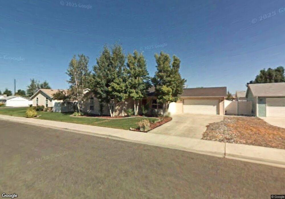
506 Sabil Dr Fruita, CO 81521
Estimated Value: $374,974 - $412,000
3
Beds
2
Baths
1,258
Sq Ft
$313/Sq Ft
Est. Value
About This Home
This home is located at 506 Sabil Dr, Fruita, CO 81521 and is currently estimated at $393,994, approximately $313 per square foot. 506 Sabil Dr is a home located in Mesa County with nearby schools including Monument Ridge Elementary School, Fruita Middle School, and Fruita 8/9 School.
Ownership History
Date
Name
Owned For
Owner Type
Purchase Details
Closed on
Apr 27, 2004
Sold by
Lee Ryan P and Lee Andrea D
Bought by
Cavagnaro Sally R
Current Estimated Value
Purchase Details
Closed on
Jan 31, 2003
Sold by
Lee Ryan P and Thompson Andrea D
Bought by
Lee Ryan P and Lee Andrea D
Home Financials for this Owner
Home Financials are based on the most recent Mortgage that was taken out on this home.
Original Mortgage
$102,400
Interest Rate
5.84%
Purchase Details
Closed on
Feb 13, 1998
Sold by
Dkh & Brh Inc
Bought by
Lee Ryan P and Thompson Andrea D
Home Financials for this Owner
Home Financials are based on the most recent Mortgage that was taken out on this home.
Original Mortgage
$88,300
Interest Rate
7.02%
Purchase Details
Closed on
Jun 21, 1996
Sold by
Wildwood Development Inc/27 Parcels
Bought by
Glick Ann Cavagnaro
Purchase Details
Closed on
May 20, 1996
Bought by
Glick Ann Cavagnaro
Create a Home Valuation Report for This Property
The Home Valuation Report is an in-depth analysis detailing your home's value as well as a comparison with similar homes in the area
Home Values in the Area
Average Home Value in this Area
Purchase History
| Date | Buyer | Sale Price | Title Company |
|---|---|---|---|
| Cavagnaro Sally R | $141,700 | First American Heritage Titl | |
| Lee Ryan P | -- | -- | |
| Lee Ryan P | $95,900 | -- | |
| Glick Ann Cavagnaro | $108,000 | -- | |
| Glick Ann Cavagnaro | -- | -- |
Source: Public Records
Mortgage History
| Date | Status | Borrower | Loan Amount |
|---|---|---|---|
| Previous Owner | Lee Ryan P | $102,400 | |
| Previous Owner | Lee Ryan P | $88,300 |
Source: Public Records
Tax History
| Year | Tax Paid | Tax Assessment Tax Assessment Total Assessment is a certain percentage of the fair market value that is determined by local assessors to be the total taxable value of land and additions on the property. | Land | Improvement |
|---|---|---|---|---|
| 2024 | $1,500 | $18,390 | $5,470 | $12,920 |
| 2023 | $1,500 | $18,390 | $5,470 | $12,920 |
| 2022 | $1,407 | $16,970 | $4,170 | $12,800 |
| 2021 | $1,417 | $17,460 | $4,290 | $13,170 |
| 2020 | $1,307 | $16,420 | $4,220 | $12,200 |
| 2019 | $1,246 | $16,420 | $4,220 | $12,200 |
| 2018 | $1,096 | $13,330 | $3,780 | $9,550 |
| 2016 | $929 | $13,050 | $3,980 | $9,070 |
Source: Public Records
Map
Nearby Homes
- 516 Vermont Ln
- 858 St Peppin Dr
- 791 Yew St
- 328 Oakwood Ave
- 825 E Ottley Ave Unit B9
- 825 E Ottley Ave Unit B5
- 825 E Ottley Ave Unit F1
- 825 E Ottley Ave Unit E 3
- 825 E Ottley Ave Unit F4
- 118 Elderberry Dr
- 1105 Sprocket Ct
- 1124 Sprocket Ct
- 1026 Lone Tree Ct
- 1107 Mee Canyon Cir
- 1109 Mee Canyon Cir
- 362 Toms Canyon Dr
- 370 Toms Canyon Dr
- 921 Caledonia Ct
- 1112 Sprocket Ct
- 203 Elderberry Dr
Your Personal Tour Guide
Ask me questions while you tour the home.