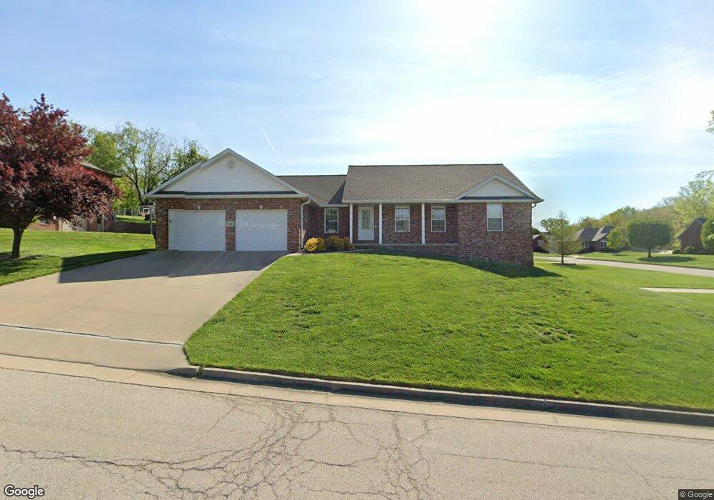
506 William Waye Dr Jefferson City, MO 65109
Estimated Value: $307,000 - $453,000
3
Beds
2
Baths
1,816
Sq Ft
$215/Sq Ft
Est. Value
About This Home
This home is located at 506 William Waye Dr, Jefferson City, MO 65109 and is currently estimated at $391,029, approximately $215 per square foot. 506 William Waye Dr is a home located in Cole County with nearby schools including Pioneer Trail Elementary School, Thomas Jefferson Middle School, and Capital City High School.
Ownership History
Date
Name
Owned For
Owner Type
Purchase Details
Closed on
Dec 19, 2022
Sold by
Smith Terry P
Bought by
Smith Terry P and Smith Paul Aaron
Current Estimated Value
Purchase Details
Closed on
Jun 27, 2022
Sold by
Smith/Ooton Revocable Inter Vivos Trust
Bought by
Smith Terry Paul
Purchase Details
Closed on
Sep 4, 2019
Sold by
Smith Terry P and Ooton Diane L
Bought by
Smith Ooton Ret
Create a Home Valuation Report for This Property
The Home Valuation Report is an in-depth analysis detailing your home's value as well as a comparison with similar homes in the area
Home Values in the Area
Average Home Value in this Area
Purchase History
| Date | Buyer | Sale Price | Title Company |
|---|---|---|---|
| Smith Terry P | -- | None Listed On Document | |
| Smith Terry Paul | -- | None Listed On Document | |
| Smith Ooton Ret | -- | -- |
Source: Public Records
Tax History Compared to Growth
Tax History
| Year | Tax Paid | Tax Assessment Tax Assessment Total Assessment is a certain percentage of the fair market value that is determined by local assessors to be the total taxable value of land and additions on the property. | Land | Improvement |
|---|---|---|---|---|
| 2025 | $2,690 | $47,160 | $5,510 | $41,650 |
| 2024 | $2,690 | $47,160 | $5,510 | $41,650 |
| 2023 | $2,690 | $47,160 | $5,510 | $41,650 |
| 2022 | $2,564 | $44,800 | $0 | $44,800 |
| 2021 | $2,578 | $44,800 | $0 | $44,800 |
| 2020 | $2,610 | $44,992 | $5,510 | $39,482 |
| 2019 | $2,535 | $44,422 | $5,510 | $38,912 |
| 2018 | $2,531 | $45,144 | $5,510 | $39,634 |
| 2017 | $2,468 | $44,802 | $5,510 | $39,292 |
| 2016 | $2,085 | $44,802 | $5,510 | $39,292 |
| 2015 | $1,814 | $0 | $0 | $0 |
| 2014 | $1,814 | $44,802 | $5,510 | $39,292 |
Source: Public Records
Map
Nearby Homes
- 5408 La Charette Dr
- 726 Dickerson Creek Dr
- 730 Dickerson Creek Dr
- 802 Dickerson Creek Dr
- 814 Dickerson Creek Dr
- 815 Dickerson Creek Dr
- 807 Dickerson Creek Dr
- 725 Dickerson Creek Dr
- 122 W Haven Dr
- 323 Covered Wagon Rd
- 319 Covered Wagon Rd
- 210 Pioneer Trail Dr
- 226 Pioneer Trail Dr
- 326 Pioneer Trail Dr
- 720 Biltmore Dr
- 322 Pioneer Trail Dr
- 728 Biltmore Dr
- 732 Biltmore Dr
- 330 Pioneer Trail Dr
- 218 Pheasant Run Rd
- 5424 La Charette Dr
- 510 William Waye Dr
- 505 William Waye Dr
- 5420 La Charette Dr
- 5409 Bull Rock Rd
- 5501 Bull Rock Rd
- 511 William Waye Dr
- 5405 Bull Rock Rd
- 5505 Bull Rock Dr
- 516 William Waye Dr
- 5508 Bull Rock Rd
- 5416 La Charette Dr
- 5505 Bull Rock Rd
- 5423 La Charette Dr
- 515 William Waye Dr
- 5503 La Charette Dr
- 5415 La Charette Dr
- 5421 Henwick Ln
- 5509 Bull Rock Rd
- 5507 La Charette Dr