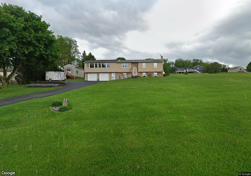
5060 Black Lick Rd Blairsville, PA 15717
Estimated Value: $118,106 - $167,000
4
Beds
2
Baths
1,725
Sq Ft
$82/Sq Ft
Est. Value
About This Home
This home is located at 5060 Black Lick Rd, Blairsville, PA 15717 and is currently estimated at $140,777, approximately $81 per square foot. 5060 Black Lick Rd is a home located in Indiana County with nearby schools including Blairsville Elementary School, River Valley Middle School, and River Valley High School.
Ownership History
Date
Name
Owned For
Owner Type
Purchase Details
Closed on
May 14, 2018
Sold by
Yurky John J and Yurky Peggy
Bought by
Doyle James P and Doyle Nancy M
Current Estimated Value
Home Financials for this Owner
Home Financials are based on the most recent Mortgage that was taken out on this home.
Original Mortgage
$66,000
Outstanding Balance
$56,881
Interest Rate
4.44%
Mortgage Type
New Conventional
Estimated Equity
$83,897
Create a Home Valuation Report for This Property
The Home Valuation Report is an in-depth analysis detailing your home's value as well as a comparison with similar homes in the area
Home Values in the Area
Average Home Value in this Area
Purchase History
| Date | Buyer | Sale Price | Title Company |
|---|---|---|---|
| Doyle James P | $88,000 | None Available |
Source: Public Records
Mortgage History
| Date | Status | Borrower | Loan Amount |
|---|---|---|---|
| Open | Doyle James P | $66,000 |
Source: Public Records
Tax History Compared to Growth
Tax History
| Year | Tax Paid | Tax Assessment Tax Assessment Total Assessment is a certain percentage of the fair market value that is determined by local assessors to be the total taxable value of land and additions on the property. | Land | Improvement |
|---|---|---|---|---|
| 2025 | $2,681 | $88,900 | $15,300 | $73,600 |
| 2024 | $2,480 | $88,900 | $15,300 | $73,600 |
| 2023 | $2,349 | $88,900 | $15,300 | $73,600 |
| 2022 | $2,337 | $88,900 | $15,300 | $73,600 |
| 2021 | $2,337 | $88,900 | $15,300 | $73,600 |
| 2020 | $2,296 | $88,900 | $15,300 | $73,600 |
| 2018 | $2,260 | $88,900 | $15,300 | $73,600 |
| 2017 | $1,441 | $88,900 | $15,300 | $73,600 |
| 2016 | -- | $88,900 | $15,300 | $73,600 |
| 2015 | -- | $12,310 | $1,960 | $10,350 |
| 2014 | -- | $12,310 | $1,960 | $10,350 |
Source: Public Records
Map
Nearby Homes
- 97 Chessie Way
- 193 Chestnut St
- 9423 S Route 119 Hwy S
- 1347 Blaire Rd
- 9995 U S 119
- 461 Marshall Heights Rd
- 279 Snyder Ln
- 122 Acs. Along Mt Tabor Rd
- 0 Penn Dr Unit 1718672
- 17 Susan Dr
- 246 Strangford Rd
- 4826 Route 217
- 60 Violet St
- 830 Indiana Ave
- 564 Henry Rd
- 200 E Burrell St
- 429 N Walnut St
- 103 Maple Ave
- 108 Maple Ave
- 422 E Campbell St
- 5060 Black Lick Rd
- 5060 Black Lick Rd
- 5060 Black Lick Rd
- 5060 Black Lick Rd
- 5060 Black Lick Rd
- 5060 Black Lick Rd
- 5076 Black Lick Rd
- 5057 Black Lick Rd
- 203 Dunlap Dr
- 5118 Black Lick Rd
- 237 Dunlap Dr
- 178 Dunlap Dr
- 142 Dunlap Dr
- 5162 Black Lick Rd
- 266 Dunlap Dr
- 5192 Black Lick Rd
- 14 Dunlap Dr
- 1371 Mcconnell Rd
- 12 Dunlap Dr
- 1405 Mcconnell Rd
