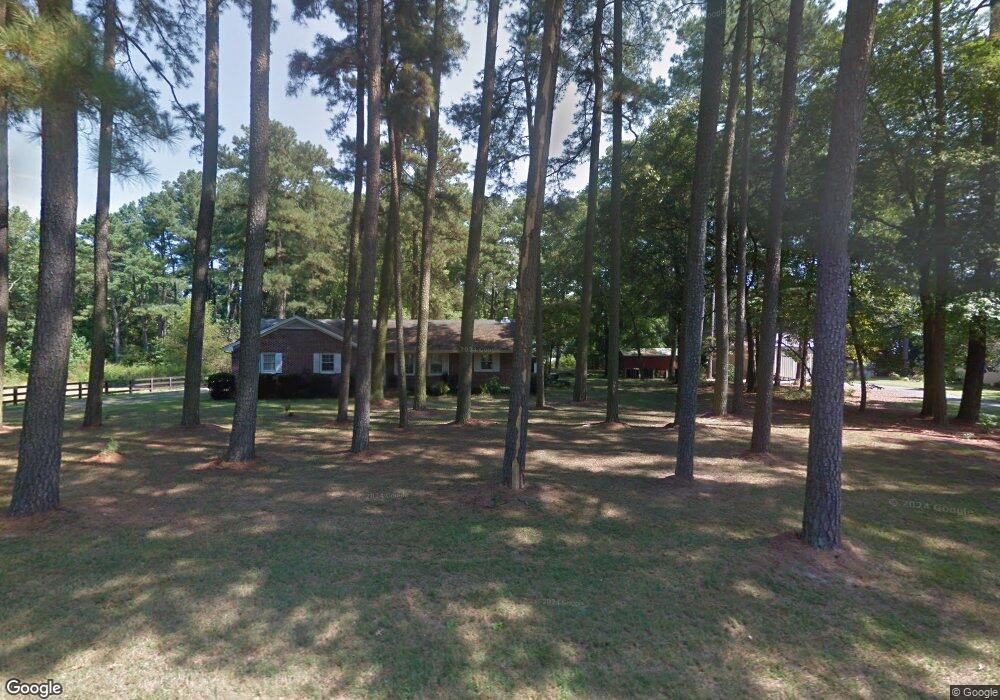
5061 Campground Rd Eden, MD 21822
South Salisbury NeighborhoodEstimated Value: $321,312 - $386,000
3
Beds
2
Baths
1,512
Sq Ft
$231/Sq Ft
Est. Value
About This Home
This home is located at 5061 Campground Rd, Eden, MD 21822 and is currently estimated at $349,078, approximately $230 per square foot. 5061 Campground Rd is a home located in Wicomico County with nearby schools including Fruitland Primary School, Fruitland Intermediate School, and Bennett Middle School.
Ownership History
Date
Name
Owned For
Owner Type
Purchase Details
Closed on
Apr 11, 2008
Sold by
Schultz Ted and Schultz Sarah
Bought by
Rich John A
Current Estimated Value
Home Financials for this Owner
Home Financials are based on the most recent Mortgage that was taken out on this home.
Original Mortgage
$118,500
Outstanding Balance
$74,903
Interest Rate
6.1%
Mortgage Type
Credit Line Revolving
Estimated Equity
$274,175
Purchase Details
Closed on
Apr 7, 2008
Sold by
Schultz Ted and Schultz Sarah
Bought by
Rich John A
Home Financials for this Owner
Home Financials are based on the most recent Mortgage that was taken out on this home.
Original Mortgage
$118,500
Outstanding Balance
$74,903
Interest Rate
6.1%
Mortgage Type
Credit Line Revolving
Estimated Equity
$274,175
Purchase Details
Closed on
Mar 7, 2003
Sold by
Malone Woodrow W
Bought by
Schultz Ted and Schultz Sarah
Create a Home Valuation Report for This Property
The Home Valuation Report is an in-depth analysis detailing your home's value as well as a comparison with similar homes in the area
Home Values in the Area
Average Home Value in this Area
Purchase History
| Date | Buyer | Sale Price | Title Company |
|---|---|---|---|
| Rich John A | $230,000 | -- | |
| Rich John A | $230,000 | -- | |
| Schultz Ted | $155,400 | -- |
Source: Public Records
Mortgage History
| Date | Status | Borrower | Loan Amount |
|---|---|---|---|
| Open | Rich John A | $118,500 | |
| Closed | Rich John A | $100,000 | |
| Closed | Rich John A | $118,500 | |
| Closed | Rich John A | $100,000 | |
| Closed | Schultz Ted | -- |
Source: Public Records
Tax History
| Year | Tax Paid | Tax Assessment Tax Assessment Total Assessment is a certain percentage of the fair market value that is determined by local assessors to be the total taxable value of land and additions on the property. | Land | Improvement |
|---|---|---|---|---|
| 2025 | $2,108 | $247,933 | $0 | $0 |
| 2024 | $2,097 | $228,300 | $37,500 | $190,800 |
| 2023 | $2,054 | $212,767 | $0 | $0 |
| 2022 | $2,011 | $197,233 | $0 | $0 |
| 2021 | $1,898 | $181,700 | $37,500 | $144,200 |
| 2020 | $1,898 | $178,267 | $0 | $0 |
| 2019 | $1,890 | $174,833 | $0 | $0 |
| 2018 | $1,863 | $171,400 | $37,500 | $133,900 |
| 2017 | $1,863 | $171,400 | $0 | $0 |
| 2016 | -- | $171,400 | $0 | $0 |
| 2015 | $1,705 | $176,300 | $0 | $0 |
| 2014 | $1,705 | $176,300 | $0 | $0 |
Source: Public Records
Map
Nearby Homes
- 0 Campground Rd Unit MDWC2021796
- 26581 Siloam Rd
- 4984 Lords Creek Dr
- 5423 Loch Ness Terrace
- 5474 Royal Mile Blvd
- 5482 Royal Mile Blvd
- 5461 Loch Ness Terrace
- 5437 Nithsdale Dr
- 5485 Saint Andrews Dr
- 27160 Scotland Pkwy
- 5709 Royal Mile Blvd
- 26188 High Banks Dr
- 5662 Clydesdale Dr
- 5660 Caledonia Dr
- 27458 Mooring Way
- 27480 Mooring Way
- 5799 Homestead St
- 5814 Homestead St
- 5850 Brook St
- 5991 Hounds Bay Cir
- 5065 Campground Rd
- 5079 Campground Rd
- 5059 Campground Rd
- 5111 Campground Rd
- 5055 Campground Rd
- 5068 Campground Rd
- 5125 Campground Rd
- 5082 Campground Rd
- 5054 Campground Rd
- 5094 Campground Rd
- 5047 Campground Rd
- 5098 Campground Rd
- 5106 Campground Rd
- 5112 Campground Rd
- 26750 Riverside Drive Extension
- 26750 Riverside Drive Extension
- 26750 Riverside Drive Extension
- 5108 Cooper
- 26778 Riverside Drive Extension
- 26801 Riverside Drive Extension
Your Personal Tour Guide
Ask me questions while you tour the home.