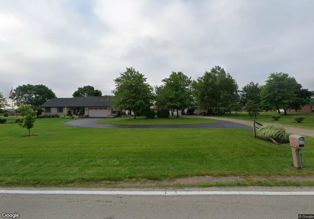
5061 S State Route 729 Sabina, OH 45169
Estimated Value: $288,118 - $487,000
3
Beds
3
Baths
1,642
Sq Ft
$222/Sq Ft
Est. Value
About This Home
This home is located at 5061 S State Route 729, Sabina, OH 45169 and is currently estimated at $365,280, approximately $222 per square foot. 5061 S State Route 729 is a home located in Clinton County with nearby schools including East Clinton High School.
Ownership History
Date
Name
Owned For
Owner Type
Purchase Details
Closed on
Sep 10, 2019
Sold by
Yeary James Kevin and Yeary Kathy
Bought by
Starkey Timothy L and Starkey Stephanie R
Current Estimated Value
Home Financials for this Owner
Home Financials are based on the most recent Mortgage that was taken out on this home.
Original Mortgage
$230,743
Outstanding Balance
$203,218
Interest Rate
3.87%
Mortgage Type
FHA
Estimated Equity
$162,062
Purchase Details
Closed on
Feb 23, 2018
Sold by
Yeary James Kevin and Yeary Kathy
Bought by
Yeary Andrew J and Krohn Christa M
Purchase Details
Closed on
Nov 20, 2006
Sold by
Bronson Bryan Lee and Bronson Jerrie Jo
Bought by
Yeary James Kevin and Yeary Kathy
Purchase Details
Closed on
Jun 17, 1997
Bought by
Bronson Bryan Lee
Create a Home Valuation Report for This Property
The Home Valuation Report is an in-depth analysis detailing your home's value as well as a comparison with similar homes in the area
Home Values in the Area
Average Home Value in this Area
Purchase History
| Date | Buyer | Sale Price | Title Company |
|---|---|---|---|
| Starkey Timothy L | $235,000 | None Available | |
| Yeary Andrew J | -- | None Available | |
| Yeary Andrew J | -- | None Available | |
| Yeary James Kevin | $233,333 | -- | |
| Bronson Bryan Lee | $10,000 | -- |
Source: Public Records
Mortgage History
| Date | Status | Borrower | Loan Amount |
|---|---|---|---|
| Open | Starkey Timothy L | $230,743 |
Source: Public Records
Tax History Compared to Growth
Tax History
| Year | Tax Paid | Tax Assessment Tax Assessment Total Assessment is a certain percentage of the fair market value that is determined by local assessors to be the total taxable value of land and additions on the property. | Land | Improvement |
|---|---|---|---|---|
| 2024 | $2,958 | $75,010 | $10,260 | $64,750 |
| 2023 | $2,958 | $75,010 | $10,260 | $64,750 |
| 2022 | $3,044 | $66,350 | $5,900 | $60,450 |
| 2021 | $3,071 | $66,350 | $5,900 | $60,450 |
| 2020 | $3,079 | $66,350 | $5,900 | $60,450 |
| 2019 | $2,525 | $53,080 | $5,900 | $47,180 |
| 2018 | $2,205 | $53,080 | $5,900 | $47,180 |
| 2017 | $910 | $53,080 | $5,900 | $47,180 |
| 2016 | $1,769 | $51,960 | $6,350 | $45,610 |
| 2015 | $1,800 | $51,960 | $6,350 | $45,610 |
| 2013 | $1,878 | $51,960 | $6,350 | $45,610 |
Source: Public Records
Map
Nearby Homes
- 3605 Ohio 72
- 3445 St Rt 72
- 3509 S State Route 72
- 3509 S St Rt 72
- 3135 Hornbeam Rd
- 2762 Reed Rd
- 612 Darbyshire Rd
- 241 Roshon Ave
- 320 San Mar Gale Dr
- 100 E Lewis Ave
- 70 Martin Place
- 400 Grand Ave
- 62 Union St
- 42 Trahera Ln
- 585 Florence Ave
- 371 Rose Ave
- 323 W Mound St
- 51 Cline Rd
- 8529 Ohio 72
- 32 Weller St
- 4993 S State Route 729
- 5087 S State Route 729
- 5087 Ohio 729
- 5096 S State Route 729
- 5096 S State Route 729
- 5174 S State Route 729
- 5227 S State Route 729
- 5345 S State Route 729
- 3865 S State Route 72
- 3865 S State Route 72
- 3895 St Rt 72
- 4108 S State Route 72
- 3677 Ohio 72
- 3677 S State Route 72
- 3721 Ohio 72
- 3721 S State Route 72
- 4423 S St Rt 72
- 4423 S State Route 72
- 4541 S State Route 72
- 4541 S St Rt 72