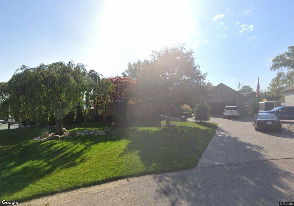
50635 Reginald St New Baltimore, MI 48047
Estimated Value: $594,000
3
Beds
3
Baths
2,284
Sq Ft
$260/Sq Ft
Est. Value
About This Home
This home is located at 50635 Reginald St, New Baltimore, MI 48047 and is currently priced at $594,000, approximately $260 per square foot. 50635 Reginald St is a home located in Macomb County with nearby schools including Lighthouse Elementary School, Anchor Bay Middle School North, and Anchor Bay High School.
Ownership History
Date
Name
Owned For
Owner Type
Purchase Details
Closed on
Oct 25, 2016
Sold by
Hibbs Russel J and Berbenchuk Sue Ann
Bought by
Hibbs Russel J and Berbenchuk Sue Ann
Current Estimated Value
Purchase Details
Closed on
Nov 12, 2010
Sold by
Schmitt Arnold R and Schmitt Linda G
Bought by
Hibbs Russel and Berbenchuk Sue Ann
Home Financials for this Owner
Home Financials are based on the most recent Mortgage that was taken out on this home.
Original Mortgage
$300,000
Interest Rate
4.17%
Mortgage Type
New Conventional
Purchase Details
Closed on
Sep 28, 1994
Sold by
Pizzo Benedict
Bought by
Makemson Donald J and Makemson Linda
Home Financials for this Owner
Home Financials are based on the most recent Mortgage that was taken out on this home.
Original Mortgage
$110,000
Interest Rate
8.55%
Mortgage Type
New Conventional
Create a Home Valuation Report for This Property
The Home Valuation Report is an in-depth analysis detailing your home's value as well as a comparison with similar homes in the area
Home Values in the Area
Average Home Value in this Area
Purchase History
Date | Buyer | Sale Price | Title Company |
---|---|---|---|
Hibbs Russel J | -- | None Available | |
Hibbs Russel | $400,000 | Colonial Title Company | |
Makemson Donald J | $355,000 | -- |
Source: Public Records
Mortgage History
Date | Status | Borrower | Loan Amount |
---|---|---|---|
Open | Hibbs Russel | $336,000 | |
Closed | Hibbs Russel J | $88,900 | |
Closed | Hibbs Russel | $300,000 | |
Previous Owner | Schmitt Arnold R | $260,000 | |
Previous Owner | Makemson Donald J | $110,000 |
Source: Public Records
Tax History Compared to Growth
Tax History
Year | Tax Paid | Tax Assessment Tax Assessment Total Assessment is a certain percentage of the fair market value that is determined by local assessors to be the total taxable value of land and additions on the property. | Land | Improvement |
---|---|---|---|---|
2023 | -- | $0 | $0 | $0 |
2022 | $0 | $0 | $0 | $0 |
2021 | $8,052 | $243,500 | $0 | $0 |
2020 | $6,804 | $235,500 | $0 | $0 |
2019 | $7,641 | $228,400 | $0 | $0 |
2018 | $7,515 | $214,400 | $0 | $0 |
2017 | $7,441 | $209,900 | $100,400 | $109,500 |
2016 | $7,441 | $209,900 | $0 | $0 |
2015 | -- | $202,400 | $0 | $0 |
2014 | -- | $175,300 | $0 | $0 |
Source: Public Records
Map
Nearby Homes
- 50720 Lenox St
- 50591 Walpole St
- 50820 Marsha Ln Unit 23
- 38141 Murdick Dr
- 38199 Murdick Dr
- 38204 Main St
- 50848 Ashley St
- 36542 Marquardt Ct
- 00 Green St
- 36712 Hathaway St
- 36465 Main St
- 10371 Riveria Ct
- 37064 Willow Creek Ln
- 53501 Mary Ann Ln
- 50716 Taylor St
- 7006 Brides Bay Ct
- 53234 Fox Pointe Dr
- 51249 Clay St
- 10270 Dixie Hwy
- 51126 Rose St
- 50635 Reginald St
- 50730 Miner St
- 50655 Reginald St
- 50736 Miner St
- 50740 Miner St
- 50665 Reginald St
- 50750 Miner St
- 50681 Reginald St
- 50760 Miner St
- 50691 Reginald St
- 50766 Miner St
- 50695 Reginald St
- 50725 Miner St
- 50730 Lenox St
- 50770 Miner St
- 50761 Miner St
- 50705 Reginald St
- 50771 Miner St Unit Bldg-Unit
- 50771 Miner St
- 50600 Brady St