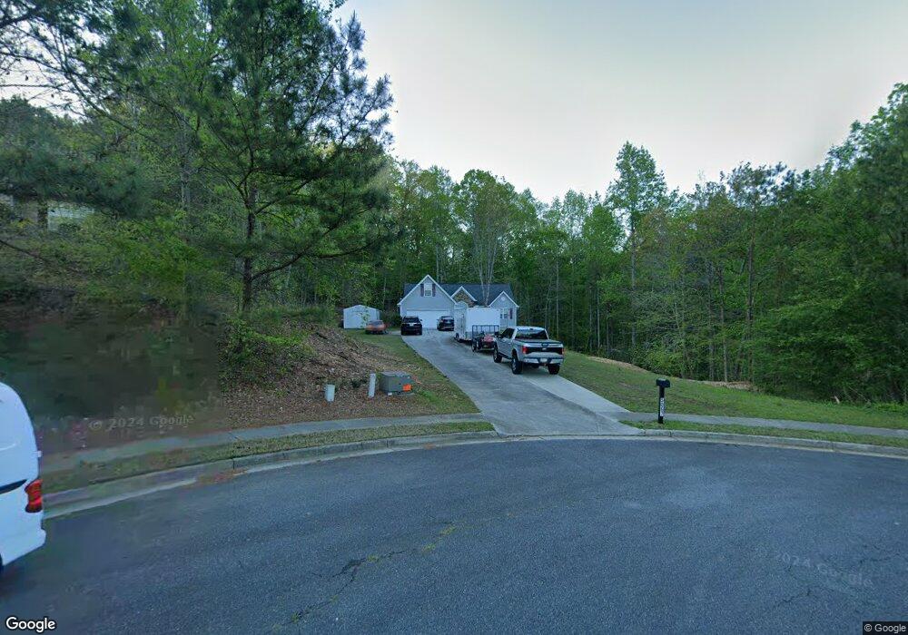
5067 Lodge Pole Dr Flowery Branch, GA 30542
Estimated Value: $358,000 - $520,021
3
Beds
2
Baths
1,936
Sq Ft
$227/Sq Ft
Est. Value
About This Home
This home is located at 5067 Lodge Pole Dr, Flowery Branch, GA 30542 and is currently estimated at $439,340, approximately $226 per square foot. 5067 Lodge Pole Dr is a home located in Hall County with nearby schools including Friendship Elementary School, C.W. Davis Middle School, and Flowery Branch High School.
Ownership History
Date
Name
Owned For
Owner Type
Purchase Details
Closed on
Mar 15, 2016
Sold by
Camire Ronda L
Bought by
Camire Joseph
Current Estimated Value
Purchase Details
Closed on
Aug 29, 2003
Sold by
Camire Joseph
Bought by
Camire Joseph and Camire Ronda
Home Financials for this Owner
Home Financials are based on the most recent Mortgage that was taken out on this home.
Original Mortgage
$140,000
Interest Rate
5.94%
Mortgage Type
New Conventional
Purchase Details
Closed on
Mar 20, 2003
Sold by
Old Orr Road Development Llc
Bought by
A & S Builders Inc
Create a Home Valuation Report for This Property
The Home Valuation Report is an in-depth analysis detailing your home's value as well as a comparison with similar homes in the area
Home Values in the Area
Average Home Value in this Area
Purchase History
| Date | Buyer | Sale Price | Title Company |
|---|---|---|---|
| Camire Joseph | $30,000 | -- | |
| Camire Joseph | -- | -- | |
| Camire Joseph | $198,700 | -- | |
| A & S Builders Inc | $227,500 | -- |
Source: Public Records
Mortgage History
| Date | Status | Borrower | Loan Amount |
|---|---|---|---|
| Previous Owner | Camire Joseph | $140,000 |
Source: Public Records
Tax History Compared to Growth
Tax History
| Year | Tax Paid | Tax Assessment Tax Assessment Total Assessment is a certain percentage of the fair market value that is determined by local assessors to be the total taxable value of land and additions on the property. | Land | Improvement |
|---|---|---|---|---|
| 2024 | $4,489 | $176,680 | $53,080 | $123,600 |
| 2023 | $3,560 | $154,720 | $37,760 | $116,960 |
| 2022 | $3,366 | $125,840 | $34,600 | $91,240 |
| 2021 | $3,322 | $121,840 | $34,600 | $87,240 |
| 2020 | $2,984 | $105,920 | $31,440 | $74,480 |
| 2019 | $2,878 | $101,120 | $31,440 | $69,680 |
| 2018 | $2,814 | $95,640 | $31,440 | $64,200 |
| 2017 | $2,591 | $88,720 | $31,440 | $57,280 |
| 2016 | $2,380 | $83,152 | $31,440 | $51,712 |
| 2015 | $2,395 | $83,152 | $31,440 | $51,712 |
| 2014 | $2,395 | $83,152 | $31,440 | $51,712 |
Source: Public Records
Map
Nearby Homes
- 4947 Old Orr Rd
- 4939 Old Orr Rd Unit LOT 1
- 4943 Old Orr Rd Unit LOT 2
- 4939 Old Orr Rd
- 4943 Old Orr Rd
- 6243 Malibu Ridge
- 6236 Malibu Ridge
- 5066 Old Orr Rd
- 0 Osborne Rd Unit 7091999
- 4885 Hog Mountain Rd
- 6775 Winding Canyon Rd
- 6151 Spout Springs Rd
- 6229 Ivy Springs Dr
- 5647 Chickory Dr Unit 119
- 5563 Overview Dr Unit 13
- 5621 Ernest Way
- 5563 Overview Dr
- 4700 Wilderness Trail
- 5649 Ernest Way
- 5662 Evelyn Ln
- 5063 Lodge Pole Dr
- 5043 Lodge Pole Dr
- 5068 Lodge Pole Dr
- 0 Blue Goose Ct Unit 8430309
- 5019 Yellow Stone Dr
- 5051 Blue Goose Ct
- 5013 Yellow Stone Dr
- 5025 Yellow Stone Dr
- 5025 Yellow Stone Dr
- 5009 Yellow Stone Dr
- 5042 Lodge Pole Dr
- 5036 Lodge Pole Dr
- 5055 Blue Goose Ct
- 4975 Old Orr Rd
- 5109 Yellow Stone Dr
- 5059 Blue Goose Ct
- 5012 Yellow Stone Dr
- 5004 Yellow Stone Dr
- 5016 Yellow Stone Dr
- 5056 Blue Goose Ct