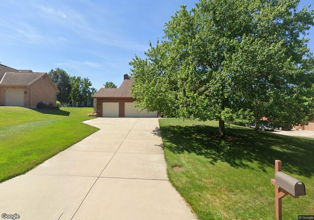
5069 Westsand Ct West Chester, OH 45069
West Chester Township NeighborhoodEstimated Value: $470,000 - $567,000
4
Beds
3
Baths
2,666
Sq Ft
$189/Sq Ft
Est. Value
About This Home
This home is located at 5069 Westsand Ct, West Chester, OH 45069 and is currently estimated at $503,182, approximately $188 per square foot. 5069 Westsand Ct is a home located in Butler County with nearby schools including Endeavor Elementary School, Lakota Plains Junior School, and Lakota West High School.
Ownership History
Date
Name
Owned For
Owner Type
Purchase Details
Closed on
Jun 5, 2017
Sold by
Replogle Ronald
Bought by
Replogle Ronald T and Replogle Carole A
Current Estimated Value
Purchase Details
Closed on
Aug 28, 2002
Sold by
Replogle Ronald T and Replogle Carole A
Bought by
Replogle Ronald and The Ronald Replogle Trust
Purchase Details
Closed on
Dec 1, 1988
Purchase Details
Closed on
Oct 1, 1987
Create a Home Valuation Report for This Property
The Home Valuation Report is an in-depth analysis detailing your home's value as well as a comparison with similar homes in the area
Home Values in the Area
Average Home Value in this Area
Purchase History
| Date | Buyer | Sale Price | Title Company |
|---|---|---|---|
| Replogle Ronald T | -- | None Available | |
| Replogle Ronald | -- | -- | |
| -- | $190,200 | -- | |
| -- | $37,100 | -- |
Source: Public Records
Tax History Compared to Growth
Tax History
| Year | Tax Paid | Tax Assessment Tax Assessment Total Assessment is a certain percentage of the fair market value that is determined by local assessors to be the total taxable value of land and additions on the property. | Land | Improvement |
|---|---|---|---|---|
| 2024 | $4,979 | $129,580 | $19,410 | $110,170 |
| 2023 | $4,935 | $125,630 | $19,410 | $106,220 |
| 2022 | $5,442 | $101,810 | $19,410 | $82,400 |
| 2021 | $4,702 | $97,890 | $19,410 | $78,480 |
| 2020 | $4,813 | $97,890 | $19,410 | $78,480 |
| 2019 | $7,869 | $82,110 | $18,990 | $63,120 |
| 2018 | $4,156 | $82,110 | $18,990 | $63,120 |
| 2017 | $4,216 | $82,110 | $18,990 | $63,120 |
| 2016 | $4,200 | $77,350 | $18,990 | $58,360 |
| 2015 | $4,193 | $77,350 | $18,990 | $58,360 |
| 2014 | $3,845 | $77,350 | $18,990 | $58,360 |
| 2013 | $3,845 | $75,830 | $18,990 | $56,840 |
Source: Public Records
Map
Nearby Homes
- 7392 Wheatland Meadow Ct
- 8330 Park Place
- 7229 W Hartford Ct
- 0 Walnut Creek Dr Unit 1850153
- 8354 Park Place
- 5241 Hamilton Mason Rd
- 7350 Keltner Dr
- 7695 Fox Chase Dr
- 6674 Southampton Ln
- 7257 Clawson Ct
- 4625 Guildford Dr
- 6993 Clawson Ridge Ct
- 7213 Quail Run Dr
- 7956 Bobtail Ct
- 7908 Pinnacle Point Dr
- 5577 Dove Ln
- 8050 Tollbridge Ct
- 5146 Mountview Ct
- 8135 Timbertree Way Unit 3
- 8003 Pinnacle Point Dr
- 5057 Westsand Ct
- 5079 Westsand Ct
- 5064 Park Ridge Ct
- 5052 Park Ridge Ct
- 5047 Westsand Ct
- 5093 Westsand Ct
- 5062 Westsand Ct
- 3 Westsand Ct
- 5042 Park Ridge Ct
- 5080 Westsand Ct
- 5037 Westsand Ct
- 5090 Westsand Ct
- 7426 Desert Spring Ct
- 5084 Park Ridge Ct
- 5032 Park Ridge Ct
- 7435 Desert Springs Ct
- 5100 Westsand Ct
- 7435 Desert Spring Ct
- 5025 Westsand Ct
- 7416 Desert Spring Ct