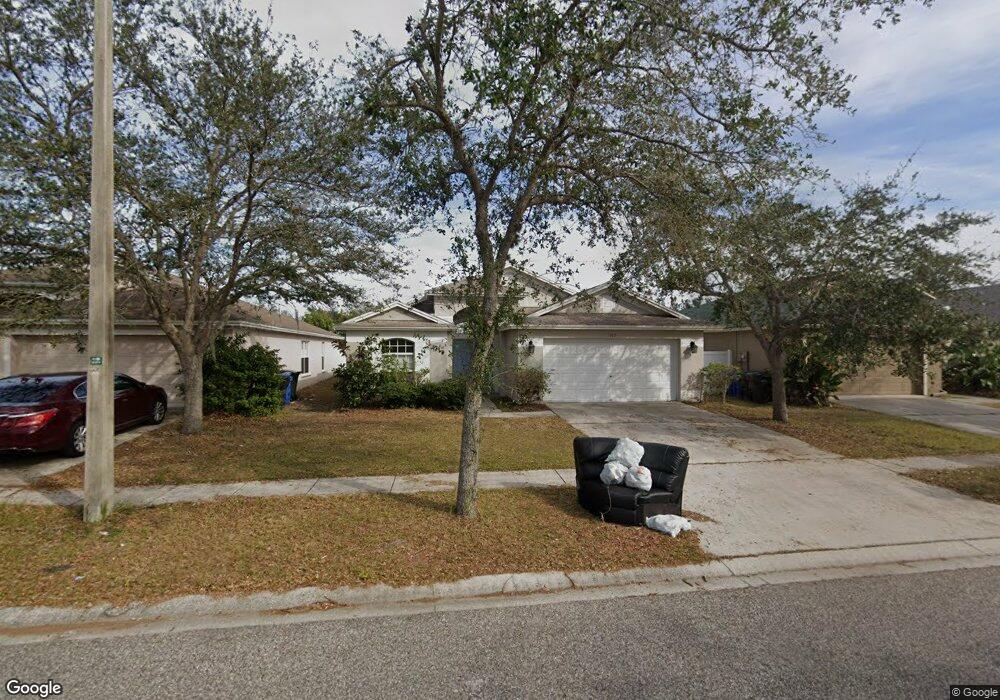
507 9th St NE Ruskin, FL 33570
Estimated Value: $285,000 - $337,000
3
Beds
2
Baths
1,858
Sq Ft
$164/Sq Ft
Est. Value
About This Home
This home is located at 507 9th St NE, Ruskin, FL 33570 and is currently estimated at $305,320, approximately $164 per square foot. 507 9th St NE is a home located in Hillsborough County with nearby schools including Thompson Elementary School, Shields Middle School, and Lennard High School.
Ownership History
Date
Name
Owned For
Owner Type
Purchase Details
Closed on
Jun 1, 2016
Bought by
Csh 2016-1 Borrower Llc
Current Estimated Value
Purchase Details
Closed on
May 16, 2014
Sold by
Clayton Derrick B and Clayton Andrea C
Bought by
Colfin Ah Florida 6 Llc
Purchase Details
Closed on
Oct 6, 2006
Sold by
Suarez Housing Corp
Bought by
Clayton Derrick B and Clayton Andrea C
Home Financials for this Owner
Home Financials are based on the most recent Mortgage that was taken out on this home.
Original Mortgage
$241,071
Interest Rate
6.36%
Mortgage Type
VA
Create a Home Valuation Report for This Property
The Home Valuation Report is an in-depth analysis detailing your home's value as well as a comparison with similar homes in the area
Home Values in the Area
Average Home Value in this Area
Purchase History
| Date | Buyer | Sale Price | Title Company |
|---|---|---|---|
| Csh 2016-1 Borrower Llc | $100 | -- | |
| Colfin Ah Florida 6 Llc | $106,400 | None Available | |
| Clayton Derrick B | $241,100 | Oakfield Title Services Llc |
Source: Public Records
Mortgage History
| Date | Status | Borrower | Loan Amount |
|---|---|---|---|
| Previous Owner | Clayton Derrick B | $241,071 |
Source: Public Records
Tax History Compared to Growth
Tax History
| Year | Tax Paid | Tax Assessment Tax Assessment Total Assessment is a certain percentage of the fair market value that is determined by local assessors to be the total taxable value of land and additions on the property. | Land | Improvement |
|---|---|---|---|---|
| 2024 | $4,894 | $248,939 | $75,735 | $173,204 |
| 2023 | $4,629 | $249,237 | $72,930 | $176,307 |
| 2022 | $4,166 | $217,173 | $50,490 | $166,683 |
| 2021 | $3,762 | $170,408 | $39,270 | $131,138 |
| 2020 | $3,415 | $149,277 | $36,465 | $112,812 |
| 2019 | $3,393 | $149,602 | $33,660 | $115,942 |
| 2018 | $3,315 | $145,014 | $0 | $0 |
| 2017 | $3,115 | $133,031 | $0 | $0 |
| 2016 | $3,066 | $129,144 | $0 | $0 |
| 2015 | $3,007 | $123,681 | $0 | $0 |
| 2014 | $1,312 | $107,224 | $0 | $0 |
| 2013 | -- | $76,698 | $0 | $0 |
Source: Public Records
Map
Nearby Homes
- 501 Delwood Breck St
- 762 Barclay Wood Dr
- 843 Royal Empress Dr
- 523 Glenn Cross Dr
- 408 Delwood Breck St
- 708 Barclay Wood Dr
- 714 Barclay Wood Dr
- 928 Royal Empress Dr
- 633 Royal Empress Dr
- 607 Royal Empress Dr
- 582 Royal Empress Dr
- 413 Royal Empress Dr
- 201 6th St NE
- 808 1st Ave NE
- 731 Cristelle Jean Dr
- 309 Blue Point Dr
- 110 14th St SE
- 714 Cristelle Jean Dr
- 1402 Delano Trent St
- 702 Cristelle Jean Dr
- 509 9th St NE
- 505 9th St NE
- 503 9th St NE
- 511 9th St NE
- 1216 Barclay Wood Dr
- 1218 Barclay Wood Dr
- 1214 Barclay Wood Dr
- 1220 Barclay Wood Dr
- 513 9th St NE
- 508 9th St NE
- 506 9th St NE
- 1222 Barclay Wood Dr
- 504 9th St NE
- 512 9th St NE
- 409 9th St NE
- 515 9th St NE
- 1212 Barclay Wood Dr
- 514 9th St NE
- 502 9th St NE
- 1224 Barclay Wood Dr Unit Dr