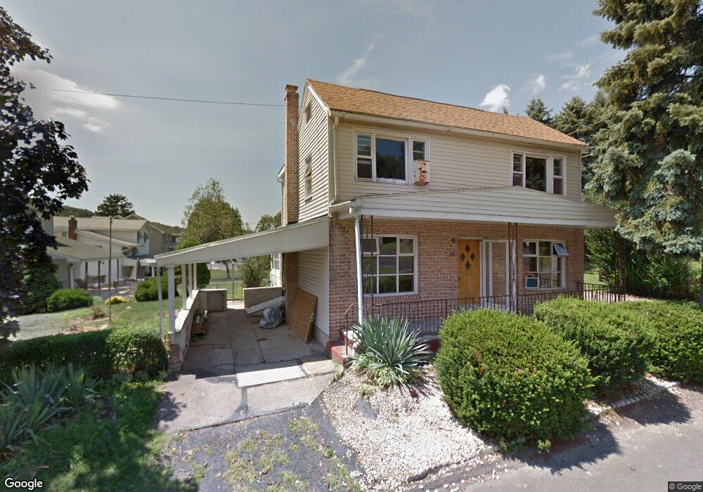
507 Broad St Mar Lin, PA 17951
Estimated Value: $131,000 - $233,000
3
Beds
2
Baths
1,820
Sq Ft
$97/Sq Ft
Est. Value
About This Home
This home is located at 507 Broad St, Mar Lin, PA 17951 and is currently estimated at $177,427, approximately $97 per square foot. 507 Broad St is a home with nearby schools including Clarke Elementary Center, Lengel Middle School, and Pottsville Area High School.
Ownership History
Date
Name
Owned For
Owner Type
Purchase Details
Closed on
Aug 26, 2020
Sold by
Hoffman Melvin and Hoffman Dawn
Bought by
George David T
Current Estimated Value
Home Financials for this Owner
Home Financials are based on the most recent Mortgage that was taken out on this home.
Original Mortgage
$92,000
Outstanding Balance
$73,731
Interest Rate
2.9%
Mortgage Type
New Conventional
Estimated Equity
$103,696
Purchase Details
Closed on
Jul 6, 2012
Sold by
Bertasavage Julia B
Bought by
Hoffman Melvin P and Hoffman Dawn M
Create a Home Valuation Report for This Property
The Home Valuation Report is an in-depth analysis detailing your home's value as well as a comparison with similar homes in the area
Home Values in the Area
Average Home Value in this Area
Purchase History
| Date | Buyer | Sale Price | Title Company |
|---|---|---|---|
| George David T | $115,000 | First Amer Ttl Guaranty Co | |
| Hoffman Melvin P | $40,000 | None Available |
Source: Public Records
Mortgage History
| Date | Status | Borrower | Loan Amount |
|---|---|---|---|
| Open | George David T | $92,000 |
Source: Public Records
Tax History Compared to Growth
Tax History
| Year | Tax Paid | Tax Assessment Tax Assessment Total Assessment is a certain percentage of the fair market value that is determined by local assessors to be the total taxable value of land and additions on the property. | Land | Improvement |
|---|---|---|---|---|
| 2025 | $1,672 | $25,040 | $5,000 | $20,040 |
| 2024 | $1,565 | $25,040 | $5,000 | $20,040 |
| 2023 | $1,500 | $24,000 | $5,000 | $19,000 |
| 2022 | $1,479 | $24,000 | $5,000 | $19,000 |
| 2021 | $1,494 | $24,000 | $5,000 | $19,000 |
| 2020 | $1,456 | $24,000 | $5,000 | $19,000 |
| 2018 | $1,375 | $24,000 | $5,000 | $19,000 |
| 2017 | $1,269 | $24,000 | $5,000 | $19,000 |
| 2015 | -- | $24,000 | $5,000 | $19,000 |
| 2011 | -- | $24,000 | $0 | $0 |
Source: Public Records
Map
Nearby Homes
- 316 Beechwood Ave
- 1560 Bunting St
- 25 Tall Oaks Dr
- 2505 W End Ave
- 201 Arlene St
- 200 Buckley St
- 18 E Sunbury St
- 423 Lytle St
- 20 Sunbury St
- 124 Spruce St
- 251 Spruce St
- 114 S 25th St
- 231 Laurel St
- 321 Cherry St
- 405 N Front St
- 125 Carbon St
- 233 South St
- 141 Carbon St
- 124 S 3rd St
- 0 Mahantongo Dr Unit PASK2021220
- 507 Broad St
- 311 Chestnut St
- 309 Chestnut St
- 306 Spruce St
- 401 Chestnut St
- 510 Broad St
- 304 Spruce St
- 307 Chestnut St
- 307 Chestnut St
- 308 Chestnut St
- 312 Chestnut St
- 400 Chestnut St
- 302 Spruce St
- 405 Chestnut St
- 305 Chestnut St
- 308 Chestnut St
- 308 Chestnut St
- 311 Spruce St
- 309 Spruce St
- 305 Spruce St