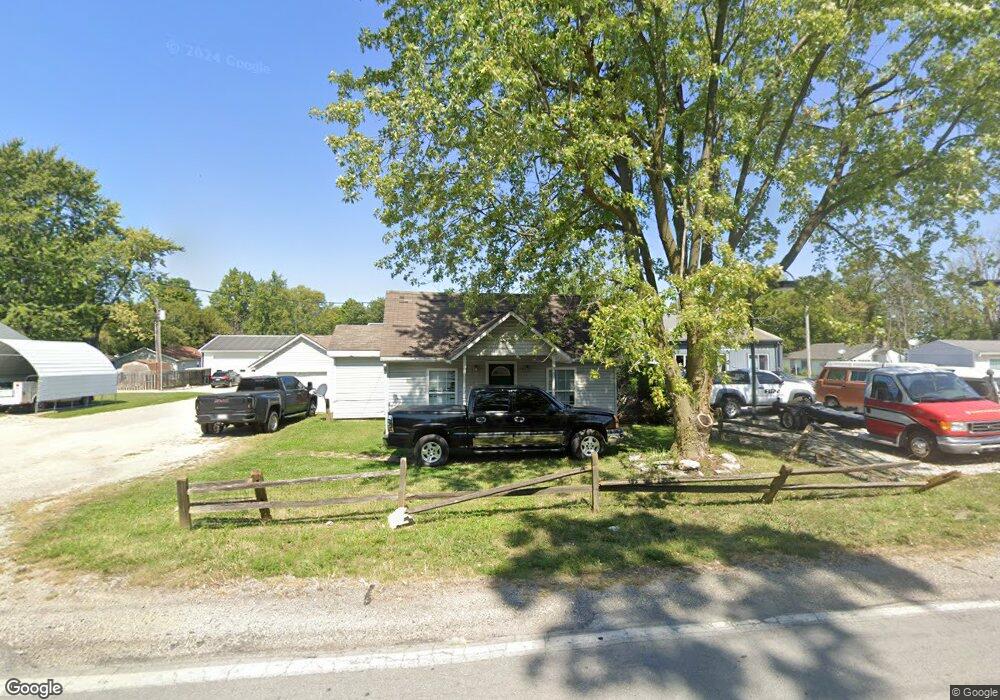
507 E 10th St Sheridan, IN 46069
Estimated Value: $100,000 - $348,000
3
Beds
1
Bath
992
Sq Ft
$212/Sq Ft
Est. Value
About This Home
This home is located at 507 E 10th St, Sheridan, IN 46069 and is currently estimated at $210,776, approximately $212 per square foot. 507 E 10th St is a home located in Hamilton County with nearby schools including Sheridan Elementary School, Sheridan Middle School, and Sheridan High School.
Ownership History
Date
Name
Owned For
Owner Type
Purchase Details
Closed on
Jun 6, 2023
Sold by
Halcomb William
Bought by
Rodriguez Bethany C
Current Estimated Value
Purchase Details
Closed on
Nov 24, 2008
Sold by
The Cit Group/Consumer Finance Inc
Bought by
Halcomb William R
Purchase Details
Closed on
Oct 2, 2008
Sold by
Rood Charles R
Bought by
The Bank Of New York
Purchase Details
Closed on
May 25, 2006
Sold by
Rood Debra E
Bought by
Rood Charles R
Home Financials for this Owner
Home Financials are based on the most recent Mortgage that was taken out on this home.
Original Mortgage
$97,750
Interest Rate
6.66%
Mortgage Type
Purchase Money Mortgage
Create a Home Valuation Report for This Property
The Home Valuation Report is an in-depth analysis detailing your home's value as well as a comparison with similar homes in the area
Home Values in the Area
Average Home Value in this Area
Purchase History
| Date | Buyer | Sale Price | Title Company |
|---|---|---|---|
| Rodriguez Bethany C | $60,000 | None Listed On Document | |
| Halcomb William R | -- | None Available | |
| The Bank Of New York | $21,447 | None Available | |
| Rood Charles R | -- | Chicago Title Insurance Co |
Source: Public Records
Mortgage History
| Date | Status | Borrower | Loan Amount |
|---|---|---|---|
| Previous Owner | Rood Charles R | $97,750 |
Source: Public Records
Tax History
| Year | Tax Paid | Tax Assessment Tax Assessment Total Assessment is a certain percentage of the fair market value that is determined by local assessors to be the total taxable value of land and additions on the property. | Land | Improvement |
|---|---|---|---|---|
| 2024 | $2,219 | $103,500 | $30,800 | $72,700 |
| 2023 | $2,304 | $101,100 | $30,800 | $70,300 |
| 2022 | $2,183 | $94,100 | $30,800 | $63,300 |
| 2021 | $2,015 | $86,600 | $30,800 | $55,800 |
| 2020 | $1,924 | $82,600 | $30,800 | $51,800 |
| 2019 | $1,747 | $74,700 | $12,900 | $61,800 |
| 2018 | $2,438 | $70,300 | $12,900 | $57,400 |
| 2017 | $1,435 | $60,800 | $12,900 | $47,900 |
| 2016 | $2,840 | $60,800 | $12,900 | $47,900 |
| 2014 | $1,227 | $56,000 | $20,200 | $35,800 |
| 2013 | $1,227 | $56,000 | $20,200 | $35,800 |
Source: Public Records
Map
Nearby Homes
- 286 Th St
- 1141 S Malott St
- 2710 W State Road 38
- 600 S Georgia St
- 903&905 S Georgia St
- 400 S Georgia St
- 514 E 2nd St
- 407 W 8th St
- 108 W 3rd St
- 21650 Mule Barn Rd
- 21350 Mule Barn Rd
- 707 S Hamilton Ave
- 390 W State Road 38
- 1225 Maple Trace Way
- 410 Shadetree Ct
- 100 S California St
- 511 Tomahawk St
- 1300 Shadetree Ln
- 1310 Shadetree Ln
- 606 W 2nd St
- 906 S Hudson St
- 0 W State Road 47 Unit 21547754
- 0 W State Road 47 Unit MBR21815520
- 0 W State Road 47 Unit MBR21807992
- 0 W State Road 47 Unit 21718848
- 0 W State Road 47 Unit 21681053
- 0 W Sr 47 Unit 21514330
- 0 W Sr 47 Unit 2917870
- 0 W Sr 47 Unit 21050513
- 0 W Sr 47 Unit 21050517
- 0 W Sr 47 Unit 21451631
- 0 W Sr 47 Unit 21451626
- 0 W Sr 47 Unit 21451619
- 0 W Sr 47 Unit 21126192
- 0 W Sr 47 Unit 21126166
- 0 W Sr 47 Unit 21213676
- 0 W Sr 47 Unit 21213670
- 0 W Sr 47 Unit 21306768
- 0 W Sr 47 Unit 21345238
- 0 W Sr 47 Unit MBR2621806
Your Personal Tour Guide
Ask me questions while you tour the home.