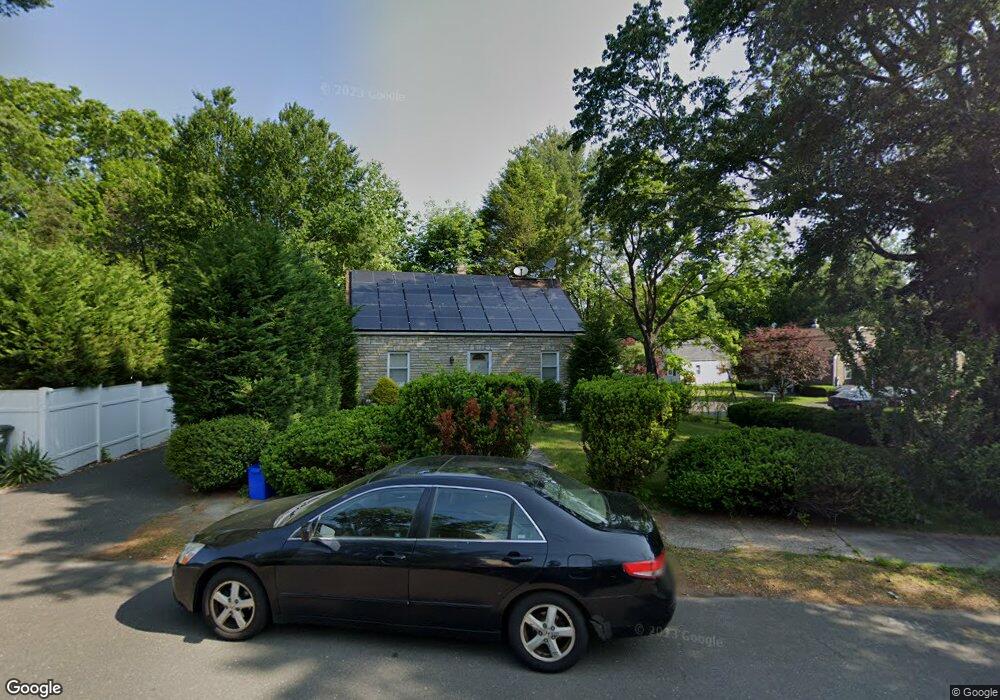
507 Evers St Bridgeport, CT 06610
North Bridgeport NeighborhoodEstimated Value: $343,000 - $420,000
3
Beds
1
Bath
1,152
Sq Ft
$323/Sq Ft
Est. Value
About This Home
This home is located at 507 Evers St, Bridgeport, CT 06610 and is currently estimated at $372,035, approximately $322 per square foot. 507 Evers St is a home located in Fairfield County with nearby schools including Hooker School, Harding High School, and Christian Heritage School.
Ownership History
Date
Name
Owned For
Owner Type
Purchase Details
Closed on
Jan 7, 2010
Sold by
Chfa
Bought by
Hdf Community Works Ll
Current Estimated Value
Purchase Details
Closed on
Jun 23, 2004
Sold by
Horvath Russell and Horvath Jeanne
Bought by
Gelin Kerry and Bennett Jodean
Purchase Details
Closed on
Aug 22, 1991
Sold by
Brooks Michael
Bought by
Horvath Russell and Horvath Jeanne
Create a Home Valuation Report for This Property
The Home Valuation Report is an in-depth analysis detailing your home's value as well as a comparison with similar homes in the area
Home Values in the Area
Average Home Value in this Area
Purchase History
| Date | Buyer | Sale Price | Title Company |
|---|---|---|---|
| Hdf Community Works Ll | $133,650 | -- | |
| Hdf Community Works Ll | $133,650 | -- | |
| Gelin Kerry | $188,000 | -- | |
| Gelin Kerry | $188,000 | -- | |
| Horvath Russell | $90,000 | -- | |
| Horvath Russell | $90,000 | -- |
Source: Public Records
Mortgage History
| Date | Status | Borrower | Loan Amount |
|---|---|---|---|
| Open | Horvath Russell | $102,000 | |
| Closed | Horvath Russell | $28,000 |
Source: Public Records
Tax History
| Year | Tax Paid | Tax Assessment Tax Assessment Total Assessment is a certain percentage of the fair market value that is determined by local assessors to be the total taxable value of land and additions on the property. | Land | Improvement |
|---|---|---|---|---|
| 2025 | $6,394 | $147,150 | $65,420 | $81,730 |
| 2024 | $6,394 | $147,150 | $65,420 | $81,730 |
| 2023 | $6,394 | $147,150 | $65,420 | $81,730 |
| 2022 | $6,394 | $147,150 | $65,420 | $81,730 |
| 2021 | $6,394 | $147,150 | $65,420 | $81,730 |
| 2020 | $6,367 | $117,930 | $53,670 | $64,260 |
| 2019 | $6,367 | $117,930 | $53,670 | $64,260 |
| 2018 | $6,412 | $117,930 | $53,670 | $64,260 |
| 2017 | $6,412 | $117,930 | $53,670 | $64,260 |
| 2016 | $6,412 | $117,930 | $53,670 | $64,260 |
| 2015 | $5,882 | $139,390 | $52,440 | $86,950 |
| 2014 | $5,882 | $139,390 | $52,440 | $86,950 |
Source: Public Records
Map
Nearby Homes
- 11 Nob Hill Cir
- 211 Louisiana Ave Unit D
- 154 Virginia Ave Unit B
- 261 Pennsylvania Ave
- 120 Huntington Turnpike Unit 202
- 132 Virginia Ave Unit 132
- 186 Louisiana Ave Unit D
- 119 Jennings Ave
- 33 Louisiana Ave Unit 35
- 3699 Broadbridge Ave Unit 330
- 3699 Broadbridge Ave Unit 101
- 72 Broadmere Rd
- 285 Hillcrest Rd
- 250 Dayton Rd
- 207 Hillcrest Rd
- 563 Pearl Harbor St
- 156 Dayton Rd
- 2100-2102 E Main St
- 2092-2096 E Main St
- 46 York St
Your Personal Tour Guide
Ask me questions while you tour the home.