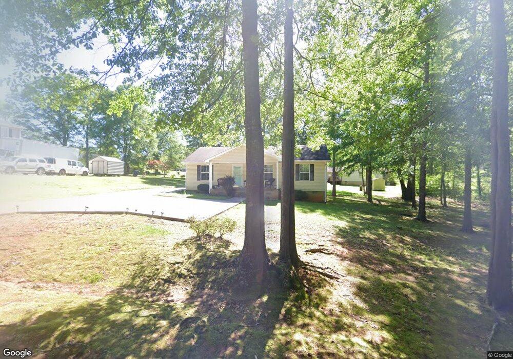
507 Mulberry St Thomaston, GA 30286
Estimated Value: $214,000 - $224,000
3
Beds
2
Baths
1,305
Sq Ft
$167/Sq Ft
Est. Value
About This Home
This home is located at 507 Mulberry St, Thomaston, GA 30286 and is currently estimated at $217,469, approximately $166 per square foot. 507 Mulberry St is a home located in Upson County with nearby schools including Upson-Lee South Elementary School, Upson-Lee North Elementary School, and Upson-Lee Middle School.
Ownership History
Date
Name
Owned For
Owner Type
Purchase Details
Closed on
Mar 17, 2005
Sold by
Fallin C Jerome
Bought by
Lary Pamela E
Current Estimated Value
Home Financials for this Owner
Home Financials are based on the most recent Mortgage that was taken out on this home.
Original Mortgage
$77,749
Outstanding Balance
$39,312
Interest Rate
5.57%
Mortgage Type
FHA
Estimated Equity
$178,157
Purchase Details
Closed on
Dec 17, 2004
Sold by
Fallin Robert P
Bought by
Fallin C Jerome
Create a Home Valuation Report for This Property
The Home Valuation Report is an in-depth analysis detailing your home's value as well as a comparison with similar homes in the area
Home Values in the Area
Average Home Value in this Area
Purchase History
| Date | Buyer | Sale Price | Title Company |
|---|---|---|---|
| Lary Pamela E | $79,000 | -- | |
| Fallin C Jerome | $5,500 | -- |
Source: Public Records
Mortgage History
| Date | Status | Borrower | Loan Amount |
|---|---|---|---|
| Open | Lary Pamela E | $77,749 |
Source: Public Records
Tax History Compared to Growth
Tax History
| Year | Tax Paid | Tax Assessment Tax Assessment Total Assessment is a certain percentage of the fair market value that is determined by local assessors to be the total taxable value of land and additions on the property. | Land | Improvement |
|---|---|---|---|---|
| 2024 | $1,736 | $65,904 | $10,240 | $55,664 |
| 2023 | $1,731 | $65,441 | $12,000 | $53,441 |
| 2022 | $1,487 | $53,622 | $12,000 | $41,622 |
| 2021 | $1,253 | $47,536 | $12,000 | $35,536 |
| 2020 | $1,164 | $41,248 | $9,600 | $31,648 |
| 2019 | $1,067 | $34,814 | $6,000 | $28,814 |
| 2018 | $1,067 | $34,814 | $6,000 | $28,814 |
| 2017 | $906 | $26,939 | $4,800 | $22,139 |
| 2016 | $895 | $26,174 | $4,800 | $21,374 |
| 2015 | $895 | $26,174 | $4,800 | $21,374 |
| 2014 | $896 | $26,174 | $4,800 | $21,374 |
Source: Public Records
Map
Nearby Homes
- 524 Sunnyland Dr
- 556 Sunnyland Dr
- 216 E Moores Crossing Rd
- 0 W Moores Crossing Rd Unit 10605207
- 2615 Barnesville Hwy
- 2724 Barnesville St
- 115 Hillside Dr
- 1205 Shady Ln
- 101 Pineview Dr
- 657 Tom McKinley Rd
- 508 Heath Dr
- 201 Creekside Manor Dr
- 3006 Barnesville Hwy
- 307 Pardue Dr
- 0 Tyler Ln
- LOT 193 Morningside Ct
- LOT 195 Morningside Ct
- LOT 194 Morningside Ct
- 458 E St
- 114 C St NE
- 505 Mulberry St
- 510 Dogwood Dr
- 503 Mulberry St
- 521 Sunnyland Dr
- 504 Dogwood Dr
- 501 Mulberry St
- 512 Dogwood Dr
- 512 Mulberry St
- 0 Mulberry Street Lot#6 Unit 20019405
- 0 Mulberry Street Lot #5 & #6
- 502 Dogwood Dr
- 509 Dogwood Dr
- 513 Mulberry St
- 511 Dogwood Dr
- 507 Dogwood Dr
- 520 Sunnyland Dr
- 516 Dogwood Dr
- 103 Kudzu St
- 500 Dogwood Dr
- 515 Dogwood Dr