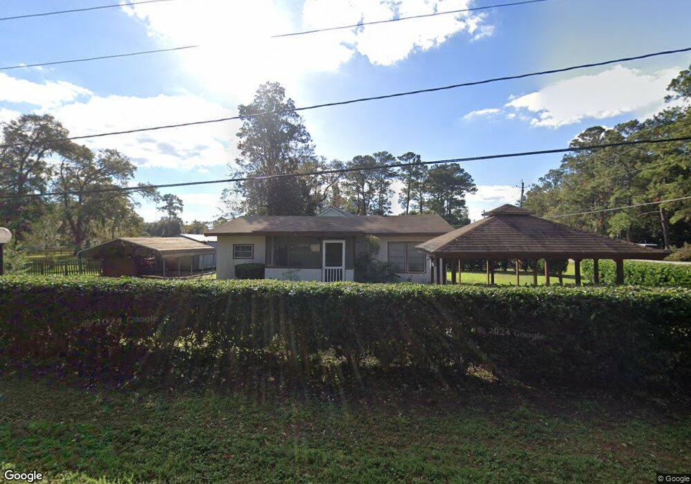
507 Pack St Darien, GA 31305
Estimated Value: $153,058 - $362,000
Studio
1
Bath
1,008
Sq Ft
$231/Sq Ft
Est. Value
About This Home
This home is located at 507 Pack St, Darien, GA 31305 and is currently estimated at $233,265, approximately $231 per square foot. 507 Pack St is a home located in McIntosh County with nearby schools including Todd Grant Elementary School, McIntosh County Middle School, and McIntosh County Academy.
Ownership History
Date
Name
Owned For
Owner Type
Purchase Details
Closed on
Jun 22, 2022
Sold by
Higgins Carla
Bought by
Walczak Robert P and Merriman Wiley Curtis
Current Estimated Value
Purchase Details
Closed on
Aug 3, 2010
Sold by
Harden Ellen
Bought by
Harden Kenneth and Harden Bonnie Sue
Purchase Details
Closed on
Jul 29, 2010
Sold by
Harden Ellen L
Bought by
Hall Bonnie Sue and Harden Kenneth W
Purchase Details
Closed on
Jun 11, 2009
Sold by
Harden Kenneth W
Bought by
Harden Ellen L
Purchase Details
Closed on
Jan 3, 2006
Sold by
Harden Kenneth W
Bought by
Harden Kenneth W and Harden Ellen L
Purchase Details
Closed on
Nov 30, 2000
Sold by
Harden L Ellen
Bought by
Harden W Kenneth
Create a Home Valuation Report for This Property
The Home Valuation Report is an in-depth analysis detailing your home's value as well as a comparison with similar homes in the area
Purchase History
| Date | Buyer | Sale Price | Title Company |
|---|---|---|---|
| Walczak Robert P | $22,000 | -- | |
| Harden Kenneth | -- | -- | |
| Hall Bonnie Sue | -- | -- | |
| Harden Ellen L | -- | -- | |
| Harden Kenneth W | -- | -- | |
| Harden W Kenneth | -- | -- |
Source: Public Records
Tax History
| Year | Tax Paid | Tax Assessment Tax Assessment Total Assessment is a certain percentage of the fair market value that is determined by local assessors to be the total taxable value of land and additions on the property. | Land | Improvement |
|---|---|---|---|---|
| 2024 | $1,630 | $41,896 | $18,360 | $23,536 |
| 2023 | $1,625 | $41,656 | $18,360 | $23,296 |
| 2022 | $974 | $29,496 | $9,960 | $19,536 |
| 2021 | $278 | $25,096 | $9,960 | $15,136 |
| 2020 | $278 | $24,856 | $9,960 | $14,896 |
| 2019 | $279 | $28,372 | $13,120 | $15,252 |
| 2018 | $862 | $28,372 | $13,120 | $15,252 |
| 2017 | $279 | $21,812 | $7,200 | $14,612 |
| 2016 | $279 | $21,812 | $7,200 | $14,612 |
| 2015 | $250 | $21,872 | $3,150 | $18,723 |
| 2014 | $250 | $21,873 | $3,150 | $18,723 |
Source: Public Records
Map
Nearby Homes
- 711 Adams St
- 709 Adams St
- 452 Adams St
- 410 Munro St
- 508 Fort King George Dr
- 1103 E Broad St
- 601 Fort King George Dr
- 902 Martin Luther King jr Blvd
- 1401 Wayne St
- 211 Trumbull St
- 1001 Poppell Dr
- 227 Fort King George Dr
- 227 Fort King George Dr Unit H
- Tract B 38 Acres
- 0 Georgia 99 Unit 1648162
- 0 Georgia 99 Unit 1647831
- 1106 Alabama St
- Lot 4 Fort King George
- Lot 3 Fort King George
- 105 Broad Unit C St
Your Personal Tour Guide
Ask me questions while you tour the home.