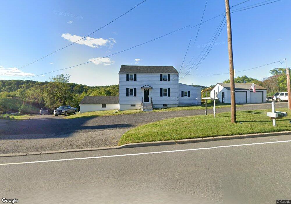
507 State Route 57 Port Murray, NJ 07865
Estimated Value: $362,000 - $439,000
--
Bed
--
Bath
2,030
Sq Ft
$198/Sq Ft
Est. Value
About This Home
This home is located at 507 State Route 57, Port Murray, NJ 07865 and is currently estimated at $401,409, approximately $197 per square foot. 507 State Route 57 is a home located in Warren County with nearby schools including Mansfield Twp Elementary School, Warren Hills Regional Middle School, and Warren Hills Reg High School.
Ownership History
Date
Name
Owned For
Owner Type
Purchase Details
Closed on
Nov 28, 2023
Sold by
Erb Paul S and Erb Joanne C
Bought by
13-15 Newark Way Llc
Current Estimated Value
Home Financials for this Owner
Home Financials are based on the most recent Mortgage that was taken out on this home.
Original Mortgage
$200,000
Outstanding Balance
$194,738
Interest Rate
5%
Mortgage Type
New Conventional
Estimated Equity
$206,671
Purchase Details
Closed on
Jul 23, 2008
Sold by
Erb Paul S and Erb Joanne C
Bought by
Bms Partners Llc
Home Financials for this Owner
Home Financials are based on the most recent Mortgage that was taken out on this home.
Original Mortgage
$450,000
Interest Rate
6.35%
Mortgage Type
Seller Take Back
Create a Home Valuation Report for This Property
The Home Valuation Report is an in-depth analysis detailing your home's value as well as a comparison with similar homes in the area
Home Values in the Area
Average Home Value in this Area
Purchase History
| Date | Buyer | Sale Price | Title Company |
|---|---|---|---|
| 13-15 Newark Way Llc | $350,000 | Green Hill Title | |
| Bms Partners Llc | $300,000 | Lawyers Title |
Source: Public Records
Mortgage History
| Date | Status | Borrower | Loan Amount |
|---|---|---|---|
| Open | 13-15 Newark Way Llc | $200,000 | |
| Previous Owner | Bms Partners Llc | $450,000 |
Source: Public Records
Tax History Compared to Growth
Tax History
| Year | Tax Paid | Tax Assessment Tax Assessment Total Assessment is a certain percentage of the fair market value that is determined by local assessors to be the total taxable value of land and additions on the property. | Land | Improvement |
|---|---|---|---|---|
| 2025 | $6,317 | $178,600 | $32,000 | $146,600 |
| 2024 | $6,344 | $178,600 | $32,000 | $146,600 |
| 2023 | $6,231 | $178,600 | $32,000 | $146,600 |
| 2022 | $6,231 | $178,600 | $32,000 | $146,600 |
| 2021 | $6,274 | $178,600 | $32,000 | $146,600 |
| 2020 | $6,212 | $178,600 | $32,000 | $146,600 |
| 2019 | $6,010 | $178,600 | $32,000 | $146,600 |
| 2018 | $5,883 | $178,600 | $32,000 | $146,600 |
| 2017 | $5,883 | $178,600 | $32,000 | $146,600 |
| 2016 | $5,749 | $178,600 | $32,000 | $146,600 |
| 2015 | $5,628 | $178,600 | $32,000 | $146,600 |
| 2014 | $5,449 | $178,600 | $32,000 | $146,600 |
Source: Public Records
Map
Nearby Homes
- 21 Gulick St
- Bramante 2-Story Plan at Mansfield Meadows 55+
- Bramante Plan at Mansfield Meadows 55+
- Palladio 2-Story Plan at Mansfield Meadows 55+
- Palladio Plan at Mansfield Meadows 55+
- 51 Mountain View Ln
- 0 Adams St
- 0 Anderson Rd
- 0 Harrison Ave
- 134 Winters Ave
- 0 Frome St Unit 3951790
- 58 Redwood Run
- 60 Redwood Run
- 2 Clover Ave
- 470 New Jersey 57
- 70 Changewater Rd
- 53 Washington Square Cir
- 0 Port Murray Rd Unit 3951792
- 0 Port Murray Rd Unit 3950462
- 0 Port Murray Rd Unit 3946276
- 510 State Route 57
- 502 State Route 57
- 518 State Route 57
- 7 Cheerio Ln
- 11 Cheerio Ln
- 461 State Route 57
- 460 New Jersey 57
- 30 Domin Ln
- 555 State Route 57
- 88 W Wood St
- 75 W Wood St
- 81 Jackson St
- 70 Gulick St
- 69 Gulick St
- 104 Morris Canal Trail
- 45 Jackson St
- 0 Middle Ln E Unit 3559833
- 0 Middle Ln E Unit 3553767
- 76 Jackson St
- 20 Harding Ave