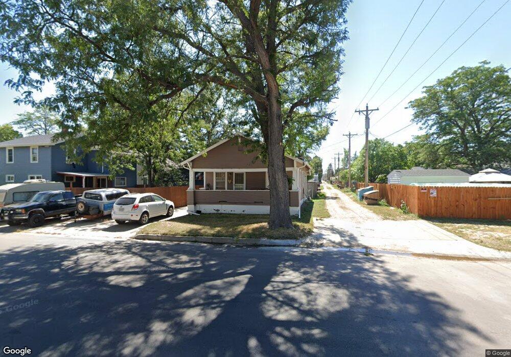
507 W 8th St Alliance, NE 69301
Estimated Value: $60,000 - $109,000
1
Bed
1
Bath
650
Sq Ft
$129/Sq Ft
Est. Value
About This Home
This home is located at 507 W 8th St, Alliance, NE 69301 and is currently estimated at $83,716, approximately $128 per square foot. 507 W 8th St is a home located in Box Butte County with nearby schools including Alliance High School, St. Agnes Academy, and Immanuel Evangelical Lutheran School.
Ownership History
Date
Name
Owned For
Owner Type
Purchase Details
Closed on
May 14, 2008
Sold by
Vogel Mary Ellen and Stenzel George T
Bought by
Schmidt Andrea K
Current Estimated Value
Home Financials for this Owner
Home Financials are based on the most recent Mortgage that was taken out on this home.
Original Mortgage
$28,350
Interest Rate
5.89%
Mortgage Type
Stand Alone First
Create a Home Valuation Report for This Property
The Home Valuation Report is an in-depth analysis detailing your home's value as well as a comparison with similar homes in the area
Home Values in the Area
Average Home Value in this Area
Purchase History
| Date | Buyer | Sale Price | Title Company |
|---|---|---|---|
| Schmidt Andrea K | -- | Kunzman Title Co |
Source: Public Records
Mortgage History
| Date | Status | Borrower | Loan Amount |
|---|---|---|---|
| Closed | Schmidt Andrea K | $28,350 |
Source: Public Records
Tax History
| Year | Tax Paid | Tax Assessment Tax Assessment Total Assessment is a certain percentage of the fair market value that is determined by local assessors to be the total taxable value of land and additions on the property. | Land | Improvement |
|---|---|---|---|---|
| 2025 | $637 | $53,664 | $1,832 | $51,832 |
| 2024 | $611 | $48,785 | $1,665 | $47,120 |
| 2023 | $839 | $48,785 | $1,665 | $47,120 |
| 2022 | $952 | $52,253 | $1,573 | $50,680 |
| 2021 | $963 | $52,253 | $1,573 | $50,680 |
| 2020 | $960 | $52,253 | $1,573 | $50,680 |
| 2019 | $938 | $52,253 | $1,573 | $50,680 |
| 2018 | $934 | $52,253 | $1,573 | $50,680 |
| 2017 | $661 | $35,605 | $1,203 | $34,402 |
| 2016 | $653 | $35,607 | $1,205 | $34,402 |
| 2015 | $643 | $33,660 | $1,205 | $32,455 |
| 2014 | $643 | $33,443 | $1,203 | $32,240 |
Source: Public Records
Map
Nearby Homes
- 719 Toluca Ave
- 823 Emerson Ave
- 616 Emerson Ave
- 601 Big Horn Ave
- 819 Black Hills Ave
- 624 W 5th St
- 936 Platte Ave
- 506 Cheyenne Ave
- 408 Toluca Ave
- 413 Big Horn Ave
- 928 Black Hills Ave
- 114 W 8th St
- 1103 Cheyenne Ave
- 1007 Laramie Ave
- 122 W 4th St
- 1021 Dakota Ave
- 1232 Cheyenne Ave
- 1232 Emerson Ave
- 112 E 11th St
- 808 Missouri Ave
- 724 Toluca Ave
- 720 Toluca Ave
- 723 Emerson Ave
- 716 Toluca Ave
- 719 Emerson Ave
- 804 Toluca Ave
- 715 Emerson Ave
- 712 Toluca Ave
- 801 Emerson Ave
- 711 Emerson Ave
- 806 Toluca Ave
- 706 Toluca Ave
- 807 Emerson Ave
- 705 Emerson Ave
- 812 Toluca Ave
- 811 Emerson Ave
- 704 Toluca Ave
- 703 Emerson Ave
- 723 Toluca Ave
- 816 Toluca Ave
Your Personal Tour Guide
Ask me questions while you tour the home.