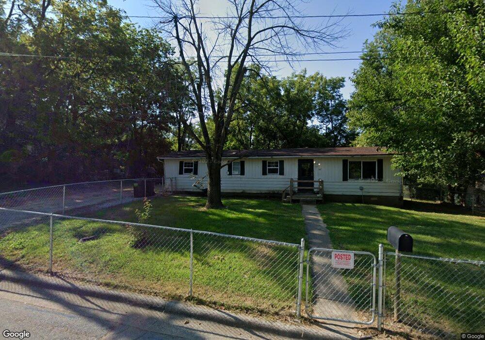
507 W Walnut St Harrisburg, IL 62946
Estimated Value: $48,000 - $165,000
--
Bed
--
Bath
--
Sq Ft
9,888
Sq Ft Lot
About This Home
This home is located at 507 W Walnut St, Harrisburg, IL 62946 and is currently estimated at $78,217. 507 W Walnut St is a home with nearby schools including East Side Intermediate School, Harrisburg Middle School, and Harrisburg High School.
Ownership History
Date
Name
Owned For
Owner Type
Purchase Details
Closed on
May 7, 2025
Sold by
Cash Janette
Bought by
Purcell Gregory
Current Estimated Value
Purchase Details
Closed on
Jul 9, 2020
Sold by
Summers Michael and Summers Samantha
Bought by
Cash Janette
Purchase Details
Closed on
Mar 5, 2018
Sold by
Goermert Cheryl
Bought by
Summers Michael Samantha
Purchase Details
Closed on
Dec 30, 2008
Sold by
Goemaat Jason
Bought by
Goemaat Cheryl
Create a Home Valuation Report for This Property
The Home Valuation Report is an in-depth analysis detailing your home's value as well as a comparison with similar homes in the area
Home Values in the Area
Average Home Value in this Area
Purchase History
| Date | Buyer | Sale Price | Title Company |
|---|---|---|---|
| Purcell Gregory | -- | None Listed On Document | |
| Purcell Gregory | -- | None Listed On Document | |
| Cash Janette | $3,500 | None Available | |
| Summers Michael Samantha | $26,000 | None Available | |
| Goemaat Cheryl | -- | None Available |
Source: Public Records
Tax History Compared to Growth
Tax History
| Year | Tax Paid | Tax Assessment Tax Assessment Total Assessment is a certain percentage of the fair market value that is determined by local assessors to be the total taxable value of land and additions on the property. | Land | Improvement |
|---|---|---|---|---|
| 2024 | $1,016 | $11,348 | $1,877 | $9,471 |
| 2023 | $1,157 | $11,715 | $1,591 | $10,124 |
| 2022 | $327 | $3,167 | $1,500 | $1,667 |
| 2021 | $172 | $3,265 | $1,546 | $1,719 |
| 2020 | $159 | $1,500 | $1,500 | $0 |
| 2019 | $162 | $1,500 | $1,500 | $0 |
| 2018 | $293 | $2,695 | $2,695 | $0 |
| 2017 | $178 | $2,695 | $2,695 | $0 |
| 2016 | $2 | $2,695 | $2,695 | $0 |
| 2015 | -- | $2,695 | $2,695 | $0 |
| 2014 | $171 | $2,695 | $2,695 | $0 |
| 2013 | $171 | $2,695 | $2,695 | $0 |
| 2012 | $171 | $2,695 | $2,695 | $0 |
Source: Public Records
Map
Nearby Homes
- 204 N Sherman St
- 430 W Church St
- 216 W Poplar St
- 202 W Poplar St
- 305 W Church St
- 504 W South St
- 210 W Lincoln St
- 305 W Lincoln St
- 215 S Jackson St
- 111 W Midkiff St
- 0 Ron Crank Dr Unit EB441387
- 206 W Homer Ave
- 500 W Sloan St
- 827 W Raymond St
- 520 S Mckinley St
- 18 S Mill St
- 311 W Poplar St
- 127 W Homer Ave
- 205 S Shaw St
- 618 S Mckinley St
- 514 W Elm St
- 511 W Walnut St
- 203 N Sherman St
- 516 W Elm St
- 518 W Elm St
- 303 N Sherman St
- 520 W Elm St
- 524 W Elm St
- 514 W Walnut St
- 113 N Sherman St
- 515 W Walnut St
- 305 N Sherman St
- 312 N Land St
- 109 N Sherman St
- 420 W Walnut St
- 525 W Logan St
- 304 N Sherman St
- 527 W Logan St
- 105 N Sherman St
- 515 W Logan St