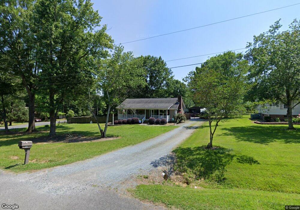
507 Westend Dr Monroe, NC 28112
Estimated Value: $293,583 - $353,000
3
Beds
2
Baths
1,250
Sq Ft
$254/Sq Ft
Est. Value
About This Home
This home is located at 507 Westend Dr, Monroe, NC 28112 and is currently estimated at $317,146, approximately $253 per square foot. 507 Westend Dr is a home located in Union County with nearby schools including Walter Bickett Elementary School, Monroe Middle School, and Monroe High School.
Ownership History
Date
Name
Owned For
Owner Type
Purchase Details
Closed on
Jun 12, 2015
Sold by
Manus Bobby Allen and Manus Karen G
Bought by
Mckee Hannah L and Autry Steven K
Current Estimated Value
Home Financials for this Owner
Home Financials are based on the most recent Mortgage that was taken out on this home.
Original Mortgage
$125,550
Outstanding Balance
$96,686
Interest Rate
3.75%
Mortgage Type
Adjustable Rate Mortgage/ARM
Estimated Equity
$220,460
Purchase Details
Closed on
Mar 31, 2006
Sold by
Trull Susan L
Bought by
Manus Bobby Allen
Home Financials for this Owner
Home Financials are based on the most recent Mortgage that was taken out on this home.
Original Mortgage
$110,000
Interest Rate
5.75%
Mortgage Type
Fannie Mae Freddie Mac
Purchase Details
Closed on
Dec 9, 2004
Sold by
Trull Russell T and Trull Rebecca T
Bought by
Trull Susan L
Home Financials for this Owner
Home Financials are based on the most recent Mortgage that was taken out on this home.
Original Mortgage
$92,000
Interest Rate
5.57%
Mortgage Type
Unknown
Create a Home Valuation Report for This Property
The Home Valuation Report is an in-depth analysis detailing your home's value as well as a comparison with similar homes in the area
Purchase History
| Date | Buyer | Sale Price | Title Company |
|---|---|---|---|
| Mckee Hannah L | $139,500 | None Available | |
| Manus Bobby Allen | $110,000 | Chicago Title Insurance Co | |
| Trull Susan L | $115,000 | Atlantis Title Co |
Source: Public Records
Mortgage History
| Date | Status | Borrower | Loan Amount |
|---|---|---|---|
| Open | Mckee Hannah L | $125,550 | |
| Previous Owner | Manus Bobby Allen | $110,000 | |
| Previous Owner | Trull Susan L | $92,000 |
Source: Public Records
Tax History
| Year | Tax Paid | Tax Assessment Tax Assessment Total Assessment is a certain percentage of the fair market value that is determined by local assessors to be the total taxable value of land and additions on the property. | Land | Improvement |
|---|---|---|---|---|
| 2025 | $2,167 | $247,900 | $0 | $0 |
| 2024 | $1,834 | $168,200 | $37,900 | $130,300 |
| 2023 | $1,834 | $168,200 | $37,900 | $130,300 |
| 2022 | $1,834 | $168,200 | $37,900 | $130,300 |
| 2021 | $1,834 | $168,200 | $37,900 | $130,300 |
| 2020 | $1,460 | $108,380 | $17,380 | $91,000 |
| 2019 | $1,460 | $108,380 | $17,380 | $91,000 |
| 2018 | $668 | $108,370 | $17,370 | $91,000 |
| 2017 | $1,482 | $108,400 | $17,400 | $91,000 |
| 2016 | $1,466 | $108,370 | $17,370 | $91,000 |
| 2015 | $842 | $108,370 | $17,370 | $91,000 |
| 2014 | $1,434 | $117,540 | $21,010 | $96,530 |
Source: Public Records
Map
Nearby Homes
- 100 Forest Hills Dr
- 0 Simpson Cir
- 1508 Marion St
- 620 Hunley St
- 1901 Waverly Dr
- 1104 Oak Hill Dr
- 2209 Waverly Dr
- 1003 Oak Hill Dr Unit 24
- 2502 Waverly Dr
- 415 Magnolia Dr
- 1022 Parker St
- 1008 Parker St
- 1100 Lucille Ave
- 00 Lancaster Ave
- 0 Lancaster Hwy
- 0 Avery Parker Rd
- 925 Southridge Dr
- 0 Labon St
- 707 Summit St
- 114 S Branch St
Your Personal Tour Guide
Ask me questions while you tour the home.