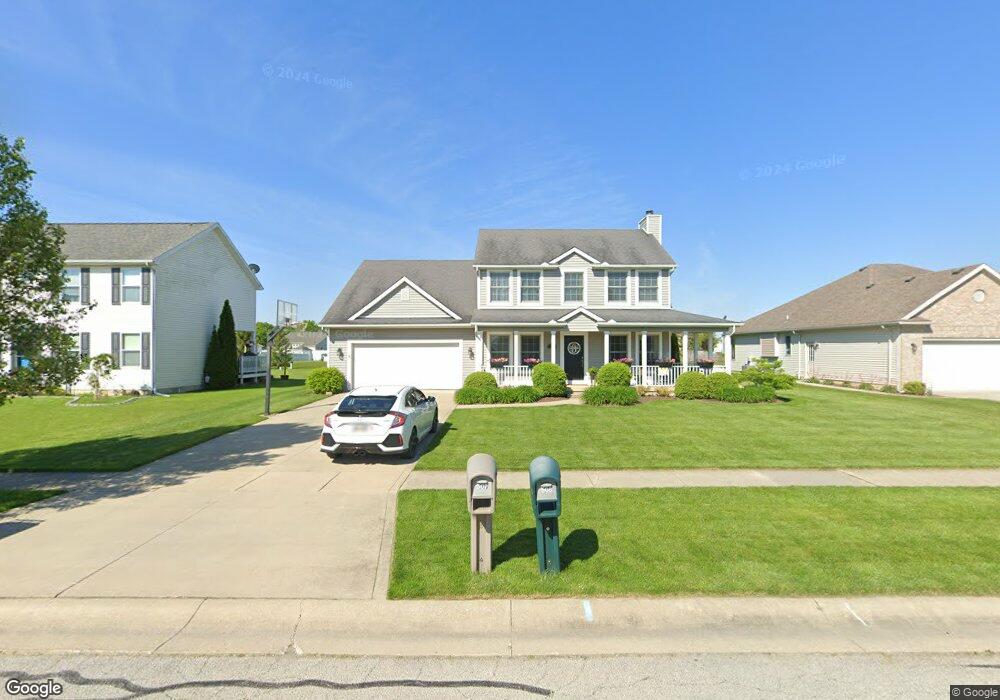
507 Yorkshire Dr Haskins, OH 43525
Estimated Value: $337,000 - $355,000
4
Beds
3
Baths
1,952
Sq Ft
$176/Sq Ft
Est. Value
About This Home
This home is located at 507 Yorkshire Dr, Haskins, OH 43525 and is currently estimated at $343,270, approximately $175 per square foot. 507 Yorkshire Dr is a home located in Wood County with nearby schools including Otsego Elementary School, Otsego Junior High School, and Otsego High School.
Ownership History
Date
Name
Owned For
Owner Type
Purchase Details
Closed on
Mar 5, 2003
Sold by
Mossman Bradley M
Bought by
Dzierwa Matthew E and Dzierwa Dasa A
Current Estimated Value
Home Financials for this Owner
Home Financials are based on the most recent Mortgage that was taken out on this home.
Original Mortgage
$26,100
Interest Rate
7.12%
Mortgage Type
Purchase Money Mortgage
Create a Home Valuation Report for This Property
The Home Valuation Report is an in-depth analysis detailing your home's value as well as a comparison with similar homes in the area
Home Values in the Area
Average Home Value in this Area
Purchase History
| Date | Buyer | Sale Price | Title Company |
|---|---|---|---|
| Dzierwa Matthew E | $29,000 | -- |
Source: Public Records
Mortgage History
| Date | Status | Borrower | Loan Amount |
|---|---|---|---|
| Closed | Dzierwa Matthew E | $26,100 |
Source: Public Records
Tax History Compared to Growth
Tax History
| Year | Tax Paid | Tax Assessment Tax Assessment Total Assessment is a certain percentage of the fair market value that is determined by local assessors to be the total taxable value of land and additions on the property. | Land | Improvement |
|---|---|---|---|---|
| 2024 | $4,079 | $88,970 | $13,615 | $75,355 |
| 2023 | $4,079 | $88,980 | $13,620 | $75,360 |
| 2021 | $3,777 | $75,640 | $12,110 | $63,530 |
| 2020 | $3,795 | $75,640 | $12,110 | $63,530 |
| 2019 | $3,353 | $64,190 | $12,110 | $52,080 |
| 2018 | $3,342 | $64,190 | $12,110 | $52,080 |
| 2017 | $3,064 | $64,190 | $12,110 | $52,080 |
| 2016 | $2,848 | $57,750 | $12,110 | $45,640 |
| 2015 | $2,848 | $57,750 | $12,110 | $45,640 |
| 2014 | $2,933 | $57,750 | $12,110 | $45,640 |
| 2013 | $3,186 | $57,750 | $12,110 | $45,640 |
Source: Public Records
Map
Nearby Homes
- 0 River Rd W
- 117 S 5th St
- 22 S 5th St
- 0 W River Rd Unit 6133310
- 0 W River Rd Unit 6134934
- 214 N 2nd St
- 132 Wilkshire Dr
- 341 N River Rd
- 842 Cherry Ln
- 305 Ridgepoint Cir
- 1371 Eastridge Dr
- 491 Patriot Dr W
- 16600 Tyler Rd
- 28 Mattatuck Way
- 540 Independence Dr
- 792 Wilkshire Dr
- 25216 John F McCarthy Way
- 0 King Rd Unit 10000333
- 25231 John F McCarthy Way
- 15024 N Cape Ct
- 505 Yorkshire Dr
- 509 Yorkshire Dr
- 511 Yorkshire Dr
- LOT 22 Yorkshire Dr
- LOT 37 Yorkshire Dr
- LOT 34 Yorkshire Dr
- LOT 36 Yorkshire Dr
- LOT 24 Yorkshire Dr
- LOT 23 Yorkshire Dr
- LOT 40 Yorkshire Dr
- LOT 26 Yorkshire Dr
- LOT 27 Yorkshire Dr
- LOT 21 Yorkshire Dr
- LOT 25 Yorkshire Dr
- LOT 20 Yorkshire Dr
- LOT 35 Yorkshire Dr
- LOT 39 Yorkshire Dr
- LOT 33 Yorkshire Dr
- 37 Yorkshire Dr
- 35 Yorkshire Dr