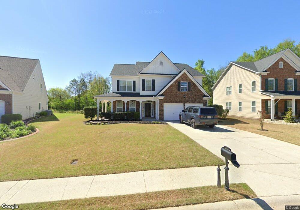
5070 Fieldgate Ridge Dr Cumming, GA 30028
Estimated Value: $491,000 - $524,000
4
Beds
3
Baths
3,051
Sq Ft
$166/Sq Ft
Est. Value
About This Home
This home is located at 5070 Fieldgate Ridge Dr, Cumming, GA 30028 and is currently estimated at $505,743, approximately $165 per square foot. 5070 Fieldgate Ridge Dr is a home located in Forsyth County with nearby schools including Silver City Elementary School, North Forsyth Middle School, and North Forsyth High School.
Ownership History
Date
Name
Owned For
Owner Type
Purchase Details
Closed on
Jun 13, 2006
Sold by
D R Horton Inc
Bought by
Chalfant Anthony S
Current Estimated Value
Home Financials for this Owner
Home Financials are based on the most recent Mortgage that was taken out on this home.
Original Mortgage
$229,616
Outstanding Balance
$134,542
Interest Rate
6.51%
Mortgage Type
FHA
Estimated Equity
$371,201
Create a Home Valuation Report for This Property
The Home Valuation Report is an in-depth analysis detailing your home's value as well as a comparison with similar homes in the area
Home Values in the Area
Average Home Value in this Area
Purchase History
| Date | Buyer | Sale Price | Title Company |
|---|---|---|---|
| Chalfant Anthony S | $233,300 | -- |
Source: Public Records
Mortgage History
| Date | Status | Borrower | Loan Amount |
|---|---|---|---|
| Open | Chalfant Anthony S | $229,616 |
Source: Public Records
Tax History Compared to Growth
Tax History
| Year | Tax Paid | Tax Assessment Tax Assessment Total Assessment is a certain percentage of the fair market value that is determined by local assessors to be the total taxable value of land and additions on the property. | Land | Improvement |
|---|---|---|---|---|
| 2025 | $4,020 | $201,640 | $54,000 | $147,640 |
| 2024 | $4,020 | $188,168 | $52,000 | $136,168 |
| 2023 | $3,511 | $179,604 | $38,000 | $141,604 |
| 2022 | $3,468 | $118,952 | $18,000 | $100,952 |
| 2021 | $3,285 | $118,952 | $18,000 | $100,952 |
| 2020 | $3,057 | $110,688 | $18,000 | $92,688 |
| 2019 | $3,039 | $109,904 | $18,000 | $91,904 |
| 2018 | $2,974 | $107,556 | $18,000 | $89,556 |
| 2017 | $2,684 | $96,700 | $18,000 | $78,700 |
| 2016 | $2,390 | $86,100 | $15,200 | $70,900 |
| 2015 | $2,611 | $93,900 | $15,200 | $78,700 |
| 2014 | $2,127 | $80,356 | $0 | $0 |
Source: Public Records
Map
Nearby Homes
- 5415 Fieldfreen Dr
- 5260 Fieldgate Ridge Dr
- Riverside Plan at Hopewell Reserve
- Canton II Plan at Hopewell Reserve
- Shelby Plan at Hopewell Reserve
- Tucker II Plan at Hopewell Reserve
- Emerson Plan at Hopewell Reserve
- 4720 Montane St
- 4730 Montane St
- 4735 Montane St
- 5045 Bucknell Trace
- 4810 Hopewell Manor Dr
- 4830 Montane St
- 5010 Mundy Dr
- 4865 Montane St
- 5060 Fieldgate Ridge Dr
- 5080 Fieldgate Ridge Dr
- 5050 Fieldgate Ridge Dr
- 5085 Fieldgate Ridge Dr
- 0 Skyland Pkwy Unit 7533958
- 0 Skyland Pkwy Unit 7373037
- 0 Skyland Pkwy Unit 3237668
- 0 Skyland Pkwy Unit 8823178
- 5055 Fieldgate Ridge Dr
- 5055 Fieldgate Ridge Dr Unit 201
- 5065 Fieldgate Ridge Dr
- 5025 Skyland Pkwy
- 5015 Skyland Pkwy
- 5040 Fieldgate Ridge Dr
- 5030 Fieldgate Ridge Dr
- 5005 Skyland Pkwy
- 5020 Skyland Creek Ct
- 5030 Skyland Pkwy
- 5007 Fieldgate Ridge Dr
- 5035 Fieldgate Ridge Dr