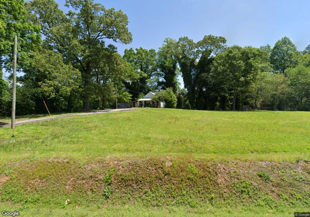
5072 Old Highway 441 N Baldwin, GA 30511
Estimated Value: $102,000 - $217,000
2
Beds
1
Bath
816
Sq Ft
$193/Sq Ft
Est. Value
About This Home
This home is located at 5072 Old Highway 441 N, Baldwin, GA 30511 and is currently estimated at $157,776, approximately $193 per square foot. 5072 Old Highway 441 N is a home located in Banks County with nearby schools including Banks County Primary School, Banks County Elementary School, and Banks County Middle School.
Ownership History
Date
Name
Owned For
Owner Type
Purchase Details
Closed on
Nov 1, 2017
Sold by
Holcomb Paving Llc
Bought by
Brady Randall and Brady Carol
Current Estimated Value
Home Financials for this Owner
Home Financials are based on the most recent Mortgage that was taken out on this home.
Original Mortgage
$35,000
Interest Rate
3.85%
Mortgage Type
New Conventional
Create a Home Valuation Report for This Property
The Home Valuation Report is an in-depth analysis detailing your home's value as well as a comparison with similar homes in the area
Home Values in the Area
Average Home Value in this Area
Purchase History
| Date | Buyer | Sale Price | Title Company |
|---|---|---|---|
| Brady Randall | $40,000 | -- |
Source: Public Records
Mortgage History
| Date | Status | Borrower | Loan Amount |
|---|---|---|---|
| Closed | Brady Randall | $35,000 |
Source: Public Records
Tax History Compared to Growth
Tax History
| Year | Tax Paid | Tax Assessment Tax Assessment Total Assessment is a certain percentage of the fair market value that is determined by local assessors to be the total taxable value of land and additions on the property. | Land | Improvement |
|---|---|---|---|---|
| 2025 | $717 | $42,144 | $9,127 | $33,017 |
| 2024 | $717 | $39,566 | $8,297 | $31,269 |
| 2023 | $740 | $30,948 | $8,097 | $22,851 |
| 2022 | $525 | $27,005 | $7,988 | $19,017 |
| 2021 | $398 | $19,815 | $5,391 | $14,424 |
| 2020 | $389 | $18,954 | $4,530 | $14,424 |
| 2019 | $391 | $18,954 | $4,530 | $14,424 |
| 2018 | $375 | $17,909 | $3,485 | $14,424 |
| 2017 | $426 | $17,454 | $3,030 | $14,424 |
| 2016 | $439 | $17,454 | $3,030 | $14,424 |
| 2015 | $482 | $17,454 | $3,030 | $14,424 |
| 2014 | $482 | $20,420 | $5,996 | $14,424 |
| 2013 | -- | $20,420 | $5,996 | $14,424 |
Source: Public Records
Map
Nearby Homes
- 0 Soapstone Rd Unit 7646343
- 0 Soapstone Rd Unit 10600294
- 535 Otis Brown Rd
- 0 Whippoorwill Terrace Unit 10552744
- 0 Whippoorwill Terrace Unit 7605702
- 382 Simmons Rd
- LOT 26 Whippoorwill Way
- 136 Lakeview Way
- 113 Wynn Wood Ln
- 133 Lakeview Walk
- 01 Planters Pointe Dr
- 0 Planters Pointe Dr Unit 10636110
- 0 Planters Pointe Ln Unit 10620249
- 0 Planters Creek Dr Unit Lot 34 CM1024458
- 0 Smokerise Unit 10602885
- 0 Planters Creek Unit LOT 34 10482364
- 340 Daily Rd
- 39 Planters Creek Dr
- 41 Planters Creek Dr
- 209 Alice Moss Ln
- 5100 Old Highway 441 N
- 5100 Old Highway 441 N Unit A & B
- 5099 Old Highway 441 N
- N Highway 441 Bypass
- 0 Highway 441 Bypass
- 0 Apple Pie Ridge Unit 8118990
- 137 Soapstone Rd
- 4951 Old Highway 441 N
- 3 Soapstone Rd
- 149 Soapstone Rd
- 0 Soapstone Rd Unit Tr2 & 2A 8321533
- 0 Soapstone Rd Unit 5938322
- 0 Soapstone Rd Unit 8293727
- 0 Soapstone Rd Unit 2A 8230813
- 1 Soapstone Rd
- 0 Soapstone Rd
- 0 Soapstone Rd Unit 10101236
- 0 Soapstone Rd Unit 7362795
- 0 Soapstone Rd Unit 10275499
- 0 Soapstone Rd Unit 7216298