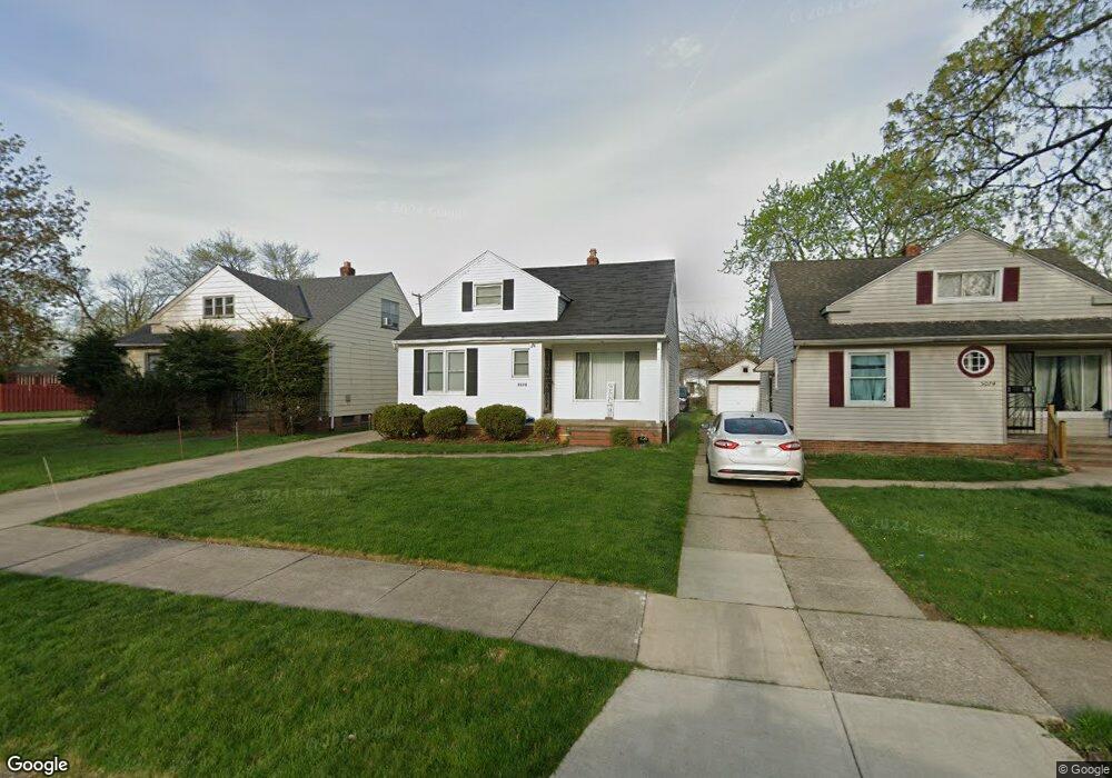
5078 Philip Ave Maple Heights, OH 44137
Estimated Value: $116,000 - $137,000
3
Beds
1
Bath
1,272
Sq Ft
$98/Sq Ft
Est. Value
About This Home
This home is located at 5078 Philip Ave, Maple Heights, OH 44137 and is currently estimated at $124,616, approximately $97 per square foot. 5078 Philip Ave is a home located in Cuyahoga County with nearby schools including Abraham Lincoln Elementary School, Rockside/ J.F. Kennedy School, and Italy High School.
Ownership History
Date
Name
Owned For
Owner Type
Purchase Details
Closed on
Oct 1, 2009
Sold by
Hicks Edgar and Hicks Lillie E
Bought by
Hicks Jenkins Kisha M
Current Estimated Value
Home Financials for this Owner
Home Financials are based on the most recent Mortgage that was taken out on this home.
Original Mortgage
$65,620
Outstanding Balance
$43,089
Interest Rate
5.19%
Mortgage Type
FHA
Estimated Equity
$81,527
Purchase Details
Closed on
Jan 19, 1990
Sold by
Koziera Philip S
Bought by
Hicks Edgar
Purchase Details
Closed on
May 29, 1987
Sold by
Beaber Chris and Beaber Jeri A
Bought by
Koziera Philip S
Purchase Details
Closed on
Jan 1, 1975
Bought by
Beaber Chris and Beaber Jeri A
Create a Home Valuation Report for This Property
The Home Valuation Report is an in-depth analysis detailing your home's value as well as a comparison with similar homes in the area
Home Values in the Area
Average Home Value in this Area
Purchase History
| Date | Buyer | Sale Price | Title Company |
|---|---|---|---|
| Hicks Jenkins Kisha M | $68,000 | Chicago Title Insurance Co | |
| Hicks Edgar | $61,900 | -- | |
| Koziera Philip S | $50,900 | -- | |
| Beaber Chris | -- | -- |
Source: Public Records
Mortgage History
| Date | Status | Borrower | Loan Amount |
|---|---|---|---|
| Open | Hicks Jenkins Kisha M | $65,620 |
Source: Public Records
Tax History Compared to Growth
Tax History
| Year | Tax Paid | Tax Assessment Tax Assessment Total Assessment is a certain percentage of the fair market value that is determined by local assessors to be the total taxable value of land and additions on the property. | Land | Improvement |
|---|---|---|---|---|
| 2024 | $3,219 | $35,700 | $7,140 | $28,560 |
| 2023 | $2,351 | $21,980 | $4,340 | $17,640 |
| 2022 | $2,343 | $21,980 | $4,340 | $17,640 |
| 2021 | $2,497 | $21,980 | $4,340 | $17,640 |
| 2020 | $2,135 | $16,660 | $3,290 | $13,370 |
| 2019 | $2,123 | $47,600 | $9,400 | $38,200 |
| 2018 | $2,112 | $16,660 | $3,290 | $13,370 |
| 2017 | $2,023 | $15,470 | $3,010 | $12,460 |
| 2016 | $1,957 | $15,470 | $3,010 | $12,460 |
| 2015 | $1,959 | $15,470 | $3,010 | $12,460 |
| 2014 | $1,959 | $17,020 | $3,330 | $13,690 |
Source: Public Records
Map
Nearby Homes
- 5082 Philip Ave
- 5110 Philip Ave
- 5061 Philip Ave
- 5031 Cato St
- 5185 Clement Ave
- 5208 Clement Ave
- 5231 Philip Ave
- 5199 Arch St
- 5212 Catherine St
- 5257 Philip Ave
- 5239 Arch St
- 16712 Kollin Ave
- 5210 Theodore St
- 5234 Erwin St
- 5320 Clement Ave
- 16241 Glenburn Ave
- 17916 North Blvd
- 17912 North Blvd
- 17204 Maple Heights Blvd
- 17806 Maple Heights Blvd
- 5074 Philip Ave
- 5082 Phiip St
- 5070 Philip Ave
- 5066 Philip Ave
- 5100 Philip Ave
- 5073 Catherine St
- 5062 Philip Ave
- 5081 Catherine St
- 5069 Catherine St
- 5108 Philip Ave
- 5073 Philip Ave
- 5081 Philip Ave
- 5101 Catherine St
- 5058 Philip Ave
- 5065 Catherine St
- 5065 Philip Ave
- 5105 Catherine St
- 5054 Philip Ave
- 5061 Catherine St
- 5107 Philip Ave