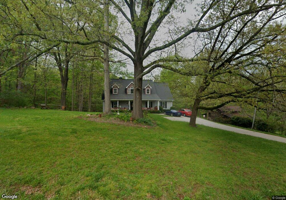
5079 Cash Rd Flowery Branch, GA 30542
Estimated Value: $396,000 - $489,000
3
Beds
3
Baths
2,322
Sq Ft
$194/Sq Ft
Est. Value
About This Home
This home is located at 5079 Cash Rd, Flowery Branch, GA 30542 and is currently estimated at $449,445, approximately $193 per square foot. 5079 Cash Rd is a home located in Hall County with nearby schools including Martin Elementary School, Southwest Middle School, and C.W. Davis Middle School.
Ownership History
Date
Name
Owned For
Owner Type
Purchase Details
Closed on
Nov 20, 2013
Sold by
Perrine Scott W
Bought by
Scott W Perrine Revocable Living Trust U
Current Estimated Value
Purchase Details
Closed on
Nov 28, 2012
Sold by
Perrine Scott W
Bought by
Perrine Scott W
Home Financials for this Owner
Home Financials are based on the most recent Mortgage that was taken out on this home.
Original Mortgage
$168,400
Interest Rate
3.44%
Mortgage Type
New Conventional
Purchase Details
Closed on
Jun 25, 2009
Sold by
Perrine Scott W
Bought by
Perrine Scott W Living Trust
Purchase Details
Closed on
Sep 12, 2005
Sold by
Perrine Scott W
Bought by
Perrine Scott W and Perrine Sandra K
Create a Home Valuation Report for This Property
The Home Valuation Report is an in-depth analysis detailing your home's value as well as a comparison with similar homes in the area
Home Values in the Area
Average Home Value in this Area
Purchase History
| Date | Buyer | Sale Price | Title Company |
|---|---|---|---|
| Scott W Perrine Revocable Living Trust U | -- | -- | |
| Perrine Scott W | -- | -- | |
| Perrine Sandra K | -- | -- | |
| Perrine Scott W Living Trust | -- | -- | |
| Perrine Sandra K Living Trust | -- | -- | |
| Perrine Scott W | -- | -- |
Source: Public Records
Mortgage History
| Date | Status | Borrower | Loan Amount |
|---|---|---|---|
| Previous Owner | Perrine Sandra K | $168,400 |
Source: Public Records
Tax History Compared to Growth
Tax History
| Year | Tax Paid | Tax Assessment Tax Assessment Total Assessment is a certain percentage of the fair market value that is determined by local assessors to be the total taxable value of land and additions on the property. | Land | Improvement |
|---|---|---|---|---|
| 2024 | $1,421 | $169,676 | $48,160 | $121,516 |
| 2023 | $1,245 | $161,316 | $48,160 | $113,156 |
| 2022 | $1,165 | $126,796 | $28,240 | $98,556 |
| 2021 | $1,134 | $116,756 | $28,240 | $88,516 |
| 2020 | $1,127 | $113,436 | $22,960 | $90,476 |
| 2019 | $1,101 | $107,876 | $22,960 | $84,916 |
| 2018 | $1,140 | $108,996 | $31,680 | $77,316 |
| 2017 | $813 | $80,917 | $18,040 | $62,877 |
| 2016 | $2,219 | $80,917 | $18,040 | $62,877 |
| 2015 | $2,236 | $80,917 | $18,040 | $62,877 |
| 2014 | $2,236 | $80,917 | $18,040 | $62,877 |
Source: Public Records
Map
Nearby Homes
- 5306 Highpoint Rd
- 5126 Cash Rd
- 5325 Highpoint Rd
- 5536 Rolling Mist Ct
- 5540 Rolling Mist Ct
- 5129 Glen Forrest Dr
- 5157 Glen Forrest Dr
- 5505 Riverchase Dr
- 5432 Aurora Trail Unit LOT 70
- 5428 Aurora Trail
- 5428 Aurora Trail Unit LOT 71
- 5427 Aurora Trail Unit LOT 65
- 5436 Aurora Trail
- 5416 Aurora Trail Unit LOT 74
- 5412 Aurora Trail Unit LOT 75
- 5427 Aurora Trail
- 5435 Aurora Trail
- 5432 Aurora Trail
- 5412 Aurora Trail
- 5424 Aurora Trail Unit LOT 72
- 5105 Cash Rd
- 5074 Cash Rd
- 5106 Cash Rd
- 5111 Elizabeth Ln
- 5123 Cash Rd
- 5056 Cash Rd
- 5112 Cash Rd
- 5122 Elizabeth Ln
- 0 Glen Forrest Dr Unit CM927316
- 0 Glen Forrest Dr Unit 8718744
- 0 Glen Forrest Dr Unit 8488547
- 0 Glen Forrest Dr Unit 7625771
- 0 Glen Forrest Dr Unit 3219168
- 0 Glen Forrest Dr Unit 3168234
- 0 Glen Forrest Dr Unit 8362230
- 0 Glen Forrest Dr Unit 8157936
- 0 Glen Forrest Dr Unit 8157894
- 0 Glen Forrest Dr Unit 8107950
- 0 Glen Forrest Dr Unit 8106140
- 0 Glen Forrest Dr Unit 8106122