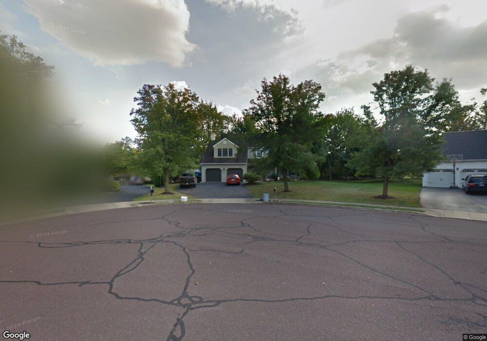
508 Country Pointe Cir Perkasie, PA 18944
East Rockhill NeighborhoodEstimated Value: $592,000 - $637,000
4
Beds
3
Baths
2,979
Sq Ft
$206/Sq Ft
Est. Value
About This Home
This home is located at 508 Country Pointe Cir, Perkasie, PA 18944 and is currently estimated at $613,534, approximately $205 per square foot. 508 Country Pointe Cir is a home located in Bucks County with nearby schools including Pennridge High School, Grace Christian School, and Community Service Foundation.
Ownership History
Date
Name
Owned For
Owner Type
Purchase Details
Closed on
Jul 20, 2001
Sold by
Graver Kenneth B and Graver Sherri M
Bought by
Graver Kenneth B
Current Estimated Value
Home Financials for this Owner
Home Financials are based on the most recent Mortgage that was taken out on this home.
Original Mortgage
$165,000
Interest Rate
6.71%
Purchase Details
Closed on
Jul 1, 1993
Bought by
Graver Kenneth B and Graver Sherri M
Create a Home Valuation Report for This Property
The Home Valuation Report is an in-depth analysis detailing your home's value as well as a comparison with similar homes in the area
Home Values in the Area
Average Home Value in this Area
Purchase History
| Date | Buyer | Sale Price | Title Company |
|---|---|---|---|
| Graver Kenneth B | -- | -- | |
| Graver Kenneth B | $195,400 | -- |
Source: Public Records
Mortgage History
| Date | Status | Borrower | Loan Amount |
|---|---|---|---|
| Closed | Graver Kenneth B | $165,000 |
Source: Public Records
Tax History Compared to Growth
Tax History
| Year | Tax Paid | Tax Assessment Tax Assessment Total Assessment is a certain percentage of the fair market value that is determined by local assessors to be the total taxable value of land and additions on the property. | Land | Improvement |
|---|---|---|---|---|
| 2025 | $6,242 | $36,300 | $8,360 | $27,940 |
| 2024 | $6,242 | $36,300 | $8,360 | $27,940 |
| 2023 | $6,169 | $36,300 | $8,360 | $27,940 |
| 2022 | $6,169 | $36,300 | $8,360 | $27,940 |
| 2021 | $6,060 | $36,300 | $8,360 | $27,940 |
| 2020 | $6,060 | $36,300 | $8,360 | $27,940 |
| 2019 | $3,585 | $36,300 | $8,360 | $27,940 |
| 2018 | $6,024 | $36,300 | $8,360 | $27,940 |
| 2017 | $5,979 | $36,300 | $8,360 | $27,940 |
| 2016 | $5,979 | $36,300 | $8,360 | $27,940 |
| 2015 | -- | $36,300 | $8,360 | $27,940 |
| 2014 | -- | $36,300 | $8,360 | $27,940 |
Source: Public Records
Map
Nearby Homes
- 505 Nob Hill Dr
- 906 Mews Dr Unit 906
- 20 Loux Ln
- 213 Hampshire Dr
- 509 Clover Ln
- 339 Thistle Ln
- 114 Orchard Rd
- 318 Pin Oak Ln
- 227 Beech Ln
- 406 Cope Ct
- 56 Independence Ct
- 221 Laurel Ln
- 124 S Main St
- 58 Independence Ct
- 420 Longleaf Dr
- 131 Misty Meadow
- 69 Maple Leaf Dr
- 96 Willow Ln
- 400 Clymer Ave
- 504 S 4th St
- 506 Country Pointe Cir
- 510 Country Pointe Cir
- 504 Country Pointe Cir
- 511 Country Pointe Cir
- 509 Country Pointe Cir
- 507 Country Pointe Cir
- 502 Country Pointe Cir
- 615 Meadow Creek Ln
- 503 Country Pointe Cir
- 603 Hillcrest Dr
- 515 Hillcrest Dr
- 601 S Main St
- 601 S Main St Unit B
- 711 S Main St
- 615 S Main St
- 617 Hillcrest Dr
- 703 S Main St
- 701 S Main St
- 531 S Main St
- 509 Hillcrest Dr