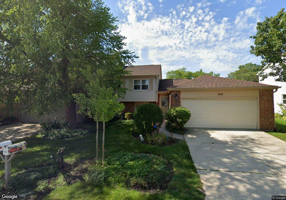
508 Dunsten Cir Northbrook, IL 60062
Estimated Value: $394,463 - $521,000
3
Beds
2
Baths
1,164
Sq Ft
$398/Sq Ft
Est. Value
About This Home
This home is located at 508 Dunsten Cir, Northbrook, IL 60062 and is currently estimated at $463,116, approximately $397 per square foot. 508 Dunsten Cir is a home located in Cook County with nearby schools including Westmoor Elementary School, Northbrook Junior High School, and Glenbrook North High School.
Ownership History
Date
Name
Owned For
Owner Type
Purchase Details
Closed on
Dec 21, 2005
Sold by
Parr Susan
Bought by
Parr Susan and Susan Parr Trust
Current Estimated Value
Purchase Details
Closed on
Jul 2, 2002
Sold by
Weinger Mitchell and Weinger Mary Lynn
Bought by
Parr Susan
Home Financials for this Owner
Home Financials are based on the most recent Mortgage that was taken out on this home.
Original Mortgage
$71,000
Outstanding Balance
$29,345
Interest Rate
6.91%
Estimated Equity
$433,771
Purchase Details
Closed on
Dec 31, 1999
Sold by
Weinger Helen
Bought by
Weinger Mitchell and Weinger Mary Lynn
Create a Home Valuation Report for This Property
The Home Valuation Report is an in-depth analysis detailing your home's value as well as a comparison with similar homes in the area
Home Values in the Area
Average Home Value in this Area
Purchase History
| Date | Buyer | Sale Price | Title Company |
|---|---|---|---|
| Parr Susan | -- | -- | |
| Parr Susan | $300,000 | Centennial Title Incorporate | |
| Weinger Mitchell | $185,000 | -- |
Source: Public Records
Mortgage History
| Date | Status | Borrower | Loan Amount |
|---|---|---|---|
| Open | Parr Susan | $71,000 | |
| Closed | Weinger Mitchell | $0 |
Source: Public Records
Tax History
| Year | Tax Paid | Tax Assessment Tax Assessment Total Assessment is a certain percentage of the fair market value that is determined by local assessors to be the total taxable value of land and additions on the property. | Land | Improvement |
|---|---|---|---|---|
| 2025 | $6,405 | $30,000 | $8,794 | $21,206 |
| 2024 | $6,405 | $32,102 | $7,002 | $25,100 |
| 2023 | $7,056 | $34,006 | $7,002 | $27,004 |
| 2022 | $7,056 | $38,000 | $7,000 | $31,000 |
| 2021 | $4,811 | $25,253 | $5,221 | $20,032 |
| 2020 | $4,815 | $25,253 | $5,221 | $20,032 |
| 2019 | $4,869 | $28,680 | $5,221 | $23,459 |
| 2018 | $4,139 | $23,856 | $4,534 | $19,322 |
| 2017 | $5,442 | $23,856 | $4,534 | $19,322 |
| 2016 | $4,200 | $23,856 | $4,534 | $19,322 |
| 2015 | $4,841 | $20,434 | $3,847 | $16,587 |
| 2014 | $3,895 | $21,614 | $3,847 | $17,767 |
| 2013 | $4,164 | $21,614 | $3,847 | $17,767 |
Source: Public Records
Map
Nearby Homes
- 580 Greenwood Rd
- 640 Pfingsten Rd
- 2535 Stonebridge Ln
- 818 Bach St
- 3030 Pheasant Creek Dr Unit 405
- 3030 Pheasant Creek Dr Unit 102
- 3050 Pheasant Creek Dr Unit 407
- 847 Division St
- 3070 Pheasant Creek Dr Unit 207
- 2506 Peachtree Ln
- 2700 Crabtree Ln
- 3085 Pheasant Creek Dr Unit 212
- 925 Spring Hill Dr Unit 101
- 3110 Pheasant Creek Dr Unit 101
- 3110 Pheasant Creek Dr Unit 104
- 3110 Pheasant Creek Dr Unit 206
- 3110 Pheasant Creek Dr Unit 318
- 2348 Ash Ln
- 1116 Adirondack Dr
- 2140 Beechnut Rd
- 506 Dunsten Cir
- 510 Dunsten Cir
- 504 Dunsten Cir
- 512 Dunsten Cir
- 515 Dunsten Cir
- 502 Dunsten Cir
- 514 Dunsten Cir
- 507 Dunsten Cir
- 517 Dunsten Cir
- 516 Dunsten Cir
- 505 Dunsten Cir
- 518 Dunsten Cir
- 521 Dunsten Cir
- 520 Dunsten Cir
- 560 Pfingsten Rd
- 544 Pfingsten Rd
- 601 Dunsten Cir
- 523 Dunsten Cir
- 522 Dunsten Cir
- 600 Dunsten Cir
Your Personal Tour Guide
Ask me questions while you tour the home.