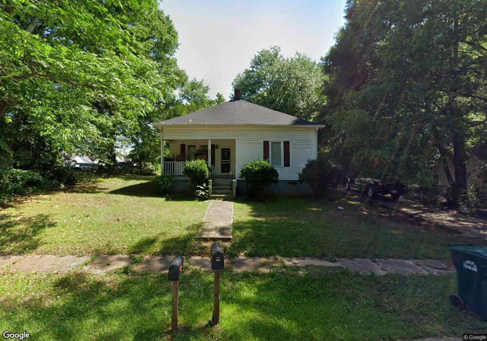
508 Lovvorn Rd Carrollton, GA 30117
Estimated Value: $172,000 - $235,000
3
Beds
2
Baths
1,621
Sq Ft
$119/Sq Ft
Est. Value
About This Home
This home is located at 508 Lovvorn Rd, Carrollton, GA 30117 and is currently estimated at $193,700, approximately $119 per square foot. 508 Lovvorn Rd is a home located in Carroll County with nearby schools including Carrollton Elementary School, Carrollton Upper Elementary School, and Carrollton Middle School.
Ownership History
Date
Name
Owned For
Owner Type
Purchase Details
Closed on
Dec 29, 2004
Sold by
Wilson Carter E and Wilson Be
Bought by
Vale Solange K
Current Estimated Value
Purchase Details
Closed on
Dec 5, 1997
Sold by
Toney Lloyd E
Bought by
Wilson Carter E and Wilson Be
Purchase Details
Closed on
Oct 29, 1996
Sold by
Bridger Mary Jane
Bought by
Toney Lloyd E
Purchase Details
Closed on
Jun 15, 1994
Bought by
Toney Lloyd
Create a Home Valuation Report for This Property
The Home Valuation Report is an in-depth analysis detailing your home's value as well as a comparison with similar homes in the area
Home Values in the Area
Average Home Value in this Area
Purchase History
| Date | Buyer | Sale Price | Title Company |
|---|---|---|---|
| Vale Solange K | -- | -- | |
| Vale Solange Katherine | -- | -- | |
| Wilson Carter E | $27,000 | -- | |
| Toney Lloyd E | -- | -- | |
| Toney Lloyd | -- | -- |
Source: Public Records
Tax History Compared to Growth
Tax History
| Year | Tax Paid | Tax Assessment Tax Assessment Total Assessment is a certain percentage of the fair market value that is determined by local assessors to be the total taxable value of land and additions on the property. | Land | Improvement |
|---|---|---|---|---|
| 2024 | $1,252 | $45,822 | $7,080 | $38,742 |
| 2023 | $1,252 | $42,644 | $7,080 | $35,564 |
| 2022 | $971 | $33,254 | $4,732 | $28,522 |
| 2021 | $828 | $28,373 | $3,505 | $24,868 |
| 2020 | $755 | $25,835 | $3,505 | $22,330 |
| 2019 | $708 | $23,994 | $3,505 | $20,489 |
| 2018 | $667 | $22,307 | $3,505 | $18,802 |
| 2017 | $671 | $22,307 | $3,505 | $18,802 |
| 2016 | $675 | $22,307 | $3,505 | $18,802 |
| 2015 | $536 | $17,359 | $2,454 | $14,906 |
| 2014 | $539 | $17,359 | $2,454 | $14,906 |
Source: Public Records
Map
Nearby Homes
- 219 Broad St
- 166 Maple St
- 141 Bowen St
- 142 Griffin Dr
- 105 Haygood Place
- 109 7th St
- 160 Watson St
- 516 Longview St
- 106 Summerfield Place Dr
- 109 Chalfont Cir
- 149 River Dr
- 149 River Dr Unit 42
- 223 Riversong Rd Unit 55
- 223 Riversong Rd
- 223 Sunset Blvd
- 109 S Park St
- 654 King St
- 250 Riversong Rd
- 250 Riversong Rd Unit 55