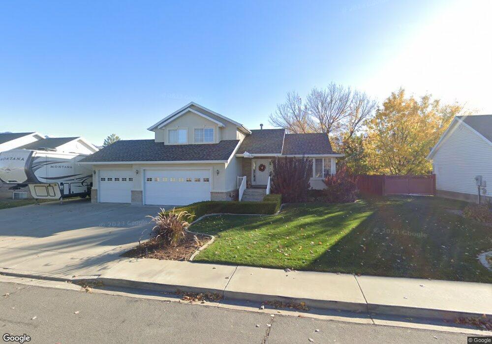
508 N 560 W Spanish Fork, UT 84660
Estimated Value: $506,000 - $560,000
3
Beds
3
Baths
1,864
Sq Ft
$288/Sq Ft
Est. Value
About This Home
This home is located at 508 N 560 W, Spanish Fork, UT 84660 and is currently estimated at $536,841, approximately $288 per square foot. 508 N 560 W is a home located in Utah County with nearby schools including Brockbank Elementary School, Spanish Fork Jr High School, and Spanish Fork High School.
Ownership History
Date
Name
Owned For
Owner Type
Purchase Details
Closed on
Dec 27, 2007
Sold by
Thomas Lane L
Bought by
Southwick Jan T
Current Estimated Value
Purchase Details
Closed on
May 27, 2004
Sold by
Johnson Matthew R and Johnson Christine S
Bought by
Thomas Lane L and Thomas Annette C
Home Financials for this Owner
Home Financials are based on the most recent Mortgage that was taken out on this home.
Original Mortgage
$155,750
Interest Rate
5.86%
Mortgage Type
Purchase Money Mortgage
Purchase Details
Closed on
Apr 9, 1999
Sold by
Ar Mitch Inc
Bought by
Johnson Matthew R and Johnson Christine S
Home Financials for this Owner
Home Financials are based on the most recent Mortgage that was taken out on this home.
Original Mortgage
$132,000
Interest Rate
6.91%
Create a Home Valuation Report for This Property
The Home Valuation Report is an in-depth analysis detailing your home's value as well as a comparison with similar homes in the area
Home Values in the Area
Average Home Value in this Area
Purchase History
| Date | Buyer | Sale Price | Title Company |
|---|---|---|---|
| Southwick Jan T | -- | None Available | |
| Thomas Lane L | -- | Title West Title Company | |
| Johnson Matthew R | -- | -- |
Source: Public Records
Mortgage History
| Date | Status | Borrower | Loan Amount |
|---|---|---|---|
| Previous Owner | Thomas Lane L | $155,750 | |
| Previous Owner | Johnson Matthew R | $132,000 |
Source: Public Records
Tax History
| Year | Tax Paid | Tax Assessment Tax Assessment Total Assessment is a certain percentage of the fair market value that is determined by local assessors to be the total taxable value of land and additions on the property. | Land | Improvement |
|---|---|---|---|---|
| 2025 | $2,570 | $293,040 | -- | -- |
| 2024 | $2,570 | $264,935 | $0 | $0 |
| 2023 | $2,645 | $272,910 | $0 | $0 |
| 2022 | $2,641 | $267,245 | $0 | $0 |
| 2021 | $2,227 | $360,500 | $130,100 | $230,400 |
| 2020 | $2,070 | $325,900 | $118,300 | $207,600 |
| 2019 | $1,924 | $318,700 | $111,100 | $207,600 |
| 2018 | $1,737 | $278,100 | $96,800 | $181,300 |
| 2017 | $1,611 | $138,600 | $0 | $0 |
| 2016 | $1,540 | $130,735 | $0 | $0 |
| 2015 | $1,558 | $130,735 | $0 | $0 |
| 2014 | $1,450 | $122,045 | $0 | $0 |
Source: Public Records
Map
Nearby Homes
Your Personal Tour Guide
Ask me questions while you tour the home.