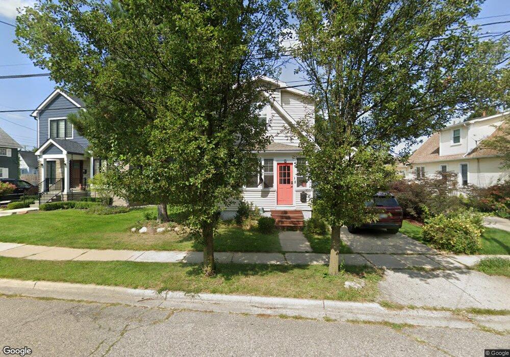
508 Roe St Unit Bldg-Unit Plymouth, MI 48170
Estimated Value: $540,000 - $750,000
2
Beds
3
Baths
1,777
Sq Ft
$350/Sq Ft
Est. Value
About This Home
This home is located at 508 Roe St Unit Bldg-Unit, Plymouth, MI 48170 and is currently estimated at $621,932, approximately $349 per square foot. 508 Roe St Unit Bldg-Unit is a home located in Wayne County with nearby schools including Canton High School, Bird Elementary School, and West Middle School.
Ownership History
Date
Name
Owned For
Owner Type
Purchase Details
Closed on
Aug 31, 2021
Sold by
Kepler Jeffery and Kepler Alexa
Bought by
Sepulveda Anastasia J and Gutierrez Christian Sepulveda
Current Estimated Value
Home Financials for this Owner
Home Financials are based on the most recent Mortgage that was taken out on this home.
Original Mortgage
$408,000
Outstanding Balance
$370,695
Interest Rate
2.7%
Mortgage Type
New Conventional
Estimated Equity
$251,237
Purchase Details
Closed on
Jan 23, 2018
Sold by
Wilson Brett and Wilson Renee
Bought by
Jkepler Jeffrey
Purchase Details
Closed on
Sep 10, 2004
Sold by
Spicer John Patrick and Spicer Alison R
Bought by
Wilson Brett R
Purchase Details
Closed on
Jan 24, 2001
Sold by
Dodge Scott H
Bought by
Smith Allison R
Purchase Details
Closed on
Sep 15, 2000
Sold by
Moore Robert W
Bought by
Moore Diane M
Create a Home Valuation Report for This Property
The Home Valuation Report is an in-depth analysis detailing your home's value as well as a comparison with similar homes in the area
Home Values in the Area
Average Home Value in this Area
Purchase History
| Date | Buyer | Sale Price | Title Company |
|---|---|---|---|
| Sepulveda Anastasia J | $480,000 | Title Solutions Agency Llc | |
| Jkepler Jeffrey | $398,000 | None Available | |
| Wilson Brett R | $235,000 | Multiple | |
| Smith Allison R | $80,000 | -- | |
| Moore Diane M | -- | -- |
Source: Public Records
Mortgage History
| Date | Status | Borrower | Loan Amount |
|---|---|---|---|
| Open | Sepulveda Anastasia J | $408,000 |
Source: Public Records
Tax History Compared to Growth
Tax History
| Year | Tax Paid | Tax Assessment Tax Assessment Total Assessment is a certain percentage of the fair market value that is determined by local assessors to be the total taxable value of land and additions on the property. | Land | Improvement |
|---|---|---|---|---|
| 2025 | $9,632 | $280,200 | $0 | $0 |
| 2024 | $9,632 | $256,900 | $0 | $0 |
| 2023 | $9,382 | $249,900 | $0 | $0 |
| 2022 | $9,945 | $231,600 | $0 | $0 |
| 2021 | $7,852 | $226,900 | $0 | $0 |
| 2020 | $7,832 | $222,600 | $0 | $0 |
| 2019 | $6,895 | $176,800 | $0 | $0 |
| 2018 | $4,730 | $156,100 | $0 | $0 |
| 2017 | $1,002 | $150,800 | $0 | $0 |
| 2016 | $5,153 | $146,800 | $0 | $0 |
| 2015 | $11,801 | $132,390 | $0 | $0 |
| 2013 | $11,432 | $123,000 | $0 | $0 |
| 2011 | -- | $108,710 | $0 | $0 |
Source: Public Records
Map
Nearby Homes
- 190 Hamilton St
- 163 Hamilton St
- 300 Hamilton St Unit 201
- 300 Hamilton St Unit 306
- 381 Hamilton St
- 525 W Ann Arbor Trail
- 628 Maple St
- 644 Maple St
- 636 Maple St
- 668 Maple St
- 660 Maple St
- 333 N Sydney Ct
- 364 N Sydney Ct
- 396 N Sydney Ct
- 303 N Sydney Ct
- 372 N Sydney Ct
- 327 N Sydney Ct
- 334 N Sydney Ct
- 335 N Sydney Ct
- 358 N Sydney Ct