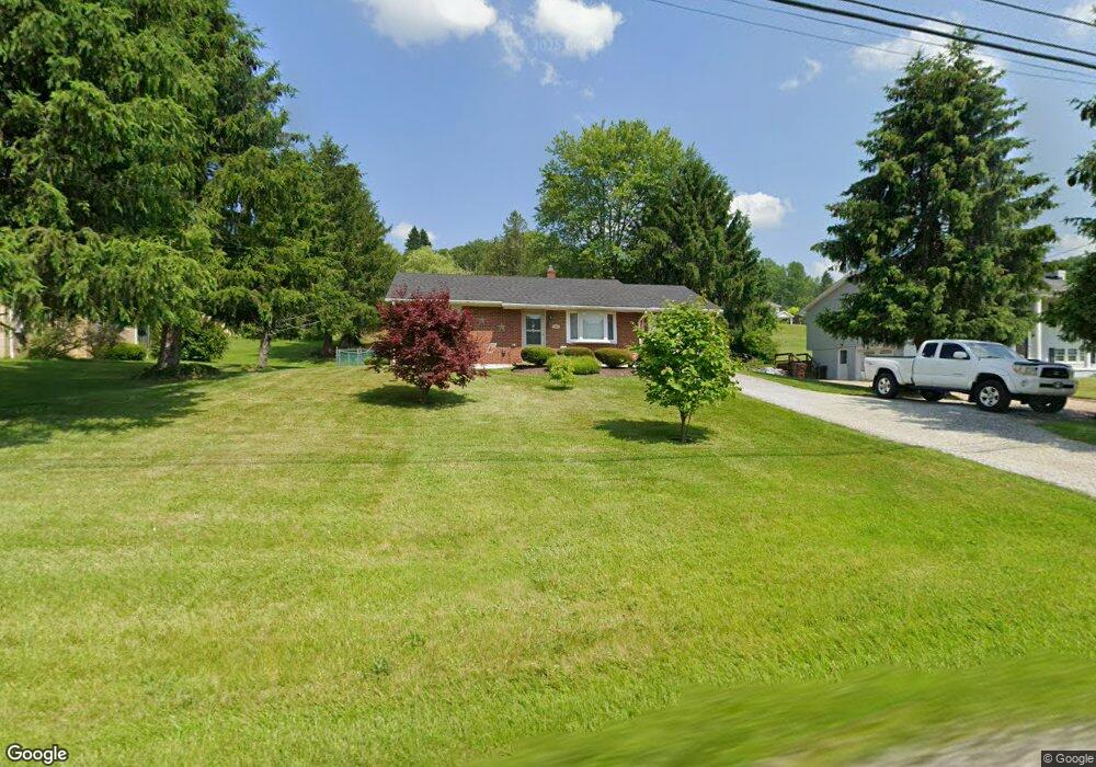
508 State Route 356 Apollo, PA 15613
Allegheny Township NeighborhoodEstimated Value: $74,422 - $202,000
--
Bed
--
Bath
--
Sq Ft
0.39
Acres
About This Home
This home is located at 508 State Route 356, Apollo, PA 15613 and is currently estimated at $156,856. 508 State Route 356 is a home located in Westmoreland County with nearby schools including Kiski Area High School.
Ownership History
Date
Name
Owned For
Owner Type
Purchase Details
Closed on
Aug 4, 2010
Sold by
Krause Caroleann
Bought by
Krause Caroleann and Capezzuto Janel
Current Estimated Value
Home Financials for this Owner
Home Financials are based on the most recent Mortgage that was taken out on this home.
Original Mortgage
$87,478
Outstanding Balance
$58,795
Interest Rate
4.95%
Mortgage Type
FHA
Estimated Equity
$98,061
Purchase Details
Closed on
Jun 30, 2010
Sold by
Large Michael C and Large Sherri R
Bought by
Krause Caroleann
Home Financials for this Owner
Home Financials are based on the most recent Mortgage that was taken out on this home.
Original Mortgage
$87,478
Outstanding Balance
$58,795
Interest Rate
4.95%
Mortgage Type
FHA
Estimated Equity
$98,061
Purchase Details
Closed on
Aug 10, 2001
Sold by
Slagle Scott A
Bought by
Large Michael C
Home Financials for this Owner
Home Financials are based on the most recent Mortgage that was taken out on this home.
Original Mortgage
$70,887
Interest Rate
7.21%
Mortgage Type
FHA
Create a Home Valuation Report for This Property
The Home Valuation Report is an in-depth analysis detailing your home's value as well as a comparison with similar homes in the area
Home Values in the Area
Average Home Value in this Area
Purchase History
| Date | Buyer | Sale Price | Title Company |
|---|---|---|---|
| Krause Caroleann | $31,868 | None Available | |
| Krause Caroleann | $89,000 | None Available | |
| Large Michael C | $72,000 | -- |
Source: Public Records
Mortgage History
| Date | Status | Borrower | Loan Amount |
|---|---|---|---|
| Open | Krause Caroleann | $87,478 | |
| Previous Owner | Large Michael C | $70,887 |
Source: Public Records
Tax History Compared to Growth
Tax History
| Year | Tax Paid | Tax Assessment Tax Assessment Total Assessment is a certain percentage of the fair market value that is determined by local assessors to be the total taxable value of land and additions on the property. | Land | Improvement |
|---|---|---|---|---|
| 2025 | $2,232 | $14,720 | $2,980 | $11,740 |
| 2024 | $2,118 | $14,720 | $2,980 | $11,740 |
| 2023 | $1,937 | $14,720 | $2,980 | $11,740 |
| 2022 | $1,893 | $14,720 | $2,980 | $11,740 |
| 2021 | $1,893 | $14,720 | $2,980 | $11,740 |
| 2020 | $1,888 | $14,720 | $2,980 | $11,740 |
| 2019 | $1,881 | $14,720 | $2,980 | $11,740 |
| 2018 | $1,851 | $14,720 | $2,980 | $11,740 |
| 2017 | $1,807 | $14,720 | $2,980 | $11,740 |
| 2016 | $1,780 | $14,720 | $2,980 | $11,740 |
| 2015 | $1,780 | $14,720 | $2,980 | $11,740 |
| 2014 | $1,771 | $14,720 | $2,980 | $11,740 |
Source: Public Records
Map
Nearby Homes
- 519 Dogwood Ct
- 620 Cedar Ridge Dr
- 628 Pine Run Rd
- 334 State Route 356
- 1016 Camelot Dr
- 1316 Hancock Ave
- 135 Thorn St
- 4792 State Route 66
- 1673 Hancock Ave
- 4797 State Route 66
- 185 Thorn St
- 100 Grace St
- 115 Acadia Ln
- 211 Old Mill Rd
- 231 Whittier St
- 0 Watson Rd
- 213 Whittier St
- 525 Burns St
- 322 N 4th St
- 404-406 N Pennsylvania Ave
- 508 Route 356
- 504 State Route 356
- 321 State Route 356
- 502 State Route 356
- 516 Route 356
- 232 Rovel St
- 516 State Route 356
- 226 Rovel St
- 222 Rovel St
- 505 State Route 356
- 498 State Route 356
- 518 State Route 356
- 509 State Route 356
- 509 State Route 356
- 509 State Route 356
- 218 Rovel St
- 218 Mt Vernon St
- 218 Mt Vernon Dr
- 501 State Route 356
- 494 State Route 356