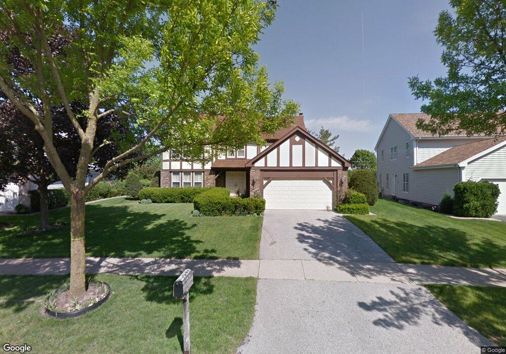
508 W Ashford Ln Arlington Heights, IL 60004
Terramere NeighborhoodEstimated Value: $709,000 - $772,000
5
Beds
3
Baths
3,170
Sq Ft
$233/Sq Ft
Est. Value
About This Home
This home is located at 508 W Ashford Ln, Arlington Heights, IL 60004 and is currently estimated at $739,298, approximately $233 per square foot. 508 W Ashford Ln is a home located in Cook County with nearby schools including Henry W Longfellow Elementary School, Cooper Middle School, and Buffalo Grove High School.
Ownership History
Date
Name
Owned For
Owner Type
Purchase Details
Closed on
Dec 7, 1994
Sold by
Brown Karl D and Smith Terry A
Bought by
Pictor Thomas A and Pictor Mary Ellen
Current Estimated Value
Home Financials for this Owner
Home Financials are based on the most recent Mortgage that was taken out on this home.
Original Mortgage
$203,150
Interest Rate
7.5%
Create a Home Valuation Report for This Property
The Home Valuation Report is an in-depth analysis detailing your home's value as well as a comparison with similar homes in the area
Home Values in the Area
Average Home Value in this Area
Purchase History
| Date | Buyer | Sale Price | Title Company |
|---|---|---|---|
| Pictor Thomas A | $438,750 | 1St American Title |
Source: Public Records
Mortgage History
| Date | Status | Borrower | Loan Amount |
|---|---|---|---|
| Closed | Pictor Thomas A | $203,150 |
Source: Public Records
Tax History Compared to Growth
Tax History
| Year | Tax Paid | Tax Assessment Tax Assessment Total Assessment is a certain percentage of the fair market value that is determined by local assessors to be the total taxable value of land and additions on the property. | Land | Improvement |
|---|---|---|---|---|
| 2024 | $13,486 | $49,000 | $10,180 | $38,820 |
| 2023 | $12,797 | $49,000 | $10,180 | $38,820 |
| 2022 | $12,797 | $49,000 | $10,180 | $38,820 |
| 2021 | $13,540 | $45,134 | $6,718 | $38,416 |
| 2020 | $13,317 | $45,134 | $6,718 | $38,416 |
| 2019 | $13,315 | $49,872 | $6,718 | $43,154 |
| 2018 | $13,748 | $46,607 | $5,904 | $40,703 |
| 2017 | $13,531 | $46,607 | $5,904 | $40,703 |
| 2016 | $13,214 | $46,607 | $5,904 | $40,703 |
| 2015 | $13,218 | $43,447 | $5,090 | $38,357 |
| 2014 | $13,056 | $43,447 | $5,090 | $38,357 |
| 2013 | $12,690 | $43,447 | $5,090 | $38,357 |
Source: Public Records
Map
Nearby Homes
- 812 W Whiting Ln
- 4040 N Harvard Ave
- 715 W Whiting Ln
- 1112 Auburn Ln
- 921 Bernard Dr
- 456 W Happfield Dr Unit 9CL
- 4121 N Mallard Dr Unit 5
- 715 W Happfield Dr
- 1854 Checker Rd
- 751 W Happfield Dr Unit 30
- 1631 W Partridge Ct Unit 8
- 872 Old Checker Rd Unit E3
- 705 Grove Dr Unit 101
- 746 Old Checker Rd Unit E5
- 535 Estate Dr
- 571 Estate Dr
- 859 Beechwood Rd
- 1545 Chickamauga Ln
- 720 Weidner Rd Unit 302
- 1942 Trail Ridge St
- 512 W Ashford Ln
- 504 W Ashford Ln
- 516 W Ashford Ln
- 505 W Ashford Ln
- 509 W Ashford Ln
- 520 W Ashford Ln
- 513 W Ashford Ln
- 4249 N Highland Ave
- 4238 N Highland Ave
- 517 W Ashford Ln
- 524 W Ashford Ln
- 420 W Foxdale Ln
- 422 W Foxdale Ln
- 521 W Ashford Ln Unit 4
- 416 W Foxdale Ln
- 4230 N Highland Ave
- 510 W Foxdale Ln
- 528 W Ashford Ln
- 412 W Foxdale Ln
- 525 W Ashford Ln