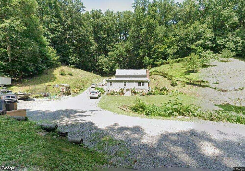
5081 Shenks Ferry Rd Brogue, PA 17309
Estimated Value: $182,000 - $281,000
2
Beds
1
Bath
1,097
Sq Ft
$212/Sq Ft
Est. Value
About This Home
This home is located at 5081 Shenks Ferry Rd, Brogue, PA 17309 and is currently estimated at $233,077, approximately $212 per square foot. 5081 Shenks Ferry Rd is a home located in York County with nearby schools including Clearview Elementary School, Red Lion Area Junior High School, and Red Lion Area Senior High School.
Ownership History
Date
Name
Owned For
Owner Type
Purchase Details
Closed on
Sep 5, 2007
Sold by
Cohenour Randall J and Cohenour Amanda L
Bought by
Cohenour Randall J and Cohenour Amanda L
Current Estimated Value
Purchase Details
Closed on
Jan 30, 2004
Sold by
Schott Matthew E and Schott Bethanne V
Bought by
Cohenour Randall J
Home Financials for this Owner
Home Financials are based on the most recent Mortgage that was taken out on this home.
Original Mortgage
$73,600
Outstanding Balance
$34,494
Interest Rate
5.82%
Mortgage Type
Purchase Money Mortgage
Estimated Equity
$198,583
Create a Home Valuation Report for This Property
The Home Valuation Report is an in-depth analysis detailing your home's value as well as a comparison with similar homes in the area
Home Values in the Area
Average Home Value in this Area
Purchase History
| Date | Buyer | Sale Price | Title Company |
|---|---|---|---|
| Cohenour Randall J | -- | None Available | |
| Cohenour Randall J | $77,500 | -- |
Source: Public Records
Mortgage History
| Date | Status | Borrower | Loan Amount |
|---|---|---|---|
| Open | Cohenour Randall J | $73,600 |
Source: Public Records
Tax History Compared to Growth
Tax History
| Year | Tax Paid | Tax Assessment Tax Assessment Total Assessment is a certain percentage of the fair market value that is determined by local assessors to be the total taxable value of land and additions on the property. | Land | Improvement |
|---|---|---|---|---|
| 2025 | $2,643 | $85,910 | $42,840 | $43,070 |
| 2024 | $2,558 | $85,910 | $42,840 | $43,070 |
| 2023 | $2,558 | $85,910 | $42,840 | $43,070 |
| 2022 | $2,558 | $85,910 | $42,840 | $43,070 |
| 2021 | $2,472 | $85,910 | $42,840 | $43,070 |
| 2020 | $2,472 | $85,910 | $42,840 | $43,070 |
| 2019 | $2,464 | $85,910 | $42,840 | $43,070 |
| 2018 | $2,438 | $85,910 | $42,840 | $43,070 |
| 2017 | $2,438 | $85,910 | $42,840 | $43,070 |
| 2016 | $0 | $85,910 | $42,840 | $43,070 |
| 2015 | -- | $85,910 | $42,840 | $43,070 |
| 2014 | -- | $85,910 | $42,840 | $43,070 |
Source: Public Records
Map
Nearby Homes
- 798 Goram Rd
- 4877 Battlehill Rd
- 5987 River Rd
- 58 Buck Run Rd
- 621 River Hill Rd
- 474 Bridge Valley Rd
- 4360 Battlehill Rd
- 367 Bridge Valley Rd
- 3641 River Rd
- 3532 L 6 River Rd
- 11119 Smith Hollow Rd
- 10620 Enfield Rd
- 0 Pequea Blvd Unit PALA2077958
- 10640 Enfield Rd
- 10400 Enfield Rd
- 142 River Rd
- 3267 Main St
- 291 Douts Hill Rd
- 2659 Furnace Rd
- 9981 Douglas Rd
- 5111 Shenks Ferry Rd
- 5125 Shenks Ferry Rd
- 5115 Shenks Ferry Rd
- 5160 Shenks Ferry Rd
- 4962 Shenks Ferry Rd Unit 2
- 4962 Shenks Ferry Rd
- 81 Patton Ln
- 65 Patton Ln
- 85 Patton Ln
- 41 Patton Ln
- 7 Patton Ln
- 5079 Shenks Ferry Rd
- 23 Patton Ln
- 35 Patton Ln
- 37 Patton Ln
- 29 Patton Ln
- 250 Middle River Rd
- 254 Middle River Rd
- 4864 Shenks Ferry Rd
- 279 Middle River Rd