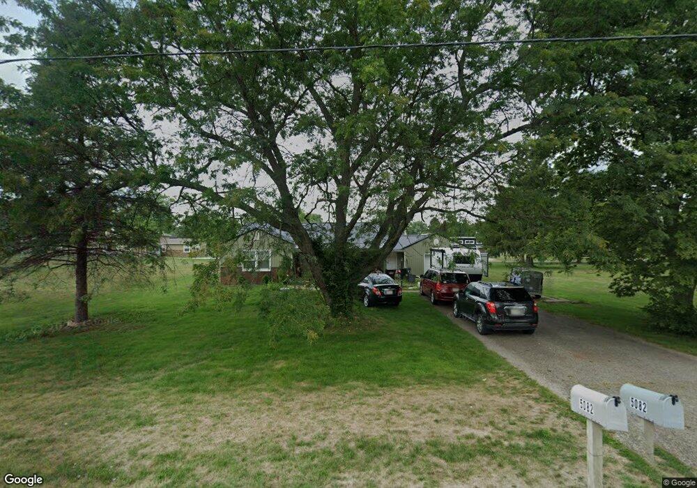
5082 Ashville Rd South Bloomfield, OH 43103
Estimated Value: $195,000 - $289,000
2
Beds
1
Bath
1,570
Sq Ft
$151/Sq Ft
Est. Value
About This Home
This home is located at 5082 Ashville Rd, South Bloomfield, OH 43103 and is currently estimated at $237,025, approximately $150 per square foot. 5082 Ashville Rd is a home located in Pickaway County.
Ownership History
Date
Name
Owned For
Owner Type
Purchase Details
Closed on
Nov 5, 2019
Sold by
Young Harrod E and Young Sandra J
Bought by
Young Travis Edward and Young Robin
Current Estimated Value
Purchase Details
Closed on
Aug 5, 2019
Sold by
Young Harrod E and Young Sandra J
Bought by
Young Travis Edward and Young Robin
Home Financials for this Owner
Home Financials are based on the most recent Mortgage that was taken out on this home.
Original Mortgage
$76,516
Interest Rate
4.87%
Mortgage Type
FHA
Purchase Details
Closed on
Sep 10, 2010
Sold by
Cline Michael E
Bought by
Young Harrod E and Young Sandra J
Purchase Details
Closed on
Jul 13, 2010
Sold by
Estate Of L Sandi Kempton Cline
Bought by
Cline Michael E
Purchase Details
Closed on
Nov 25, 1992
Sold by
Valentine Helen M
Bought by
Cline Michael E
Purchase Details
Closed on
Oct 31, 1992
Create a Home Valuation Report for This Property
The Home Valuation Report is an in-depth analysis detailing your home's value as well as a comparison with similar homes in the area
Home Values in the Area
Average Home Value in this Area
Purchase History
| Date | Buyer | Sale Price | Title Company |
|---|---|---|---|
| Young Travis Edward | $94,000 | Citizens Land Title Box | |
| Young Travis Edward | $94,000 | Citizens Land Title | |
| Young Harrod E | $86,500 | Clt | |
| Cline Michael E | -- | None Available | |
| Cline Michael E | $66,000 | -- | |
| -- | $66,000 | -- |
Source: Public Records
Mortgage History
| Date | Status | Borrower | Loan Amount |
|---|---|---|---|
| Previous Owner | Young Travis Edward | $76,516 |
Source: Public Records
Tax History Compared to Growth
Tax History
| Year | Tax Paid | Tax Assessment Tax Assessment Total Assessment is a certain percentage of the fair market value that is determined by local assessors to be the total taxable value of land and additions on the property. | Land | Improvement |
|---|---|---|---|---|
| 2024 | -- | $49,160 | $9,850 | $39,310 |
| 2023 | $1,932 | $49,160 | $9,850 | $39,310 |
| 2022 | $1,562 | $36,650 | $8,200 | $28,450 |
| 2021 | $1,483 | $36,650 | $8,200 | $28,450 |
| 2020 | $1,487 | $36,650 | $8,200 | $28,450 |
| 2019 | $1,264 | $30,820 | $8,200 | $22,620 |
| 2018 | $1,305 | $30,820 | $8,200 | $22,620 |
| 2017 | $1,338 | $30,820 | $8,200 | $22,620 |
| 2016 | $1,243 | $28,500 | $8,110 | $20,390 |
| 2015 | $1,244 | $28,500 | $8,110 | $20,390 |
| 2014 | $1,245 | $28,500 | $8,110 | $20,390 |
| 2013 | $1,292 | $28,590 | $8,110 | $20,480 |
Source: Public Records
Map
Nearby Homes
- 5069 Ashville Rd
- 5050 S Walnut St
- 5049 Lee Rd
- 0 U S 23
- Aspire Plan at Bloomfield Hills
- Hampton Plan at Bloomfield Hills
- Mitchell Plan at Bloomfield Hills
- Crisfield Plan at Bloomfield Hills
- Sereneda Plan at Bloomfield Hills
- Oakdale Plan at Bloomfield Hills
- 5009 Roese Ave
- 30 Bazler Ln
- The Daffodil Plan at Riverbend at Scioto Landing
- The Daisy Plan at Riverbend at Scioto Landing
- The Avalon Plan at Riverbend at Scioto Landing
- The Aster Plan at Riverbend at Scioto Landing
- 51 Henderson Ln
- 92 Richard Ave
- 94 Richard Ave
- 127 Boutot St
- 5080 Ashville Rd
- 10694 Ashville Rd
- 0 Ashville Rd
- 5065 Cook Rd
- 5071 Ashville Rd
- 5088 Ashville Rd
- 5073 Ashville Rd
- 5078 Ashville Rd
- 5063 Cook Rd
- 5075 Ashville Rd
- 5068 Scioto Dr
- 5098 Ashville Rd
- 5062 Cook Rd
- 5062 Lee Rd
- 5061 Cook Rd
- 5066 Ashville Rd
- 5077 Ashville Rd
- 5100 Ashville Rd
- 5060 Cook Rd
- 5065 Ashville Rd