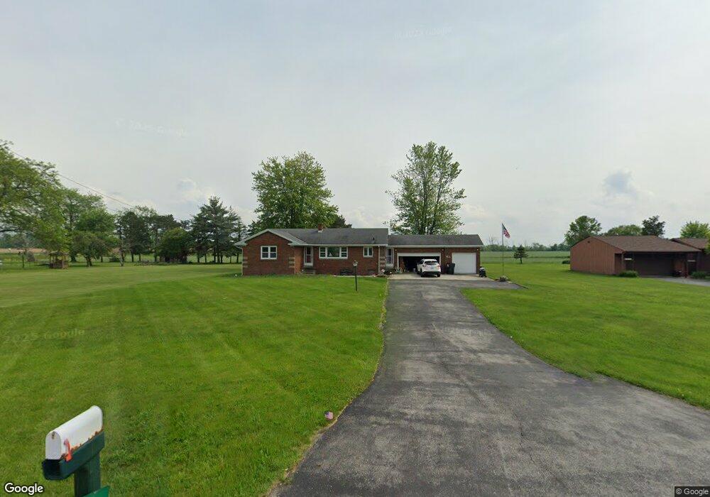
5084 West Harbor Rd Port Clinton, OH 43452
Estimated Value: $181,000 - $210,113
3
Beds
2
Baths
1,172
Sq Ft
$171/Sq Ft
Est. Value
About This Home
This home is located at 5084 West Harbor Rd, Port Clinton, OH 43452 and is currently estimated at $200,528, approximately $171 per square foot. 5084 West Harbor Rd is a home located in Ottawa County with nearby schools including Bataan Memorial Primary School, Bataan Memorial Intermediate School, and Port Clinton Middle School.
Ownership History
Date
Name
Owned For
Owner Type
Purchase Details
Closed on
Feb 19, 2017
Sold by
Howard Forrest A and Howard Hilda J
Bought by
Kennedy Lucas K
Current Estimated Value
Home Financials for this Owner
Home Financials are based on the most recent Mortgage that was taken out on this home.
Original Mortgage
$128,040
Interest Rate
3.78%
Mortgage Type
New Conventional
Create a Home Valuation Report for This Property
The Home Valuation Report is an in-depth analysis detailing your home's value as well as a comparison with similar homes in the area
Home Values in the Area
Average Home Value in this Area
Purchase History
| Date | Buyer | Sale Price | Title Company |
|---|---|---|---|
| Kennedy Lucas K | $132,000 | None Available |
Source: Public Records
Mortgage History
| Date | Status | Borrower | Loan Amount |
|---|---|---|---|
| Previous Owner | Kennedy Lucas K | $128,040 |
Source: Public Records
Tax History Compared to Growth
Tax History
| Year | Tax Paid | Tax Assessment Tax Assessment Total Assessment is a certain percentage of the fair market value that is determined by local assessors to be the total taxable value of land and additions on the property. | Land | Improvement |
|---|---|---|---|---|
| 2024 | $1,921 | $58,755 | $4,946 | $53,809 |
| 2023 | $1,921 | $47,870 | $3,532 | $44,338 |
| 2022 | $1,736 | $47,870 | $3,532 | $44,338 |
| 2021 | $1,734 | $47,870 | $3,530 | $44,340 |
| 2020 | $1,596 | $42,260 | $3,050 | $39,210 |
| 2019 | $1,581 | $42,260 | $3,050 | $39,210 |
| 2018 | $1,578 | $42,260 | $3,050 | $39,210 |
| 2017 | $870 | $31,660 | $2,960 | $28,700 |
| 2016 | $872 | $31,660 | $2,960 | $28,700 |
| 2015 | $829 | $31,660 | $2,960 | $28,700 |
| 2014 | $812 | $30,230 | $2,960 | $27,270 |
| 2013 | $812 | $30,230 | $2,960 | $27,270 |
Source: Public Records
Map
Nearby Homes
- 265 S Meachem Rd
- 265 S Meachem Rd Unit 62
- 265 S Meachem Rd Unit 24
- 265 S Meachem Rd Unit 41
- 265 S Meachem Rd Unit 39
- 295 Meachem Rd
- 3800 W Lakeshore Dr
- 5225 W Lakeshore Dr
- 2915 W Rising Sun Rd
- 2915 W Risingsun Rd
- 2860 W Rising Sun Rd
- 141 N Wexford Dr E
- 2738 W Columbus St
- 2400 Sandy Ln
- 1805 W Lakeshore Dr Unit 3
- 1805 W Lakeshore Dr
- 6991 W Lakeshore Dr
- 51 N Schooner Point Dr
- 89 N Schooner Point Dr Unit 89
- 87 N Schooner Point Dr
- 5084 W State Rd 163 State Hwy
- 5120 W State Route 163
- 5120 W Harbor Rd
- 5048 West Harbor Rd
- 5048 W Harbor Rd
- 5160 W Harbor Rd
- 5160 West Harbor Rd
- 5024 West Harbor Rd
- 5180 West Harbor Rd
- 5180 West Harbor Rd
- 5180 W Harbor Rd
- 5200 West Harbor Rd
- 5200 W Harbor Rd
- 5360 West Harbor Rd
- 4925 West Harbor Rd
- 5394 West Harbor Rd
- 5456 West Harbor Rd
- 5431 West Harbor Rd
- 5406 West Harbor Rd
- 26 N Tettau Rd