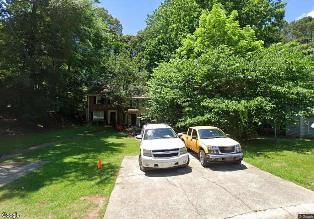
5087 Farm Valley Dr NE Woodstock, GA 30188
Sandy Plains NeighborhoodEstimated Value: $243,000 - $271,000
2
Beds
2
Baths
1,280
Sq Ft
$198/Sq Ft
Est. Value
About This Home
This home is located at 5087 Farm Valley Dr NE, Woodstock, GA 30188 and is currently estimated at $253,733, approximately $198 per square foot. 5087 Farm Valley Dr NE is a home located in Cobb County with nearby schools including Nicholson Elementary School, McCleskey Middle School, and Kell High School.
Ownership History
Date
Name
Owned For
Owner Type
Purchase Details
Closed on
Jan 15, 2004
Sold by
Campbell Miriam Trust
Bought by
Harrison Walter A and Harrison Mary
Current Estimated Value
Home Financials for this Owner
Home Financials are based on the most recent Mortgage that was taken out on this home.
Original Mortgage
$73,720
Outstanding Balance
$34,089
Interest Rate
5.85%
Mortgage Type
New Conventional
Estimated Equity
$219,644
Create a Home Valuation Report for This Property
The Home Valuation Report is an in-depth analysis detailing your home's value as well as a comparison with similar homes in the area
Home Values in the Area
Average Home Value in this Area
Purchase History
| Date | Buyer | Sale Price | Title Company |
|---|---|---|---|
| Harrison Walter A | $92,200 | -- |
Source: Public Records
Mortgage History
| Date | Status | Borrower | Loan Amount |
|---|---|---|---|
| Open | Harrison Walter A | $73,720 |
Source: Public Records
Tax History Compared to Growth
Tax History
| Year | Tax Paid | Tax Assessment Tax Assessment Total Assessment is a certain percentage of the fair market value that is determined by local assessors to be the total taxable value of land and additions on the property. | Land | Improvement |
|---|---|---|---|---|
| 2025 | $3,091 | $102,600 | $28,000 | $74,600 |
| 2024 | $2,611 | $86,584 | $24,000 | $62,584 |
| 2023 | $2,290 | $75,948 | $18,000 | $57,948 |
| 2022 | $2,127 | $70,088 | $16,000 | $54,088 |
| 2021 | $1,496 | $49,288 | $12,000 | $37,288 |
| 2020 | $1,275 | $42,024 | $8,000 | $34,024 |
| 2019 | $1,275 | $42,024 | $8,000 | $34,024 |
| 2018 | $1,100 | $36,260 | $8,000 | $28,260 |
| 2017 | $993 | $34,536 | $8,000 | $26,536 |
| 2016 | $740 | $25,736 | $4,800 | $20,936 |
| 2015 | $692 | $23,484 | $4,800 | $18,684 |
| 2014 | $698 | $23,484 | $0 | $0 |
Source: Public Records
Map
Nearby Homes
- 294 Farm Ridge Dr NE
- 5142 Farm Place Dr NE
- 540 Stockwood Dr
- 162 Ridgewood Dr
- The Gavin E Plan at The Village at Shallowford - Signature Series
- The Marion A Plan at The Village at Shallowford - Classic Series
- The Cary A Plan at The Village at Shallowford - Classic Series
- 4669 Blue Topaz Trail
- 4793 Moonstone Trace
- 4785 Moonstone Trace
- 4778 Moonstone Trace
- 4785 Moonstone Trace NE
- 707 Smokey Quartz Way
- 710 Smokey Quartz Way
- 694 Smokey Quartz Way
- 706 Smokey Quartz Way
- 703 Smokey Quartz Way
- 702 Smokey Quartz Way
- 5085 Farm Valley Dr NE
- 5089 Farm Valley Dr NE Unit 145B
- 5089 Farm Valley Dr NE
- 5083 Farm Valley Dr NE
- 5091 Farm Valley Dr NE Unit 145A
- 5091 Farm Valley Dr NE
- 5081 Farm Valley Dr NE
- 293 Farm Ridge Dr NE
- 0 Farm Valley Dr NE Unit 7041579
- 0 Farm Valley Dr NE Unit 7349595
- 0 Farm Valley Dr NE Unit 3289824
- 0 Farm Valley Dr NE Unit 3194859
- 0 Farm Valley Dr NE Unit 3236842
- 0 Farm Valley Dr NE Unit 8541675
- 0 Farm Valley Dr NE
- 295 Farm Ridge Dr NE
- 5140 Farm Place Dr NE Unit 5138
- 5138 Farm Place Dr NE Unit 5140
- 5138 Farm Place Dr NE
- 5138 Farm Place Dr NE