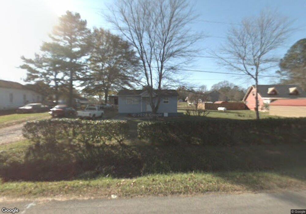
509 Arrowhead Dr NE Dalton, GA 30721
Estimated Value: $113,000 - $199,000
2
Beds
1
Bath
900
Sq Ft
$163/Sq Ft
Est. Value
About This Home
This home is located at 509 Arrowhead Dr NE, Dalton, GA 30721 and is currently estimated at $146,549, approximately $162 per square foot. 509 Arrowhead Dr NE is a home located in Whitfield County with nearby schools including Dawnville Elementary School and Coahulla Creek High School.
Ownership History
Date
Name
Owned For
Owner Type
Purchase Details
Closed on
Sep 23, 2010
Sold by
Citifinancial Svcs Inc
Bought by
Bramblett Beverly
Current Estimated Value
Purchase Details
Closed on
Jun 1, 2010
Sold by
Citifinancial Svcs Inc
Bought by
Citifinancial Svcs Inc
Purchase Details
Closed on
Dec 11, 2007
Sold by
Blackwell Edwin
Bought by
Blackwell Charles D
Home Financials for this Owner
Home Financials are based on the most recent Mortgage that was taken out on this home.
Original Mortgage
$20,000
Interest Rate
6.21%
Mortgage Type
New Conventional
Create a Home Valuation Report for This Property
The Home Valuation Report is an in-depth analysis detailing your home's value as well as a comparison with similar homes in the area
Home Values in the Area
Average Home Value in this Area
Purchase History
| Date | Buyer | Sale Price | Title Company |
|---|---|---|---|
| Bramblett Beverly | $18,500 | -- | |
| Citifinancial Svcs Inc | $17,098 | -- | |
| Blackwell Charles D | -- | -- |
Source: Public Records
Mortgage History
| Date | Status | Borrower | Loan Amount |
|---|---|---|---|
| Previous Owner | Blackwell Charles D | $20,000 |
Source: Public Records
Tax History Compared to Growth
Tax History
| Year | Tax Paid | Tax Assessment Tax Assessment Total Assessment is a certain percentage of the fair market value that is determined by local assessors to be the total taxable value of land and additions on the property. | Land | Improvement |
|---|---|---|---|---|
| 2024 | $449 | $36,984 | $1,344 | $35,640 |
| 2023 | $449 | $21,908 | $1,344 | $20,564 |
| 2022 | $237 | $14,656 | $1,344 | $13,312 |
| 2021 | $237 | $14,656 | $1,344 | $13,312 |
| 2020 | $237 | $14,656 | $1,344 | $13,312 |
| 2019 | $237 | $14,656 | $1,344 | $13,312 |
| 2018 | $230 | $14,259 | $1,344 | $12,915 |
| 2017 | $230 | $14,259 | $1,344 | $12,915 |
| 2016 | $233 | $14,434 | $2,688 | $11,746 |
| 2014 | $234 | $14,434 | $2,688 | $11,746 |
| 2013 | -- | $14,434 | $2,688 | $11,746 |
Source: Public Records
Map
Nearby Homes
- 3871 Miller Dr NE
- 162 Alcoa Dr
- 4960 Mark Brown Rd NE
- 4685 Mitchell Bridge Rd NE
- 3922 Miller Dr NE
- 5111 Mark Brown Rd NE
- 355 Heritage Cir
- 117 Indian Trace
- 4363 Bass Dr NE
- 210 Gordon Dr
- 89 Arrowhead Dr
- 685 Goswick Rd
- 0 Leon Cir
- 0 Old Free Hope Rd
- 620 Lower Dawnville Rd NE
- 1259 Rollins Ketchum Rd
- 0 Rollins Ketchum Rd
- 247 Robert Jackson Rd
- 230 Indian Dr NE
- 1070 Dawnville Rd NE
- 505 Arrowhead Dr NE
- 519 Arrowhead Dr NE
- 4027 Miller Dr NE
- 523 Arrowhead Dr NE
- 437 Arrowhead Dr NE
- 521 Arrowhead Dr NE
- 423 Arrowhead Dr NE
- 3654 Miller Dr NE
- 3700 Miller Dr NE
- 427 Arrowhead Dr NE
- 3688 Miller Dr NE
- 4021 Miller Dr NE
- 414 Arrowhead Dr NE
- 136 Alcoa Dr
- 4016 Miller Dr NE
- 3651 Miller Dr NE
- 3646 Miller Dr NE
- 511 Hammond Dr NE
- 519 Hammond Dr NE
- 3791 Miller Dr NE