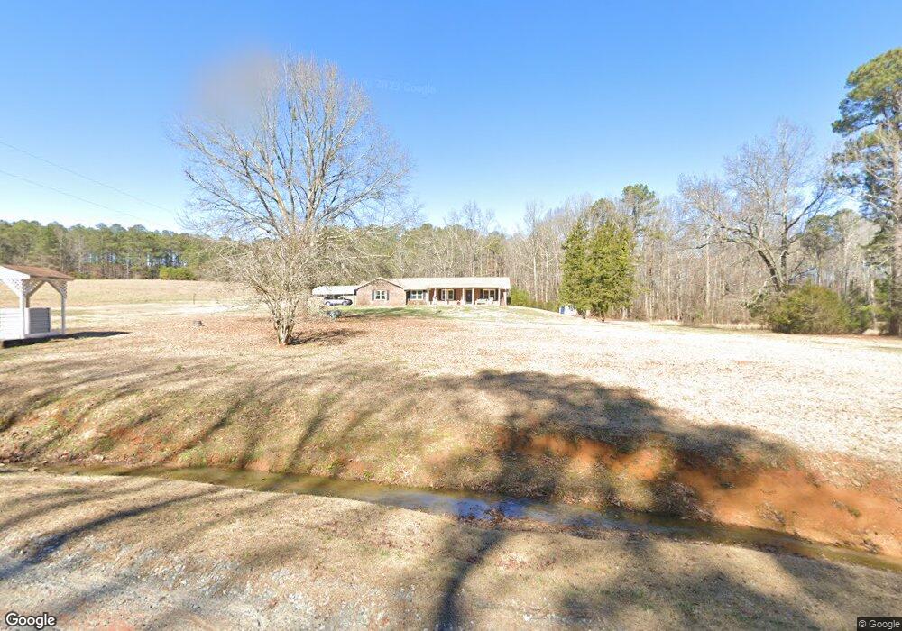
509 Davis Rd Fayetteville, GA 30215
Estimated Value: $456,000 - $521,331
--
Bed
2
Baths
1,991
Sq Ft
$244/Sq Ft
Est. Value
About This Home
This home is located at 509 Davis Rd, Fayetteville, GA 30215 and is currently estimated at $485,833, approximately $244 per square foot. 509 Davis Rd is a home located in Fayette County with nearby schools including Cleveland Elementary School, Bennett's Mill Middle School, and Fayette County High School.
Ownership History
Date
Name
Owned For
Owner Type
Purchase Details
Closed on
Sep 15, 2016
Sold by
Smith Paige
Bought by
Steele Samuel and Steele Mamie
Current Estimated Value
Purchase Details
Closed on
Apr 22, 2014
Sold by
Fincher Ronald Eugene Esta
Bought by
Gelinas Paige
Home Financials for this Owner
Home Financials are based on the most recent Mortgage that was taken out on this home.
Original Mortgage
$174,115
Interest Rate
4.43%
Mortgage Type
New Conventional
Create a Home Valuation Report for This Property
The Home Valuation Report is an in-depth analysis detailing your home's value as well as a comparison with similar homes in the area
Home Values in the Area
Average Home Value in this Area
Purchase History
| Date | Buyer | Sale Price | Title Company |
|---|---|---|---|
| Steele Samuel | $230,000 | -- | |
| Gelinas Paige | $179,500 | -- |
Source: Public Records
Mortgage History
| Date | Status | Borrower | Loan Amount |
|---|---|---|---|
| Previous Owner | Gelinas Paige | $174,115 |
Source: Public Records
Tax History Compared to Growth
Tax History
| Year | Tax Paid | Tax Assessment Tax Assessment Total Assessment is a certain percentage of the fair market value that is determined by local assessors to be the total taxable value of land and additions on the property. | Land | Improvement |
|---|---|---|---|---|
| 2024 | $1,356 | $184,732 | $68,092 | $116,640 |
| 2023 | $1,356 | $170,540 | $59,580 | $110,960 |
| 2022 | $1,199 | $158,396 | $53,196 | $105,200 |
| 2021 | $1,001 | $133,780 | $48,940 | $84,840 |
| 2020 | $905 | $117,900 | $41,340 | $76,560 |
| 2019 | $890 | $114,460 | $41,340 | $73,120 |
| 2018 | $827 | $106,712 | $38,192 | $68,520 |
| 2017 | $598 | $77,500 | $30,140 | $47,360 |
| 2016 | $2,347 | $81,672 | $30,032 | $51,640 |
| 2015 | $1,719 | $59,516 | $23,196 | $36,320 |
| 2014 | $2,165 | $74,192 | $30,032 | $44,160 |
| 2013 | -- | $72,592 | $0 | $0 |
Source: Public Records
Map
Nearby Homes
- 539 Davis Rd
- 550 Davis Rd
- 105 Godby Dr
- 0 Ebenezer Rd Unit 10631625
- 100 Hamilton Glen Ct
- 105 Arlington Trace
- 135 Discovery Lake Dr
- 140 Lapis Lake Point Unit 363
- 110 Lapis Lake Point
- 120 Lapis Lake Point
- 130 Lapis Lake Point
- 130 Dockside Dr Unit 380
- 180 Dockside Dr Unit LOT 385
- Savannah Plan at Huntcliff
- Corsica Plan at Huntcliff
- Esquire Place Plan at Huntcliff
- Normandy Plan at Huntcliff
- Versailles Plan at Huntcliff
- 111 Windsail Way
- 125 Silver Lake Way