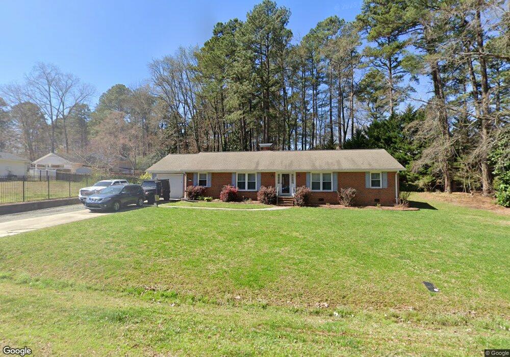
509 Duluth St Durham, NC 27705
Croasdaile NeighborhoodEstimated Value: $449,546 - $483,000
3
Beds
2
Baths
1,984
Sq Ft
$236/Sq Ft
Est. Value
About This Home
This home is located at 509 Duluth St, Durham, NC 27705 and is currently estimated at $468,637, approximately $236 per square foot. 509 Duluth St is a home located in Durham County with nearby schools including Hillandale Elementary School, George L Carrington Middle, and Riverside High School.
Ownership History
Date
Name
Owned For
Owner Type
Purchase Details
Closed on
Apr 5, 2002
Sold by
Mallard Harvey M and Mallard Jeane J
Bought by
Pope Robert H and Pope Tracey Cody
Current Estimated Value
Home Financials for this Owner
Home Financials are based on the most recent Mortgage that was taken out on this home.
Original Mortgage
$151,387
Outstanding Balance
$63,920
Interest Rate
7.07%
Mortgage Type
FHA
Estimated Equity
$404,717
Create a Home Valuation Report for This Property
The Home Valuation Report is an in-depth analysis detailing your home's value as well as a comparison with similar homes in the area
Home Values in the Area
Average Home Value in this Area
Purchase History
| Date | Buyer | Sale Price | Title Company |
|---|---|---|---|
| Pope Robert H | $154,000 | -- |
Source: Public Records
Mortgage History
| Date | Status | Borrower | Loan Amount |
|---|---|---|---|
| Open | Pope Robert H | $151,387 |
Source: Public Records
Tax History
| Year | Tax Paid | Tax Assessment Tax Assessment Total Assessment is a certain percentage of the fair market value that is determined by local assessors to be the total taxable value of land and additions on the property. | Land | Improvement |
|---|---|---|---|---|
| 2025 | $4,239 | $427,581 | $164,250 | $263,331 |
| 2024 | $3,323 | $238,202 | $65,565 | $172,637 |
| 2023 | $3,120 | $238,202 | $65,565 | $172,637 |
| 2022 | $3,049 | $238,202 | $65,565 | $172,637 |
| 2021 | $3,034 | $238,202 | $65,565 | $172,637 |
| 2020 | $2,963 | $238,202 | $65,565 | $172,637 |
| 2019 | $2,963 | $238,202 | $65,565 | $172,637 |
| 2018 | $2,875 | $211,969 | $43,710 | $168,259 |
| 2017 | $2,854 | $211,969 | $43,710 | $168,259 |
| 2016 | $2,758 | $211,969 | $43,710 | $168,259 |
| 2015 | $2,623 | $189,452 | $43,733 | $145,719 |
| 2014 | $2,623 | $189,452 | $43,733 | $145,719 |
Source: Public Records
Map
Nearby Homes
- 4408 Cheshire Ct
- 2104 Skipping Stone Dr
- 605 Blackwood Ct
- 6 Webster Ct
- Collins Plan at Stonewood Estates - Legacy
- Mitchell Plan at Stonewood Estates - Landmark
- Fisher Plan at Stonewood Estates - Landmark
- Hatteras Plan at Stonewood Estates - Landmark
- Winston Plan at Stonewood Estates - Landmark
- 524 Soapstone Dr
- 1217 Opal Ln
- 1221 Opal Ln
- 1229 Opal Ln
- 96 Sparger Springs Ln
- 2708 Ferrand Dr
- 2200 Anthony Dr
- 2606 Newquay St
- 4404 Regis Ave
- 112 Mt Evans Dr
- 3735 Stoneybrook Dr
Your Personal Tour Guide
Ask me questions while you tour the home.