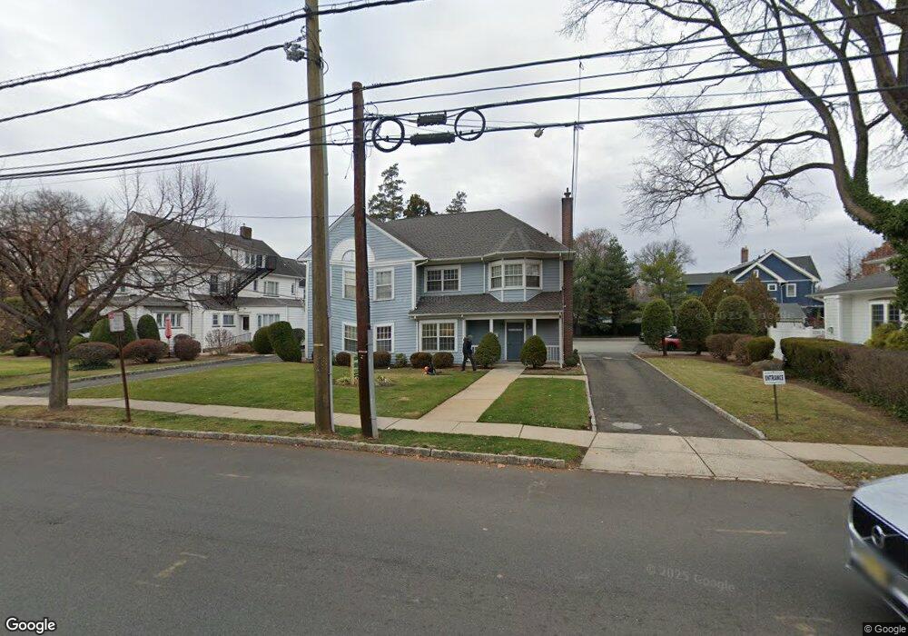
509 E Broad St Unit 13 Westfield, NJ 07090
Estimated Value: $1,882,327
Studio
--
Bath
2,556
Sq Ft
$736/Sq Ft
Est. Value
About This Home
This home is located at 509 E Broad St Unit 13, Westfield, NJ 07090 and is currently estimated at $1,882,327, approximately $736 per square foot. 509 E Broad St Unit 13 is a home located in Union County with nearby schools including Wilson Elementary School, Roosevelt Intermediate School, and Westfield Senior High School.
Ownership History
Date
Name
Owned For
Owner Type
Purchase Details
Closed on
Jan 20, 2015
Sold by
Murphy Kathleen and Freeman Barry
Bought by
Chapin Berkley Associates Llc
Current Estimated Value
Purchase Details
Closed on
Jun 8, 2010
Sold by
Thaller Md Jeffrey
Bought by
Murphy Md Kathleen A and Md Jeffrey Thaller D
Purchase Details
Closed on
May 27, 2010
Sold by
Derosa Md Joseph
Bought by
Murphy Md Kathleen and Westfield Professional Associates
Purchase Details
Closed on
May 12, 2010
Sold by
Callender Jeffrey
Bought by
Derosa Md Joseph and Murphy Md Kathleen
Purchase Details
Closed on
Dec 29, 2003
Sold by
Percy John
Bought by
Derosa Joseph
Purchase Details
Closed on
May 24, 2002
Sold by
Faraldo Md Joseph T
Bought by
Derosa Joseph and Faraldo Md Joseph T
Create a Home Valuation Report for This Property
The Home Valuation Report is an in-depth analysis detailing your home's value as well as a comparison with similar homes in the area
Home Values in the Area
Average Home Value in this Area
Purchase History
| Date | Buyer | Sale Price | Title Company |
|---|---|---|---|
| Chapin Berkley Associates Llc | $900,000 | Multiple | |
| Murphy Md Kathleen A | $322,232 | None Available | |
| Murphy Md Kathleen | $765,000 | Lawyers Title Insurance Corp | |
| Derosa Md Joseph | $351,341 | Lawyers Title Insurance Corp | |
| Derosa Joseph | $107,133 | -- | |
| Derosa Joseph | $419,076 | -- |
Source: Public Records
Tax History
| Year | Tax Paid | Tax Assessment Tax Assessment Total Assessment is a certain percentage of the fair market value that is determined by local assessors to be the total taxable value of land and additions on the property. | Land | Improvement |
|---|---|---|---|---|
| 2025 | $18,016 | $800,000 | $696,000 | $104,000 |
| 2024 | $22,042 | $800,000 | $696,000 | $104,000 |
| 2023 | $22,042 | $999,200 | $696,000 | $303,200 |
| 2022 | $21,583 | $999,200 | $696,000 | $303,200 |
| 2021 | $21,613 | $999,200 | $696,000 | $303,200 |
| 2020 | $21,563 | $999,200 | $696,000 | $303,200 |
| 2019 | $21,483 | $999,200 | $696,000 | $303,200 |
| 2018 | $23,540 | $253,200 | $126,900 | $126,300 |
| 2017 | $23,411 | $253,200 | $126,900 | $126,300 |
| 2016 | $22,861 | $253,200 | $126,900 | $126,300 |
| 2015 | $26,830 | $303,200 | $126,900 | $176,300 |
| 2014 | -- | $303,200 | $126,900 | $176,300 |
Source: Public Records
Map
Nearby Homes
- 318 S Euclid Ave
- 208 Jefferson Ave
- 756 Kimball Ave
- 553 Parkview Ave
- 765 Marcellus Dr
- 203 Ross Place
- 215 Ross Place Unit J
- 771 Oak Ave
- 820 E Broad St
- 529 Benson Place
- 515 Trinity Place Unit 3AN
- 122 Livingston St
- 710 Girard Ave
- 615 Maple Ct Unit 615
- 825 Grant Ave
- 23 Stoneleigh Park
- 722 Boulevard
- 564 Spruce Ave
- 514 Downer St
- 143 Stanmore Place
- 519 E Broad St
- 114 N Euclid Ave
- 115 Harrison Ave
- 118 N Euclid Ave
- 117 Harrison Ave
- 123 Harrison Ave
- 102 Harrison Ave
- 126 N Euclid Ave
- 512 E Broad St
- 108 Harrison Ave
- 502 E Broad St
- 445 E Broad St
- 127 Harrison Ave
- 118 Harrison Ave
- 117 N Euclid Ave
- 132 N Euclid Ave
- 121 N Euclid Ave
- 435 E Broad St
- 435 E Broad St Unit 1
- 526 E Broad St Unit 2
Your Personal Tour Guide
Ask me questions while you tour the home.