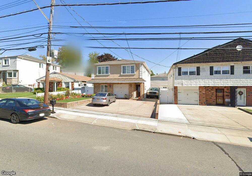
509 Foster Rd Staten Island, NY 10309
Woodrow NeighborhoodEstimated Value: $852,895 - $973,000
4
Beds
2
Baths
2,000
Sq Ft
$464/Sq Ft
Est. Value
About This Home
This home is located at 509 Foster Rd, Staten Island, NY 10309 and is currently estimated at $928,974, approximately $464 per square foot. 509 Foster Rd is a home located in Richmond County with nearby schools including P.S. 36 - J.C. Drumgoole, I.S. 075 Frank D. Paulo, and Tottenville High School.
Ownership History
Date
Name
Owned For
Owner Type
Purchase Details
Closed on
Feb 4, 2004
Sold by
Regaled John
Bought by
Mati Abdula and Mati Dalandishe
Current Estimated Value
Home Financials for this Owner
Home Financials are based on the most recent Mortgage that was taken out on this home.
Original Mortgage
$335,000
Interest Rate
5.94%
Mortgage Type
Purchase Money Mortgage
Create a Home Valuation Report for This Property
The Home Valuation Report is an in-depth analysis detailing your home's value as well as a comparison with similar homes in the area
Home Values in the Area
Average Home Value in this Area
Purchase History
| Date | Buyer | Sale Price | Title Company |
|---|---|---|---|
| Mati Abdula | $420,000 | Ticor Title Ins Co |
Source: Public Records
Mortgage History
| Date | Status | Borrower | Loan Amount |
|---|---|---|---|
| Previous Owner | Mati Abdula | $335,000 |
Source: Public Records
Tax History Compared to Growth
Tax History
| Year | Tax Paid | Tax Assessment Tax Assessment Total Assessment is a certain percentage of the fair market value that is determined by local assessors to be the total taxable value of land and additions on the property. | Land | Improvement |
|---|---|---|---|---|
| 2025 | $8,131 | $55,920 | $9,168 | $46,752 |
| 2024 | $8,143 | $50,100 | $10,182 | $39,918 |
| 2023 | $8,092 | $41,246 | $9,272 | $31,974 |
| 2022 | $7,554 | $48,660 | $12,180 | $36,480 |
| 2021 | $7,508 | $42,960 | $12,180 | $30,780 |
| 2020 | $7,128 | $42,960 | $12,180 | $30,780 |
| 2019 | $7,008 | $45,840 | $12,180 | $33,660 |
| 2018 | $6,709 | $34,372 | $11,093 | $23,279 |
| 2017 | $6,373 | $32,733 | $10,804 | $21,929 |
| 2016 | $5,874 | $30,931 | $10,697 | $20,234 |
| 2015 | $5,277 | $29,229 | $8,837 | $20,392 |
| 2014 | $5,277 | $29,085 | $9,187 | $19,898 |
Source: Public Records
Map
Nearby Homes
- 880 Sinclair Ave
- 839 Sinclair Ave
- 973 Sheldon Ave
- 859 Rathbun Ave
- 960 Rensselaer Ave
- 104 Wieland Ave
- 106 Wieland Ave
- 980 Rensselaer Ave
- 108 Wieland Ave
- 816 Sinclair Ave
- 1272 Woodrow Rd
- 142 Wieland Ave
- 0 Woodrow Rd
- 1030 Rensselaer Ave
- 727 Stafford Ave
- 859 Lamont Ave
- 1046 Rensselaer Ave
- 703 Marcy Ave
- 265 Ramapo Ave
- 559 Alverson Ave
- 505 Foster Rd
- 511 Foster Rd
- 503 Foster Rd
- 515 Foster Rd
- 895 Sheldon Ave
- 896 Sinclair Ave
- 517 Foster Rd
- 891 Sheldon Ave
- 894 Sinclair Ave
- 923 Sheldon Ave
- 912 Sinclair Ave
- 887 Sheldon Ave
- 890 Sinclair Ave
- 910 Sheldon Ave
- 927 Sheldon Ave
- 916 Sinclair Ave
- 883 Sheldon Ave
- 884 Sinclair Ave
- 900 Sheldon Ave
- 931 Sheldon Ave