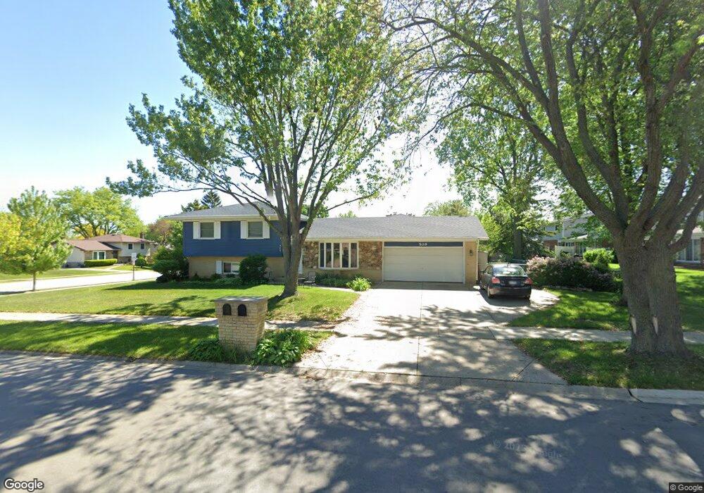
509 Juli Dr Schaumburg, IL 60193
East Schaumburg NeighborhoodEstimated Value: $314,000 - $440,000
2
Beds
2
Baths
1,050
Sq Ft
$371/Sq Ft
Est. Value
About This Home
This home is located at 509 Juli Dr, Schaumburg, IL 60193 and is currently estimated at $389,687, approximately $371 per square foot. 509 Juli Dr is a home located in Cook County with nearby schools including Michael Collins Elementary School, Robert Frost Junior High School, and J B Conant High School.
Ownership History
Date
Name
Owned For
Owner Type
Purchase Details
Closed on
Jan 26, 2004
Sold by
Megger Dieter K
Bought by
Megger Dieter K and Megger Elizabeth Overland
Current Estimated Value
Home Financials for this Owner
Home Financials are based on the most recent Mortgage that was taken out on this home.
Original Mortgage
$70,000
Outstanding Balance
$31,925
Interest Rate
5.88%
Mortgage Type
New Conventional
Estimated Equity
$357,762
Purchase Details
Closed on
May 13, 2002
Sold by
Nikki America Inc
Bought by
Edwards Timothy T and Kainz Sharon P
Home Financials for this Owner
Home Financials are based on the most recent Mortgage that was taken out on this home.
Original Mortgage
$300,700
Outstanding Balance
$122,665
Interest Rate
6.87%
Estimated Equity
$267,022
Create a Home Valuation Report for This Property
The Home Valuation Report is an in-depth analysis detailing your home's value as well as a comparison with similar homes in the area
Home Values in the Area
Average Home Value in this Area
Purchase History
| Date | Buyer | Sale Price | Title Company |
|---|---|---|---|
| Megger Dieter K | -- | Chicago Title Insurance Comp | |
| Edwards Timothy T | $429,000 | -- |
Source: Public Records
Mortgage History
| Date | Status | Borrower | Loan Amount |
|---|---|---|---|
| Open | Megger Dieter K | $70,000 | |
| Open | Edwards Timothy T | $300,700 |
Source: Public Records
Tax History
| Year | Tax Paid | Tax Assessment Tax Assessment Total Assessment is a certain percentage of the fair market value that is determined by local assessors to be the total taxable value of land and additions on the property. | Land | Improvement |
|---|---|---|---|---|
| 2025 | $8,191 | $41,000 | $11,495 | $29,505 |
| 2024 | $8,191 | $32,556 | $9,771 | $22,785 |
| 2023 | $7,914 | $32,556 | $9,771 | $22,785 |
| 2022 | $7,914 | $32,556 | $9,771 | $22,785 |
| 2021 | $6,499 | $24,774 | $6,609 | $18,165 |
| 2020 | $6,455 | $24,774 | $6,609 | $18,165 |
| 2019 | $6,996 | $29,531 | $6,609 | $22,922 |
| 2018 | $6,762 | $25,967 | $5,460 | $20,507 |
| 2017 | $6,673 | $25,967 | $5,460 | $20,507 |
| 2016 | $7,315 | $28,980 | $5,460 | $23,520 |
| 2015 | $6,672 | $24,926 | $4,598 | $20,328 |
| 2014 | $6,615 | $24,926 | $4,598 | $20,328 |
| 2013 | $6,428 | $24,926 | $4,598 | $20,328 |
Source: Public Records
Map
Nearby Homes
- 98 Wiltshire Ct
- 168 Farmgate Dr
- 609 Deborah Ct
- 605 Limerick Ln Unit 2B
- 552 Stone Gate Cir
- 614 Tralee Ct Unit 2-C
- 614 Tralee Ct Unit 2D
- 712 Tipperary Ct Unit 1C
- 220 S Roselle Rd Unit 224
- 108 Mullingar Ct Unit 2D
- 112 Mullingar Ct Unit 1C
- 631 Derry Ct Unit 1B
- 631 Derry Ct Unit 3C
- 631 Derry Ct Unit 2C
- 733 Limerick Ln Unit 7333D
- 25 Superior Ct Unit L2
- 635 Limerick Ln Unit 2B
- 717 Killarney Ct Unit 2D
- 701 Limerick Ln Unit 3B
- 5 Illinois Ave
- 103 Barrett Ln
- 96 Wiltshire Ct
- 100 Wiltshire Ct
- 102 Wiltshire Ct
- 104 Wiltshire Ct
- 107 Barrett Ln
- 106 Wiltshire Ct Unit 1
- 501 Juli Dr
- 508 Juli Dr
- 512 Juli Dr
- 100 Barrett Ln
- 504 Juli Dr
- 522 Wiltshire Ct
- 516 Juli Dr
- 111 Barrett Ln
- 104 Barrett Ln
- 524 Wiltshire Ct
- 500 Juli Dr
- 520 Juli Dr
- 519 Wiltshire Ct
Your Personal Tour Guide
Ask me questions while you tour the home.