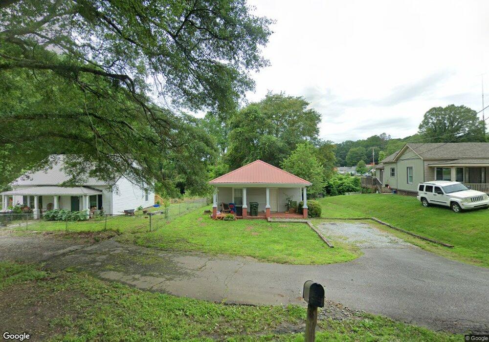
509 King St Easley, SC 29640
Estimated Value: $95,547 - $163,000
2
Beds
1
Bath
720
Sq Ft
$178/Sq Ft
Est. Value
About This Home
This home is located at 509 King St, Easley, SC 29640 and is currently estimated at $128,137, approximately $177 per square foot. 509 King St is a home located in Pickens County with nearby schools including McKissick Academy of Science & Technology, Richard H. Gettys Middle School, and Easley High School.
Ownership History
Date
Name
Owned For
Owner Type
Purchase Details
Closed on
Nov 23, 2022
Sold by
Brooks Benjamin Adam
Bought by
509 King St Llc
Current Estimated Value
Purchase Details
Closed on
Jun 29, 2022
Sold by
509 King St Llc
Bought by
Brooks Benjamin Adam
Home Financials for this Owner
Home Financials are based on the most recent Mortgage that was taken out on this home.
Original Mortgage
$71,250
Interest Rate
5.09%
Mortgage Type
New Conventional
Purchase Details
Closed on
Mar 29, 2019
Sold by
Brooks Benjamin Adam
Bought by
509 King St Llc
Purchase Details
Closed on
Dec 16, 2016
Sold by
Hamblin John E and Hamblin Edith M
Bought by
Brooks Benjamin Adam
Create a Home Valuation Report for This Property
The Home Valuation Report is an in-depth analysis detailing your home's value as well as a comparison with similar homes in the area
Home Values in the Area
Average Home Value in this Area
Purchase History
| Date | Buyer | Sale Price | Title Company |
|---|---|---|---|
| 509 King St Llc | -- | -- | |
| Brooks Benjamin Adam | -- | None Listed On Document | |
| 509 King St Llc | -- | None Available | |
| Brooks Benjamin Adam | $10,500 | None Available |
Source: Public Records
Mortgage History
| Date | Status | Borrower | Loan Amount |
|---|---|---|---|
| Previous Owner | Brooks Benjamin Adam | $71,250 |
Source: Public Records
Tax History
| Year | Tax Paid | Tax Assessment Tax Assessment Total Assessment is a certain percentage of the fair market value that is determined by local assessors to be the total taxable value of land and additions on the property. | Land | Improvement |
|---|---|---|---|---|
| 2025 | $742 | $2,820 | $360 | $2,460 |
| 2024 | $742 | $2,820 | $360 | $2,460 |
| 2023 | $768 | $2,820 | $360 | $2,460 |
| 2022 | $738 | $2,820 | $360 | $2,460 |
| 2021 | $732 | $2,820 | $360 | $2,460 |
| 2020 | $715 | $2,820 | $360 | $2,460 |
| 2019 | $0 | $2,820 | $360 | $2,460 |
| 2018 | $697 | $2,590 | $360 | $2,230 |
| 2017 | $679 | $2,590 | $360 | $2,230 |
| 2015 | $606 | $2,300 | $0 | $0 |
| 2008 | -- | $1,740 | $360 | $1,380 |
Source: Public Records
Map
Nearby Homes
- 507 King St
- 511 King St
- 505 King St
- 104 Norton St
- 503 King St
- 105 Norton St
- 102 Norton St
- 501 King St
- 314 Gentry Memorial Hwy
- 319 Gentry Memorial Hwy
- 316 Gentry Memorial Hwy
- 500 King St
- 103 Norton St
- 202 Pickens St
- 320 Gentry Memorial Hwy
- 108 Pickens St
- 204 Pickens St
- 1435 Gentry Memorial Hwy
- 110 Fern St
- 101 Norton St
Your Personal Tour Guide
Ask me questions while you tour the home.