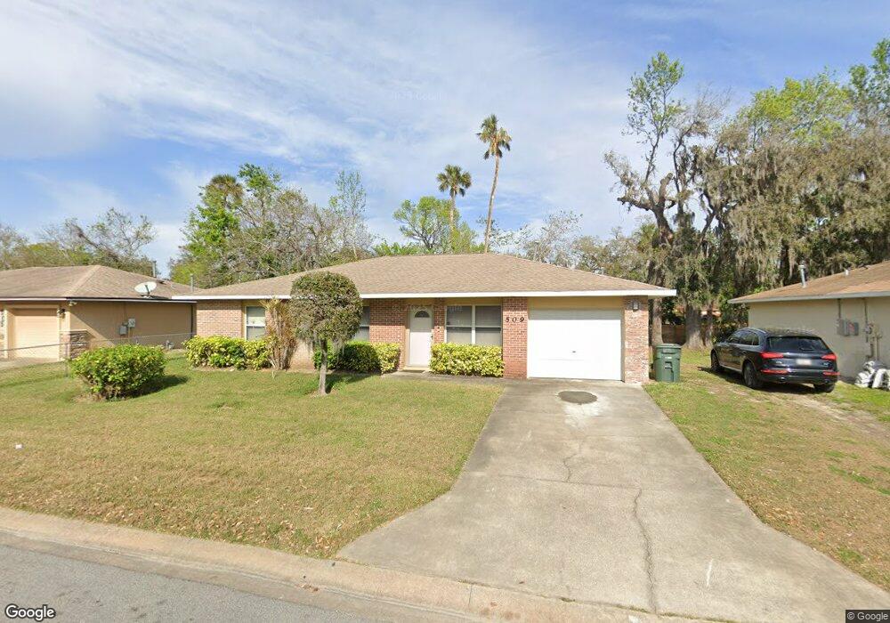
509 Loomis Trail Daytona Beach, FL 32114
Central Daytona NeighborhoodEstimated Value: $194,000 - $223,000
4
Beds
2
Baths
1,385
Sq Ft
$153/Sq Ft
Est. Value
About This Home
This home is located at 509 Loomis Trail, Daytona Beach, FL 32114 and is currently estimated at $211,896, approximately $152 per square foot. 509 Loomis Trail is a home located in Volusia County with nearby schools including Turie T. Small Elementary School, Campbell Middle School, and Spruce Creek High School.
Ownership History
Date
Name
Owned For
Owner Type
Purchase Details
Closed on
May 21, 1996
Sold by
City Daytona Bch
Bought by
Jones Melvese Moore
Current Estimated Value
Home Financials for this Owner
Home Financials are based on the most recent Mortgage that was taken out on this home.
Original Mortgage
$48,900
Outstanding Balance
$2,768
Interest Rate
7.93%
Mortgage Type
Purchase Money Mortgage
Estimated Equity
$209,128
Create a Home Valuation Report for This Property
The Home Valuation Report is an in-depth analysis detailing your home's value as well as a comparison with similar homes in the area
Home Values in the Area
Average Home Value in this Area
Purchase History
| Date | Buyer | Sale Price | Title Company |
|---|---|---|---|
| Jones Melvese Moore | $61,500 | -- |
Source: Public Records
Mortgage History
| Date | Status | Borrower | Loan Amount |
|---|---|---|---|
| Open | Jones Melvese Moore | $48,900 |
Source: Public Records
Tax History Compared to Growth
Tax History
| Year | Tax Paid | Tax Assessment Tax Assessment Total Assessment is a certain percentage of the fair market value that is determined by local assessors to be the total taxable value of land and additions on the property. | Land | Improvement |
|---|---|---|---|---|
| 2025 | $595 | $80,163 | -- | -- |
| 2024 | $595 | $77,904 | -- | -- |
| 2023 | $595 | $75,635 | $0 | $0 |
| 2022 | $583 | $73,432 | $0 | $0 |
| 2021 | $607 | $71,293 | $0 | $0 |
| 2020 | $604 | $70,309 | $0 | $0 |
| 2019 | $606 | $68,728 | $0 | $0 |
| 2018 | $619 | $67,447 | $0 | $0 |
| 2017 | $635 | $66,060 | $0 | $0 |
| 2016 | $657 | $64,701 | $0 | $0 |
| 2015 | $687 | $64,251 | $0 | $0 |
| 2014 | $691 | $63,741 | $0 | $0 |
Source: Public Records
Map
Nearby Homes
- 635 Mccormick St
- 643 Mc Cormick St
- 704 Park Dr
- 704 Cedar St
- 241 Martin Luther King Blvd S
- 735 Martin Luther King Blvd S
- 616 Cedar Park Dr
- 716 Verdell St
- 437 Lockhart St
- 812 Kottle Cir S
- 812 Kottle Cir S Unit S
- TBD Division St
- 425 Lockhart St
- 547 Division St
- 825 Kottle Cir S
- 835 Kottle Cir N Unit N
- 835 Kottle Cir N
- 562 South St
- 530 George St
- 809 Maley St
- 505 Loomis Trail
- 513 Loomis Trail
- 712 Park Dr
- 510 Loomis Trail
- 721 Loomis Ave
- 506 Loomis Trail
- 517 Loomis Trail
- 711 Park Dr
- 502 Loomis Trail
- 628 Mccormick St
- 709 Loomis Ave Unit ETAL
- 709 Loomis Ave
- 706 Park Dr
- 623 Mccormick St
- 704 Park Dr
- 521 Loomis Trail
- 631 Mccormick St
- 632 Mccormick St
- 530 Loomis Trail
- 710 Loomis Ave