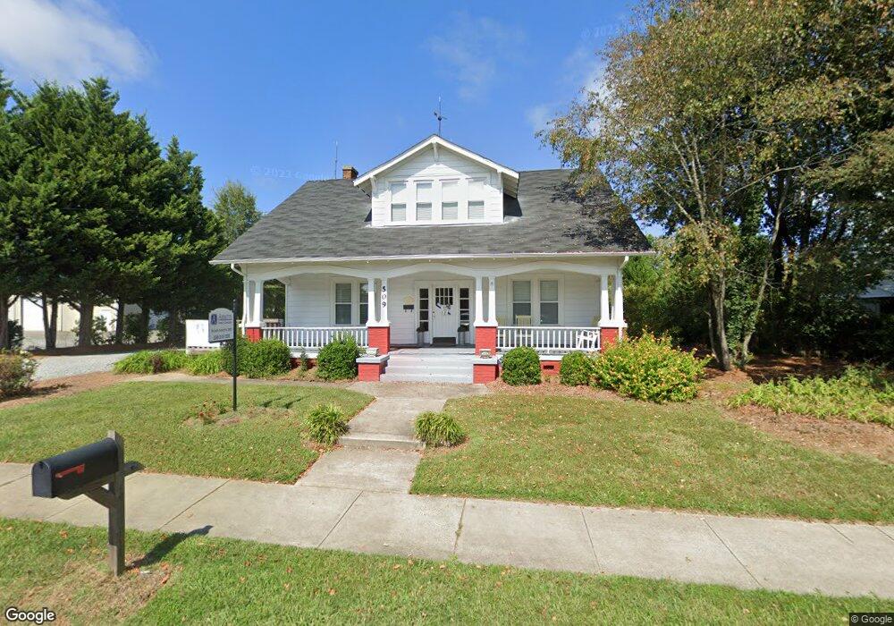
509 N Main St Kernersville, NC 27284
Downtown Kernersville NeighborhoodEstimated Value: $301,000 - $383,000
3
Beds
1
Bath
2,057
Sq Ft
$168/Sq Ft
Est. Value
About This Home
This home is located at 509 N Main St, Kernersville, NC 27284 and is currently estimated at $346,604, approximately $168 per square foot. 509 N Main St is a home located in Forsyth County with nearby schools including Kernersville Elementary School, Kernersville Middle, and East Forsyth High School.
Ownership History
Date
Name
Owned For
Owner Type
Purchase Details
Closed on
Feb 27, 2022
Sold by
Larue Development Llc
Bought by
Wilson Arnette Edward
Current Estimated Value
Home Financials for this Owner
Home Financials are based on the most recent Mortgage that was taken out on this home.
Original Mortgage
$150,000
Interest Rate
6.13%
Mortgage Type
Credit Line Revolving
Purchase Details
Closed on
Apr 4, 2013
Sold by
Larue Michael S and Larue Terri E
Bought by
Larue Development Llc
Create a Home Valuation Report for This Property
The Home Valuation Report is an in-depth analysis detailing your home's value as well as a comparison with similar homes in the area
Home Values in the Area
Average Home Value in this Area
Purchase History
| Date | Buyer | Sale Price | Title Company |
|---|---|---|---|
| Wilson Arnette Edward | $325,000 | -- | |
| Larue Development Llc | -- | None Available |
Source: Public Records
Mortgage History
| Date | Status | Borrower | Loan Amount |
|---|---|---|---|
| Previous Owner | Wilson Arnette Edward | $150,000 |
Source: Public Records
Tax History Compared to Growth
Tax History
| Year | Tax Paid | Tax Assessment Tax Assessment Total Assessment is a certain percentage of the fair market value that is determined by local assessors to be the total taxable value of land and additions on the property. | Land | Improvement |
|---|---|---|---|---|
| 2024 | $2,857 | $221,100 | $183,000 | $38,100 |
| 2023 | $2,857 | $221,100 | $183,000 | $38,100 |
| 2022 | $2,827 | $221,100 | $183,000 | $38,100 |
| 2021 | $2,827 | $221,100 | $183,000 | $38,100 |
| 2020 | $2,668 | $196,100 | $180,700 | $15,400 |
| 2019 | $2,688 | $196,100 | $180,700 | $15,400 |
| 2018 | $2,629 | $196,100 | $180,700 | $15,400 |
| 2016 | $2,472 | $182,918 | $147,821 | $35,097 |
| 2015 | $2,422 | $182,918 | $147,821 | $35,097 |
| 2014 | $2,396 | $182,918 | $147,821 | $35,097 |
Source: Public Records
Map
Nearby Homes
- 603 Nelson St
- 124 Adams St
- 126 Adams St
- 128 Adams St
- 587 Porter Ln
- 419 Vance St
- 3180 Piney Grove Rd
- 104 Gordon Terrace Rd Unit 48
- 803 Kensal Green Dr
- 112 Baxter St
- 1838 Pheasant Trace Cir
- 1834 Pheasant Trace Cir
- 1894 Pheasant Trace Cir
- 1888 Pheasant Trace Cir
- 1896 Pheasant Trace Cir
- 348 Clay Flynt Rd
- 703 Oakhurst St
- 311 Salisbury St Unit 46
- 311 Salisbury St Unit 41
- 311 Salisbury St Unit 58
- 513 N Main St
- 505 N Main St
- 501 N Main St
- 538 Nelson St
- 601 N Main St
- 536 Nelson St
- 540 Nelson St
- 510 N Main St
- 542 Nelson St
- 603 N Main St Unit A
- 600 Nelson St
- 605 N Main St
- 602 N Main St
- 500 N Main St
- 604 N Main St
- 606 Nelson St
- 424 N Main St
- 603 Nelson St Unit D
- 603 Nelson St Unit C
- 603 Nelson St Unit B