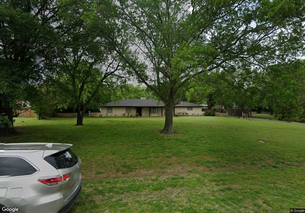
509 Preston Dr Pottsboro, TX 75076
Estimated Value: $438,000 - $457,069
3
Beds
2
Baths
2,674
Sq Ft
$167/Sq Ft
Est. Value
About This Home
This home is located at 509 Preston Dr, Pottsboro, TX 75076 and is currently estimated at $447,535, approximately $167 per square foot. 509 Preston Dr is a home located in Grayson County with nearby schools including Pottsboro Elementary School, Pottsboro Middle School, and Pottsboro High School.
Ownership History
Date
Name
Owned For
Owner Type
Purchase Details
Closed on
May 15, 2018
Sold by
Stewart Rebecca and Stewart Michael W
Bought by
Kennedy Morgan
Current Estimated Value
Home Financials for this Owner
Home Financials are based on the most recent Mortgage that was taken out on this home.
Original Mortgage
$192,800
Outstanding Balance
$165,650
Interest Rate
4.4%
Mortgage Type
New Conventional
Estimated Equity
$281,885
Purchase Details
Closed on
Nov 8, 2011
Sold by
Wells Fargo Bank Na
Bought by
The Secretary Of Housing & Urban Develop
Purchase Details
Closed on
Nov 1, 2011
Sold by
Baker Angela Michelle and Baker Jeff Shawn
Bought by
Wells Fargo Bank N A
Create a Home Valuation Report for This Property
The Home Valuation Report is an in-depth analysis detailing your home's value as well as a comparison with similar homes in the area
Home Values in the Area
Average Home Value in this Area
Purchase History
| Date | Buyer | Sale Price | Title Company |
|---|---|---|---|
| Kennedy Morgan | -- | Red River Title Co | |
| The Secretary Of Housing & Urban Develop | -- | None Available | |
| Wells Fargo Bank N A | $150,684 | None Available |
Source: Public Records
Mortgage History
| Date | Status | Borrower | Loan Amount |
|---|---|---|---|
| Open | Kennedy Morgan | $192,800 |
Source: Public Records
Tax History Compared to Growth
Tax History
| Year | Tax Paid | Tax Assessment Tax Assessment Total Assessment is a certain percentage of the fair market value that is determined by local assessors to be the total taxable value of land and additions on the property. | Land | Improvement |
|---|---|---|---|---|
| 2025 | $5,325 | $375,845 | -- | -- |
| 2024 | $6,594 | $341,677 | $0 | $0 |
| 2023 | $4,725 | $310,615 | $0 | $0 |
| 2022 | $5,983 | $282,377 | $0 | $0 |
| 2021 | $5,694 | $296,169 | $54,825 | $241,344 |
| 2020 | $5,348 | $233,369 | $16,108 | $217,261 |
| 2019 | $5,718 | $238,268 | $16,108 | $222,160 |
| 2018 | $4,116 | $189,213 | $16,108 | $173,105 |
| 2017 | $3,787 | $180,925 | $16,108 | $164,817 |
| 2016 | $4,258 | $173,702 | $16,108 | $157,594 |
| 2015 | $0 | $127,687 | $16,108 | $111,579 |
| 2014 | -- | $125,532 | $16,108 | $109,424 |
Source: Public Records
Map
Nearby Homes
- 514 Preston Dr
- TBD Lot 4 Farm To Market 120
- 104 Loraine St
- 200 Herberta St
- 102 William St
- Lot 39 White Tail Way
- 200 Clement Ct
- 401 Grayson St
- 405 Grayson St
- 105 E William St
- 617 Grayson St
- 110 E Fm 120
- 614 Franklin Ave
- 106 Kristy Ct
- 622 Franklin Ave
- 308 Front St
- 206 S Magnolia St
- 408 Front St
- TBD Cardinal Ln
- 412 Main St