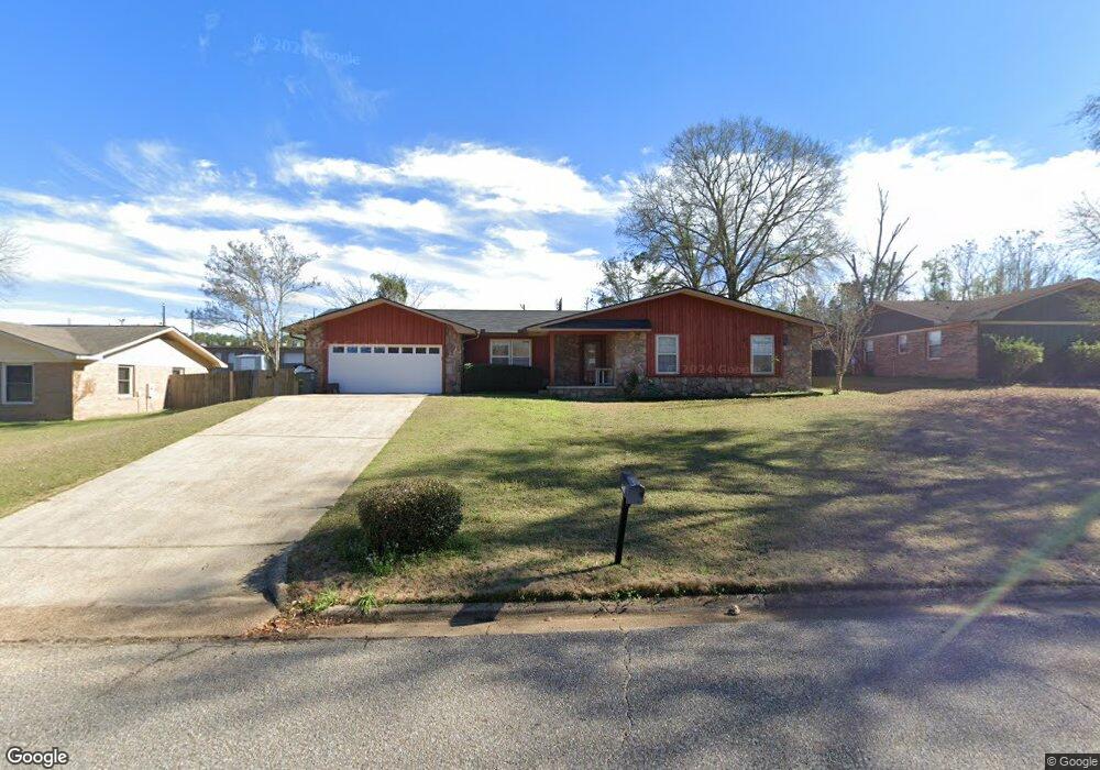
509 Robin Ln Enterprise, AL 36330
Estimated Value: $196,866 - $209,000
About This Home
This home is located at 509 Robin Ln, Enterprise, AL 36330 and is currently estimated at $202,967, approximately $115 per square foot. 509 Robin Ln is a home located in Coffee County with nearby schools including Harrand Creek Elementary School, Dauphin Junior High School, and Enterprise High School.
Ownership History
We collect this data history from publicly available records. To have your information removed, we recommend requesting removal directly through your county’s website.
Purchase Details
Home Financials for this Owner
Home Financials are based on the most recent Mortgage that was taken out on this home.Purchase Details
Home Financials for this Owner
Home Financials are based on the most recent Mortgage that was taken out on this home.Purchase History
We collect this data history from publicly available records. To have your information removed, we recommend requesting removal directly through your county’s website.
| Date | Buyer | Sale Price | Title Company |
|---|---|---|---|
| -- | None Available | ||
| -- | -- |
Mortgage History
We collect this data history from publicly available records. To have your information removed, we recommend requesting removal directly through your county’s website.
| Date | Status | Borrower | Loan Amount |
|---|---|---|---|
| Closed | $132,097 | ||
| Closed | $164,247 |
Tax History
We collect this data history from publicly available records. To have your information removed, we recommend requesting removal directly through your county’s website.
| Year | Tax Paid | Tax Assessment Tax Assessment Total Assessment is a certain percentage of the fair market value that is determined by local assessors to be the total taxable value of land and additions on the property. | Land | Improvement |
|---|---|---|---|---|
| 2025 | $1,883 | $39,000 | $3,674 | $35,326 |
| 2024 | $1,770 | $36,580 | $3,673 | $32,907 |
| 2023 | $1,639 | $30,348 | $3,600 | $26,748 |
| 2022 | $1,472 | $30,360 | $0 | $0 |
| 2021 | $570 | $13,500 | $0 | $0 |
| 2020 | $550 | $13,040 | $0 | $0 |
| 2019 | $550 | $13,040 | $0 | $0 |
| 2018 | $550 | $13,040 | $0 | $0 |
| 2017 | $549 | $13,020 | $0 | $0 |
| 2016 | $559 | $13,240 | $0 | $0 |
| 2015 | $559 | $13,240 | $0 | $0 |
| 2014 | $559 | $13,240 | $0 | $0 |
| 2013 | $579 | $0 | $0 | $0 |
Map
- 100 Cahaba St
- 1302 Rucker Blvd
- 114 Iroquois Rd
- 323 Chickasaw Rd
- 600 Morgan Ln
- 105 Comanche St
- 208 Deerfield Dr
- 604 Springdale Dr
- 410 Melbourne Dr
- 304 Dixie Dr
- 613 Chickasaw Rd
- 000 Springdale Dr
- 121 Lightfoot Dr
- 605 Grand Pine Dr
- 108 Glenwood Ln
- 200 Myrick Dr
- 100 Sioux St
- 413 Springdale Dr
- 115 Woodrun Dr
- 48 Woodfield Place
Ask me questions while you tour the home.