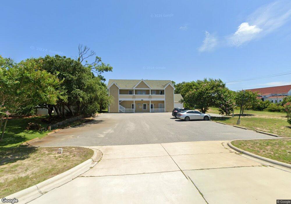
509 S Mustian St Kill Devil Hills, NC 27948
Estimated Value: $1,048,912
--
Bed
4
Baths
3,364
Sq Ft
$312/Sq Ft
Est. Value
About This Home
This home is located at 509 S Mustian St, Kill Devil Hills, NC 27948 and is currently estimated at $1,048,912, approximately $311 per square foot. 509 S Mustian St is a home located in Dare County with nearby schools including First Flight Elementary School, First Flight Middle School, and First Flight High School.
Ownership History
Date
Name
Owned For
Owner Type
Purchase Details
Closed on
May 30, 2014
Sold by
Outer Banks Coastal Properties Llc
Bought by
Kam Mak Properties Llc
Current Estimated Value
Purchase Details
Closed on
Sep 29, 2011
Sold by
Federal Deposit Insurance Corporation
Bought by
Outer Banks Coastal Properties Llc
Purchase Details
Closed on
Jul 31, 2008
Sold by
Silman Land Co Llc
Bought by
Cooperative Bank
Create a Home Valuation Report for This Property
The Home Valuation Report is an in-depth analysis detailing your home's value as well as a comparison with similar homes in the area
Home Values in the Area
Average Home Value in this Area
Purchase History
| Date | Buyer | Sale Price | Title Company |
|---|---|---|---|
| Kam Mak Properties Llc | $5,050 | None Available | |
| Outer Banks Coastal Properties Llc | $380,000 | None Available | |
| Cooperative Bank | $760,000 | None Available |
Source: Public Records
Tax History Compared to Growth
Tax History
| Year | Tax Paid | Tax Assessment Tax Assessment Total Assessment is a certain percentage of the fair market value that is determined by local assessors to be the total taxable value of land and additions on the property. | Land | Improvement |
|---|---|---|---|---|
| 2025 | $5,554 | $1,022,400 | $405,000 | $617,400 |
| 2024 | $4,502 | $595,900 | $236,300 | $359,600 |
| 2023 | $4,502 | $595,900 | $236,300 | $359,600 |
| 2022 | $4,293 | $595,900 | $236,300 | $359,600 |
| 2021 | $4,293 | $595,900 | $236,300 | $359,600 |
| 2020 | $4,293 | $595,900 | $236,300 | $359,600 |
| 2019 | $4,622 | $531,300 | $189,000 | $342,300 |
| 2018 | $3,021 | $531,300 | $189,000 | $342,300 |
| 2017 | $4,521 | $531,300 | $189,000 | $342,300 |
| 2016 | $4,308 | $531,300 | $189,000 | $342,300 |
| 2014 | $4,149 | $531,300 | $189,000 | $342,300 |
Source: Public Records
Map
Nearby Homes
- 804 S Memorial Blvd Unit 2B
- 804 S Memorial Blvd Unit 1-E
- 902 S Virginia Dare Trail Unit 102
- 701 S Virginia Dare Trail Unit 1
- 505 S Virginia Dare Trail Unit 2
- 803 6th Ave Unit Lot 9
- 105 E Aviation Ave Unit 15
- 503 N Virginia Dare Trail Unit 5
- 302 W Clark St Unit Lot 6
- 113 E Aviation Ave
- 113 E Aviation Ave Unit Lot 19
- 815 S Virginia Dare Trail Unit 202
- 1014 S Virginia Dare Trail Unit 301
- 1014 S Virginia Dare Trail Unit 402
- 200 E Martin St Unit 202
- 1209 Wrightsville Blvd Unit Lot 26
- 1205 S Virginia Dare Trail Unit Lot 3
- 0 W Martin St
- 111 Baker Ave Unit Lot18Pt17
- 0 W Boundary St Unit Lot 1-R 130568
- 105 W Saint Clair St
- 0 W Saint Clair St Unit 100207
- 0 W Saint Clair Rd Unit 84120
- 0 W Saint Clair St Unit 88711
- 0 W Saint Clair St Unit Lots 7,14 127976
- 0 W Saint Clair St Unit 124269
- 0 W Saint Clair St Unit 114434
- 110 W Saint Clair St
- 112 W Saint Clair St Unit 12
- 108 W Saint Clair St
- 400 S Croatan Hwy
- 501 S Croatan Hwy
- 102 Goddard St Unit 10
- 102 Goddard St
- 103 E Saint Clair St
- 100 E Saint Clair St
- 0 Holly St Unit Lot 1 120061
- 0 Holly St
- 100 St Clair St E
- 701 Fox St