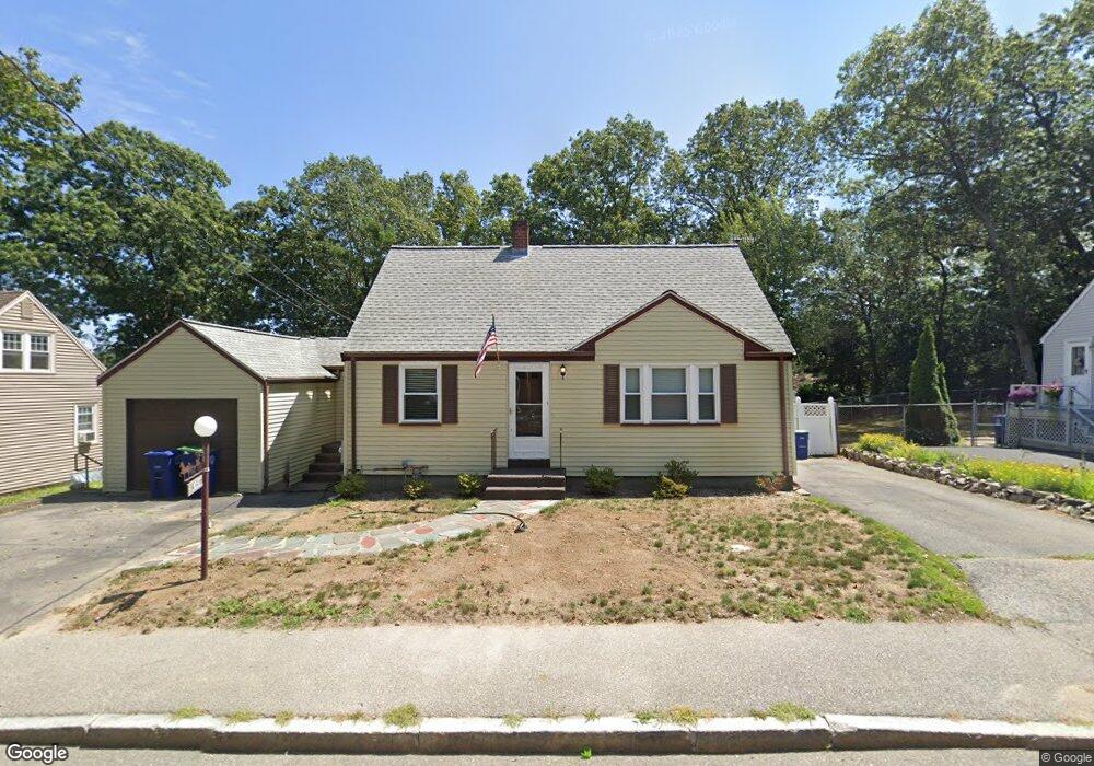
509 Union St Unit 1&2 Braintree, MA 02184
East Braintree NeighborhoodEstimated Value: $770,000 - $894,000
3
Beds
3
Baths
2,684
Sq Ft
$302/Sq Ft
Est. Value
About This Home
This home is located at 509 Union St Unit 1&2, Braintree, MA 02184 and is currently estimated at $811,132, approximately $302 per square foot. 509 Union St Unit 1&2 is a home located in Norfolk County with nearby schools including Braintree High School, Sacred Heart Elementary School, and South Shore Christian Academy.
Ownership History
Date
Name
Owned For
Owner Type
Purchase Details
Closed on
Nov 1, 2024
Sold by
Demers Michael J and Overstreet James P
Bought by
Overstreet James P
Current Estimated Value
Purchase Details
Closed on
Sep 1, 2024
Sold by
Demers Michael J and Overstreet James P
Bought by
Overstreet James P
Purchase Details
Closed on
Dec 30, 2020
Sold by
509 Union Street Rt and Grugnale
Bought by
Murphy John J
Purchase Details
Closed on
Feb 3, 2017
Sold by
Grugnale Donna
Bought by
509 Union Street Rt
Purchase Details
Closed on
Dec 7, 1964
Bought by
Murphy John Joseph and Murphy Virginia F
Create a Home Valuation Report for This Property
The Home Valuation Report is an in-depth analysis detailing your home's value as well as a comparison with similar homes in the area
Home Values in the Area
Average Home Value in this Area
Purchase History
| Date | Buyer | Sale Price | Title Company |
|---|---|---|---|
| Overstreet James P | -- | None Available | |
| Overstreet James P | -- | None Available | |
| Overstreet James P | -- | None Available | |
| Overstreet James P | -- | None Available | |
| Murphy John J | -- | None Available | |
| Murphy John J | -- | None Available | |
| 509 Union Street Rt | -- | -- | |
| Grugnale Donna | -- | -- | |
| Murphy John Joseph | -- | -- | |
| 509 Union Street Rt | -- | -- |
Source: Public Records
Mortgage History
| Date | Status | Borrower | Loan Amount |
|---|---|---|---|
| Previous Owner | Murphy John Joseph | $80,000 |
Source: Public Records
Tax History Compared to Growth
Tax History
| Year | Tax Paid | Tax Assessment Tax Assessment Total Assessment is a certain percentage of the fair market value that is determined by local assessors to be the total taxable value of land and additions on the property. | Land | Improvement |
|---|---|---|---|---|
| 2025 | $6,194 | $620,600 | $299,000 | $321,600 |
| 2024 | $5,625 | $593,400 | $276,400 | $317,000 |
| 2023 | $5,402 | $553,500 | $253,700 | $299,800 |
| 2022 | $5,327 | $535,400 | $235,600 | $299,800 |
| 2021 | $4,890 | $491,500 | $217,500 | $274,000 |
| 2020 | $4,668 | $473,400 | $199,400 | $274,000 |
| 2019 | $4,551 | $451,000 | $199,400 | $251,600 |
| 2018 | $4,358 | $413,500 | $172,200 | $241,300 |
| 2017 | $4,232 | $394,000 | $163,100 | $230,900 |
| 2016 | $4,053 | $369,100 | $145,000 | $224,100 |
| 2015 | $3,890 | $351,400 | $135,900 | $215,500 |
| 2014 | $3,754 | $328,700 | $130,500 | $198,200 |
Source: Public Records
Map
Nearby Homes
- 124 Louise Rd
- 298 Lisle St
- 51 Faxon St
- 605 Middle St Unit 38
- 41 Lantern Ln
- 37 Lantern Ln
- 74 Magnolia St
- 141 Commercial St Unit 9
- 125 Allen St Unit A
- 141 Hobart St
- 159 Hobart St
- 15 Summer St
- 491 Washington St Unit 1
- 1 Pantano St
- 312 Shaw St
- 122 Washington St Unit 22
- 67 Somerville Ave
- 37 Monatiquot Ave
- 11 Richmond St
- 9 Hillside Ave