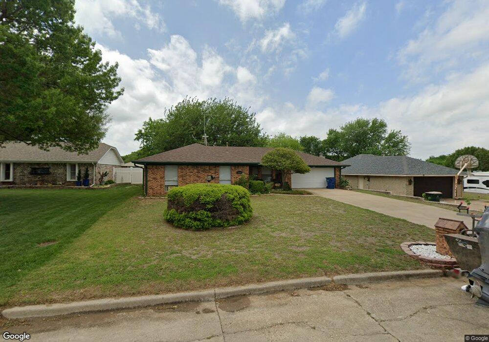
509 Westridge Dr Duncan, OK 73533
Estimated Value: $162,000 - $192,000
3
Beds
2
Baths
1,462
Sq Ft
$118/Sq Ft
Est. Value
About This Home
This home is located at 509 Westridge Dr, Duncan, OK 73533 and is currently estimated at $172,554, approximately $118 per square foot. 509 Westridge Dr is a home located in Stephens County with nearby schools including Mark Twain Elementary School, Duncan Middle School, and Duncan High School.
Ownership History
Date
Name
Owned For
Owner Type
Purchase Details
Closed on
May 24, 2024
Sold by
Jordan Vicki and Gifford Kristopher
Bought by
Hale David O and Gifford Kristopher
Current Estimated Value
Purchase Details
Closed on
May 20, 2024
Sold by
Hale David O and Hale Jo Ann
Bought by
Jordan Vicki and Gifford Kristopher
Purchase Details
Closed on
May 26, 2020
Sold by
Sellers Jo H
Bought by
Hale David O and Hale Jo Ann
Purchase Details
Closed on
Jul 28, 2000
Sold by
Davis Angela Sue
Bought by
Sellers Jo H
Create a Home Valuation Report for This Property
The Home Valuation Report is an in-depth analysis detailing your home's value as well as a comparison with similar homes in the area
Home Values in the Area
Average Home Value in this Area
Purchase History
| Date | Buyer | Sale Price | Title Company |
|---|---|---|---|
| Hale David O | -- | None Listed On Document | |
| Jordan Vicki | -- | None Listed On Document | |
| Hale David O | $120,000 | Stephens County Abstract Co | |
| Sellers Jo H | $65,500 | -- |
Source: Public Records
Tax History Compared to Growth
Tax History
| Year | Tax Paid | Tax Assessment Tax Assessment Total Assessment is a certain percentage of the fair market value that is determined by local assessors to be the total taxable value of land and additions on the property. | Land | Improvement |
|---|---|---|---|---|
| 2025 | $1,422 | $16,847 | $855 | $15,992 |
| 2024 | $1,237 | $14,521 | $855 | $13,666 |
| 2023 | $1,237 | $13,897 | $855 | $13,042 |
| 2022 | $1,120 | $13,829 | $855 | $12,974 |
| 2021 | $1,068 | $12,543 | $855 | $11,688 |
| 2020 | $0 | $7,152 | $483 | $6,669 |
| 2019 | $0 | $7,151 | $508 | $6,643 |
| 2018 | $459 | $7,151 | $554 | $6,597 |
| 2017 | $443 | $7,151 | $546 | $6,605 |
| 2016 | $438 | $7,151 | $577 | $6,574 |
| 2015 | $451 | $7,151 | $577 | $6,574 |
| 2014 | $451 | $7,151 | $612 | $6,539 |
Source: Public Records
Map
Nearby Homes
- TBD S 27th St
- 106 Emery Rd
- 2110 W Main St
- 206 N 28th St
- 210 N 31st St
- 201 N 23rd St
- 0 W Beech Ave
- 1223 S 42nd St
- 209 N 22nd St
- 2006 W Oak Ave
- 2011 W Oak Ave
- 174831 N 2844 Rd
- 1244 Carriage Dr
- 1309 W Pecan Ave
- 451 S 11th St
- 711 711 S 12th
- 507 N Alice Dr
- 123 N Highway 81
- 2210 Western Dr
- 1109 W Stephens Ave
- 509 Westridge Dr
- 505 Westridge Dr
- 601 Westridge Dr
- 624 Catherine Ln
- 620 Catherine Ln
- 702 Catherine Ln
- 605 Westridge Dr
- 501 Westridge Dr
- 510 Westridge Dr
- 602 W Ridge Dr
- 602 Westridge Dr
- 606 W Ridge Dr
- 506 Westridge Dr
- 609 Westridge Dr
- 710 Catherine Ln
- 411 Westridge Dr
- 714 Catherine Ln
- 2801 Johnathan Place
- 610 Westridge Dr
- 701 Westridge Dr