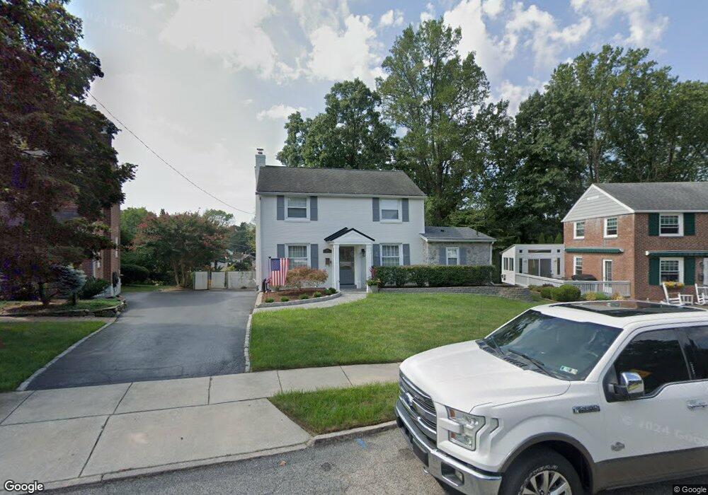
509 Wheatsheaf Rd Springfield, PA 19064
Estimated Value: $502,000 - $565,000
4
Beds
3
Baths
2,173
Sq Ft
$249/Sq Ft
Est. Value
About This Home
This home is located at 509 Wheatsheaf Rd, Springfield, PA 19064 and is currently estimated at $540,194, approximately $248 per square foot. 509 Wheatsheaf Rd is a home located in Delaware County with nearby schools including Springfield High School, St Francis Of Assisi School, and Holy Cross School.
Ownership History
Date
Name
Owned For
Owner Type
Purchase Details
Closed on
Apr 17, 1997
Sold by
Wright Ann and Arcaro Carole A
Bought by
Costello Louis P and Flagiello Gina
Current Estimated Value
Home Financials for this Owner
Home Financials are based on the most recent Mortgage that was taken out on this home.
Original Mortgage
$119,900
Outstanding Balance
$15,326
Interest Rate
7.76%
Estimated Equity
$524,868
Create a Home Valuation Report for This Property
The Home Valuation Report is an in-depth analysis detailing your home's value as well as a comparison with similar homes in the area
Home Values in the Area
Average Home Value in this Area
Purchase History
| Date | Buyer | Sale Price | Title Company |
|---|---|---|---|
| Costello Louis P | $149,900 | -- |
Source: Public Records
Mortgage History
| Date | Status | Borrower | Loan Amount |
|---|---|---|---|
| Open | Costello Louis P | $119,900 |
Source: Public Records
Tax History
| Year | Tax Paid | Tax Assessment Tax Assessment Total Assessment is a certain percentage of the fair market value that is determined by local assessors to be the total taxable value of land and additions on the property. | Land | Improvement |
|---|---|---|---|---|
| 2025 | $9,027 | $321,160 | $96,640 | $224,520 |
| 2024 | $9,027 | $321,160 | $96,640 | $224,520 |
| 2023 | $8,692 | $321,160 | $96,640 | $224,520 |
| 2022 | $8,504 | $321,160 | $96,640 | $224,520 |
| 2021 | $13,170 | $321,160 | $96,640 | $224,520 |
| 2020 | $7,421 | $163,770 | $46,460 | $117,310 |
| 2019 | $7,247 | $163,770 | $46,460 | $117,310 |
| 2018 | $7,143 | $163,770 | $0 | $0 |
| 2017 | $6,978 | $163,770 | $0 | $0 |
| 2016 | $899 | $163,770 | $0 | $0 |
| 2015 | $917 | $163,770 | $0 | $0 |
| 2014 | $917 | $163,770 | $0 | $0 |
Source: Public Records
Map
Nearby Homes
- 493 Wheatsheaf Rd
- 249 Gleaves Rd
- 364 S Rolling Rd
- 1299 Country Club Dr Unit Q141
- 1291 Country Club Dr Unit Q137
- 1433 Country Club Dr Unit T214
- 227 E Leamy Ave
- 332 Franklin Ave
- 1588 Nicklaus Dr Unit H65
- 658 E Leamy Ave
- 933 Greenbriar Ln
- 525 N Swarthmore Ave
- 147 Snyder Ln
- 226 Lynbrooke Rd
- 519 Walnut Ln Unit 1
- 114 Providence Rd
- 641 W Sproul Rd
- 412 Foster Dr
- 978 Westfield Rd
- 507 School St
- 505 Wheatsheaf Rd
- 513 Wheatsheaf Rd
- 501 Wheatsheaf Rd
- 512 Briarhill Rd
- 126 E Thomson Ave
- 498 Wheatsheaf Rd
- 100 E Thomson Ave
- 514 Wheatsheaf Rd
- 116 E Thomson Ave
- 497 Wheatsheaf Rd
- 508 Briarhill Rd
- 109 Ashwood Rd
- 503 Briarhill Rd
- 492 Wheatsheaf Rd
- 200 E Thompson Ave
- 33 E Thomson Ave
- 506 Briarhill Rd
- 115 Ashwood Rd
- 200 E Thomson Ave
- 489 Wheatsheaf Rd
Your Personal Tour Guide
Ask me questions while you tour the home.